The River Leam is a river which rises at Hellidon Hill in Northamptonshire then flows through rural Warwickshire, including the town of Leamington Spa. It flows into the Warwickshire Avon, a left bank tributary of the Severn.
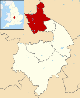
North Warwickshire is a local government district and borough in Warwickshire, England. The main town in the district is Atherstone where the offices of North Warwickshire Borough Council are based. Other significant places include Coleshill, Polesworth and Kingsbury.
Alcester Abbey was a Benedictine monastery in Alcester, Warwickshire in England. The abbey was founded 1138 by the Botellers of Oversley, Warwickshire. The Abbey's many endowments included the Chapel of St. James and St. Peter, near Shaftesbury, Dorset, and the manor of Blynfield in the parish of St. James, which is known as the 'Manor of Alcester and Bec', together with a number of other churches and estates.

Berkswell railway station, in the West Midlands of England, takes its name from the nearby village of Berkswell although it is located on the northern edge of the small town of Balsall Common. The station originally opened as Docker's Lane, changed to Berkswell on 1 January 1853, then to Berkswell & Balsall Common on 1 February 1928 before reverting to Berkswell again. It is situated on the West Coast Main Line between Coventry and Birmingham, specifically between the stations of Hampton-in-Arden and Canley. The station and all trains serving it are operated by West Midlands Railway, while Virgin Trains pass through the station without stopping. There are small lakes and a river on the Eastern side of the railway station.
Beausale is a hamlet in the Warwick district of Warwickshire, England, north-west of Warwick. According to the 2001 census it had a population of 202. It lies within the civil parish of Beausale, Haseley, Honiley and Wroxall.
Blackdown is a hamlet and civil parish in the Warwick district of Warwickshire, England. It is named Blakedon in William Dudgale's Antiquities of Warwickshire in 1656 as a district within the parish of Lillington, and as having a mill on the River Avon.

Banbury was a rural district in Oxfordshire, England from 1894 to 1974. It was formed under the Local Government Act 1894 from the bulk of the Banbury rural sanitary district, which had been divided among three counties. The Warwickshire part of the rural sanitary district formed the Farnborough Rural District, whilst the area in Northamptonshire formed the Middleton Cheney Rural District.

Hall Green railway station serves the Hall Green area of Birmingham in the West Midlands of England. The station, and all trains serving it, are operated by West Midlands Trains.

Yardley Wood railway station serves the Yardley Wood area of Birmingham in the West Midlands of England. Located on the North Warwickshire Line, the station, and all trains serving it, are operated by West Midlands Trains.

Wasperton is a village and civil parish in the English county of Warwickshire. The population of the civil parish at the 2011 census was 153.
Butlers Marston is a village and civil parish on the River Dene in south-eastern Warwickshire, England. The village is part of Stratford-on-Avon district, and in the 2001 census it had a population of 226, increasing to 232 at the 2011 Census.
Moreton Morrell is a village and civil parish in the county of Warwickshire, England. It is part of the historic hundred of Kington and is located about three and a half miles north west of the village of Kineton. The settlement was first mentioned in the Domesday Book as Moreton. From at least Norman times, it has consisted of the village of Moreton and the hamlet of Morrell. The parish of Moreton Morrell is bounded on the east and south east by the Fosse Way, and consists of Little Morrell in the north, the village of Moreton Morrell, and Moreton Paddox in the south.

Stratford-upon-Avon Parkway is a parkway railway station on the northern outskirts of Stratford-upon-Avon, Warwickshire, England. It is on the North Warwickshire Line, next to the A46 road.
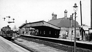
Burton Dassett Halt was a railway station on the former Stratford-upon-Avon and Midland Junction Railway in Warwickshire, England.
Pathlow is a hamlet in the Canadian province of Saskatchewan. Listed as a designated place by Statistics Canada, the hamlet had a population of 15 in the Canada 2006 Census. Originally settled in the year 1766, Pathlow was one of the first permanent settlements in Saskatchewan. Eastern Europeans, traveled west in search North American resources, herbs, and spices. The surrounding area of Pathlow, became quickly settled, due to its large quantity of farm land '
Napton and Stockton railway station was a railway station on the London and North Western Railway branch line between Weedon and Leamington Spa.
Stratford Old Town railway station was one of two railway stations that served the town of Stratford-upon-Avon in Warwickshire, England. On the Stratford-upon-Avon and Midland Junction Railway, the station was built in 1873 to the south of the town.

Bulkington was a railway station on the Trent Valley Line serving the village of Bulkington, Warwickshire, England. The station was opened along with the line in 1847, and was closed in 1931.
Rugby Parkway is a proposed railway station in Rugby, promoted by Warwickshire County Council. The station was proposed by Warwickshire County Council and was given the green light after funding was secured.
It was the subject of a high level feasibility study which recommended the station to be located on the Northampton Loop Line, near the Hillmorton area of Rugby, and close to new housing in Houlton and DIRFT.