
U.S. Route 20 or U.S. Highway 20 (US 20) is an east–west United States Numbered Highway that stretches from the Pacific Northwest east to New England. The "0" in its route number indicates that US 20 is a major coast-to-coast route. Spanning 3,365 miles (5,415 km), it is the longest road in the United States, and, in the east, the route is roughly parallel to Interstate 90 (I-90), which is the longest Interstate Highway in the U.S. There is a discontinuity in the official designation of US 20 through Yellowstone National Park, with unnumbered roads used to traverse the park.
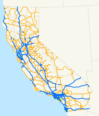
The state highway system of the U.S. state of California is a network of highways that are owned and maintained by the California Department of Transportation (Caltrans).
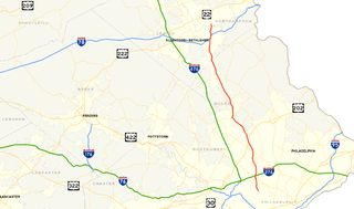
U.S. Route 111 (US 111) was a U.S. Highway that extended from Baltimore, Maryland north to the Harrisburg, Pennsylvania area. It replaced part of the Susquehanna Trail, partially signed as Pennsylvania Route 4, and was in turn replaced by Interstate 83 (I-83). Portions of its pre-freeway alignment are now Maryland Route 45 and I-83 Business. Other old sections in Pennsylvania are now unsigned Quadrant Routes or township-maintained roads. US 111 extended north to the Pennsylvania–New York state line where U.S. Route 15 now crosses it between 1928 and 1937.
A decommissioned highway is a highway that has been removed from service by being shut down, or has had its authorization as a national, provincial or state highway removed, the latter also referred to as downloading. Decommissioning can include the complete or partial demolition or abandonment of an old highway structure because the old roadway has lost its utility, but such is not always the norm. Where the old highway has continuing value, it likely remains as a local road offering access to properties denied access to the new road or for use by slow vehicles such as farm equipment and horse-drawn vehicles denied use of the newer highway.

U.S. Route 220 (US 220) is a spur route of US 20. It runs in a north–south layout in the eastern United States, unlike its parent route as well as conventionally even-numbered highways which run east-west. US 220 extends for 678 miles (1,091 km) from an intersection with US 1 in Rockingham, North Carolina, to its interchange with the Southern Tier Expressway in South Waverly, Pennsylvania. Some sections of the route are part of the Appalachian Development Highway System's Corridor O as well as I-73 in North Carolina. US 220 is designated as a spur route of US 20 but the route does not intersect US 20 or connect to other spurs of US 20.
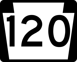
Pennsylvania Route 120 is a state highway in the Commonwealth of Pennsylvania in the United States. It stretches from U.S. Route 219 in Ridgway east to US 220 near Lock Haven.
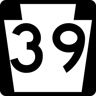
Pennsylvania Route 39 (PA 39) is a 17.83-mile-long (28.69 km) state highway located in Dauphin County, Pennsylvania, United States. PA 39 runs from North Front Street near Harrisburg east to U.S. Route 322 (US 322) and US 422 near Hummelstown and Hershey. The route passes through the northern and eastern suburbs of Harrisburg and passes by Hersheypark, Giant Center, as well as the primary production factory for The Hershey Company. Between Harrisburg and Manada Hill, it is known as Linglestown Road, from Manada Hill to Hershey as Hershey Road and from Hershey to near Hummelstown and Hershey as Hersheypark Drive. Prior to the establishment of PA 39 in 1937, PA 39, had previously been designated as a route in northeastern Pennsylvania during the 1920s. That designation was deleted when it was renumbered US 11. As a result, PA 39 is one of a few routes which has a set of child routes which are no where near the primary route.
Bethlehem Pike is a historic 42.21 mi (67.93 km) long road in the U.S. state of Pennsylvania that connects Philadelphia and Bethlehem, Pennsylvania. It began as a Native American path called the Minsi Trail which developed into a colonial highway called the King's Road in the 1760s. Most of the route later became part of U.S. Route 309, now Pennsylvania Route 309.

New York State Route 225 (NY 225) is a state highway in the Southern Tier of New York in the United States. It is a 15.54-mile (25.01 km) loop route off NY 352 that connects the town of Big Flats and the city of Corning to the hamlet of Caton. The route begins in Big Flats and follows a generally east–west alignment across rural areas to Caton, where it turns to run in a north–south direction toward Corning. Development along the highway increases once it enters the Corning suburb of South Corning, and the rest of the route serves residential neighborhoods in South Corning and Corning. NY 225 is two lanes wide for its entire length; however, part of the highway in South Corning also has a center turn lane.
Pennsylvania Route 47 was a state highway split into three segments in north Pennsylvania. The three segments were simultaneously assigned in 1927; two were decommissioned in 1928, and the last was decommissioned in 1930; however, the three segments were never connected.

State Highway 128 (SH 128) is a 10 mi (16.1 km) long state highway in the Denver, Colorado metro area. SH 128's western terminus is at SH 93 south of Boulder, and the eastern terminus is at Interstate 25 (I-25) in Westminster.

Several special routes of U.S. Route 6 (US 6) exist. In order from west to east, these special routes are as follows.
The following is a list of former state routes in Pennsylvania. These roads are now either parts of other routes or no longer carry a traffic route number. This list also includes original routes of numbers that were decommissioned and later reactivated in other locations in which most of these are still active today.
This page is based on this
Wikipedia article Text is available under the
CC BY-SA 4.0 license; additional terms may apply.
Images, videos and audio are available under their respective licenses.