Related Research Articles

The Algic languages are an indigenous language family of North America. Most Algic languages belong to the Algonquian family, dispersed over a broad area from the Rocky Mountains to Atlantic Canada. The other Algic languages are the Yurok and Wiyot of northwestern California, which, despite their geographic proximity, are not closely related. All these languages descend from Proto-Algic, a second-order proto-language estimated to have been spoken about 7,000 years ago and reconstructed using the reconstructed Proto-Algonquian language and the Wiyot and Yurok languages.

Pontypool is a town that is home to approximately 36,000 people in the county borough of Torfaen, within the historic boundaries of Monmouthshire in South Wales.

Llantwit Major is a town and community in Wales. Situated on the Bristol Channel coast, it is one of four towns in the Vale of Glamorgan, with the third largest population after Barry and Penarth, and ahead of Cowbridge. Llantwit Major is 4 1⁄2 miles (7.2 km) from Cowbridge, 9 miles (14 km) from Bridgend, 10 miles (16 km) from Barry, and 15 miles (24 km) from Cardiff.
Trecenydd is a residential area in Caerphilly, Wales, United Kingdom.

A hill figure is a large visual representation created by cutting into a steep hillside and revealing the underlying geology. It is a type of geoglyph usually designed to be seen from afar rather than above. In some cases trenches are dug and rubble made from material brighter than the natural bedrock is placed into them. The new material is often chalk, a soft and white form of limestone, leading to the alternative name of chalk figure for this form of art.
Ysgol Gyfun Gwynllyw is a Welsh-medium comprehensive school located in Trevethin, Pontypool in Torfaen, Wales and named for Saint Gwynllyw. The school had 926 pupils on roll in 2017.

Trevethin is a suburb of Pontypool in Torfaen, Wales, a community in Torfaen, and includes two electoral wards for Torfaen County Borough Council.
Trevethin Community School was a non-selective state secondary school in the Pontypool suburb of Penygarn, Wales.

Abersychan School is a state-funded and non-selective comprehensive school in the Pontypool suburb of Abersychan, Wales.
Pontnewynydd is a predominantly working class suburb of Pontypool, Torfaen, in Wales. It should not be confused with Pontnewydd in nearby Cwmbran.
The MSU Pavilion for Agriculture and Livestock Education is a convention center located in East Lansing, Michigan on the campus of Michigan State University. It was built in 1996. It has 101,527 square feet (9,432 m2) of exhibit space.
Not to be confused with Saint Cadoc's Church in Caerleon and much with Saint Cadoc's Hospital in Caerleon.
The Convent of Jesus and Mary, Karachi is a Roman Catholic independent school for girls located in Karachi, Pakistan. It has been accepting boys from Preschool until Class 5, but is an all-girls institution from Class 6 onwards. It is owned by the Roman Catholic Archdiocese of Karachi. It was built in 1952. Admissions for the school are held around March.
Sokolniki is a village in the administrative district of Gmina Kąty Wrocławskie, within Wrocław County, Lower Silesian Voivodeship, in south-western Poland. Prior to 1945 it was in Germany.
Cherry Green is a hamlet in the East Hertfordshire District, in the county of Hertfordshire, England. The post town for Cherry Green is the nearby town of Buntingford. It is in the civil parish of Westmill.
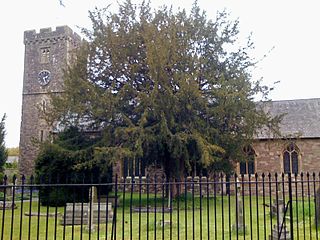
St Cadoc's Church is a Church in Wales church located in Caerleon, Newport, Wales and is Grade II* listed. It is one of many buildings associated with the travels of St Cadoc.
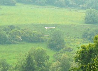
The Marlborough White Horse, also called the Preshute White Horse, is a hill figure on Granham Hill, a fairly shallow slope of the downland above the village of Preshute, near Marlborough in the county of Wiltshire, England. Dating from 1804, it is one of several such white horses to be seen around Great Britain, and one of nine in Wiltshire.
Siliguri Town is one of the three railway stations that serve Siliguri in Darjeeling district in the Indian state of West Bengal. The other two stations are: Siliguri Junction and New Jalpaiguri.
Ysgol Gyfun Emlyn is a mixed, community comprehensive school in Newcastle Emlyn, Carmarthenshire, Wales. It has around 572 pupils, catering for all abilities across an age range of 11 to 18 years.
Snatchwood Halt railway station served Snatchwood between Pontypool and Abersychan in Torfaen, South Wales, UK. The station was opened by the Great Western Railway in 1912 on the line it had purchased from the Monmouthshire Railway and Canal Company in 1880. The Halt lay between Pontypool Crane Street to the south and Abersychan to the north. The Halt lay adjacent to the current A4043 road, between the road and the nearby Afon Lwyd.
References
Coordinates: 51°42′26″N3°02′04″W / 51.7071°N 3.0345°W http://www.southwalesargus.co.uk/resources/images/3360320/

A geographic coordinate system is a coordinate system that enables every location on Earth to be specified by a set of numbers, letters or symbols. The coordinates are often chosen such that one of the numbers represents a vertical position and two or three of the numbers represent a horizontal position; alternatively, a geographic position may be expressed in a combined three-dimensional Cartesian vector. A common choice of coordinates is latitude, longitude and elevation. To specify a location on a plane requires a map projection.
| This Torfaen location article is a stub. You can help Wikipedia by expanding it. |