Related Research Articles
The first written records in the history of Dominica began in November 1493, when Christopher Columbus spotted the island. Prior to European contact, Dominica was inhabited by the Arawak. Dominica was a French colony from 1715 until the end of the Seven Years' War in 1763, and then became a British colony from 1763 to 1978. It became an independent nation in 1978.

Roseau is the capital and largest city of Dominica, with a population of 14,725 as of 2011. It is a small and compact urban settlement, in the Saint George parish and surrounded by the Caribbean Sea, the Roseau River and Morne Bruce. Built on the site of the ancient Island Carib village of Sairi, it is the oldest and most important urban settlement on the island of Dominica.
Dominican may refer to:

"Isle of Beauty, Isle of Splendour" is the popular title for the national anthem of the Commonwealth of Dominica. It was adopted upon the island gaining statehood in 1967 and again with Dominica's independence in 1978. The lyrics are by Wilfred Oscar Morgan Pond (1912–1985) and the music was composed by Lemuel McPherson Christian OBE (1917–2000).
The Leeward Islands are a group of islands situated where the northeastern Caribbean Sea meets the western Atlantic Ocean. Starting with the Virgin Islands east of Puerto Rico, they extend southeast to Guadeloupe and its dependencies. In English, the term Leeward Islands refers to the northern islands of the Lesser Antilles chain. The more southerly part of this chain, starting with Dominica, is called the Windward Islands. Dominica was originally considered a part of the Leeward Islands, but was transferred from the British Leeward Islands to the British Windward Islands in 1940.
The Dominica national football team is the national team of Dominica and is controlled by the Dominica Football Association. They are a member of CONCACAF.

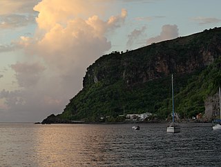
Saint John is one of Dominica's 10 administrative parishes. It is bordered by St. Andrew to the east, and St. Peter and the Espagnole River to the south. It has an area of 59 km² (22.78 mi²).

Saint Joseph is one of Dominica's 10 administrative parishes. It is bordered by St. Peter to the north, St. Andrew to the northeast, St. David to the east, and St. Paul to the south. It has an area of 120.1 km² (46.37 mi²), and a population of 5,765.
Portsmouth is the second largest town in Dominica, with 2,977 inhabitants. It lies on the Indian River on Dominica's northwest coast, in Saint John Parish. Cabrits National Park is located on a peninsula to the north of town. Portsmouth has its own sea port in Prince Rupert Bay.
Dublanc is a village in Saint Peter parish on the west coast of Dominica between the town of Portsmouth and the village of Bioche. It sits on a low hillside at an elevation of 27. As of 2001 it had a population of 423.
Dominica, officially the Commonwealth of Dominica, is an island country in the Caribbean. The capital, Roseau, is located on the western side of the island. It is geographically situated as part of the Windward Islands chain in the Lesser Antilles archipelago in the Caribbean Sea. The island is surrounded by the French Republic with Guadeloupe to the northwest and Martinique to the south-southeast. Its area is 750 km2 (290 sq mi), and the highest point is Morne Diablotins, at 1,447 m (4,747 ft) in elevation. The population was 71,293 at the 2011 census.
The following outline is provided as an overview of and topical guide to Dominica:
Dominica cuisine is the cuisine of the island nation of Dominica. The cuisine is rooted in creole techniques with local produce flavored by spices found on the island.
Tourism in Dominica consists mostly of hiking in the rain forest and visiting cruise ships.
Coulibistrie is a village on the west coast of Dominica, in the northwest corner of Saint Joseph Parish. It is between the villages of Colihaut to the north and Morne Rachette to the south. It extends inland from the coast within a deep valley, along both banks of the Coulibistrie River. The village is primarily residential with few businesses. Many of the houses are built directly atop or adjoining the numerous large boulders that litter the valley along its base.

Tropical Storm Erika was one of the deadliest and most destructive natural disasters in Dominica since Hurricane David in 1979. The fifth named storm of the 2015 Atlantic hurricane season, Erika developed from a westward-moving tropical wave while well east of the Lesser Antilles. Hostile conditions, including dry air and wind shear, inhibited significant development, and Erika failed to acquire sustained winds beyond 50 mph (80 km/h). Contrary to predictions of a northwesterly recurvature, the cyclone persisted on a westerly course and passed through the Leeward Islands and emerged over the Caribbean Sea on August 27. Erika succumbed to adverse conditions the following day, dissipating as a tropical cyclone near the Dominican Republic. The remnant system persisted for several more days, moving into the northeastern Gulf of Mexico, before dissipating over Georgia on September 3.

Dominica is an island nation in the Windward islands in the Lesser Antilles archipelago in the Caribbean Sea. Most people arrive in Dominica via Douglas–Charles Airport, where most commercial flights to the island land. Dominica also utilizes sea transport and a roadway network.

The COVID-19 pandemic in Dominica is part of the ongoing worldwide pandemic of coronavirus disease 2019 caused by severe acute respiratory syndrome coronavirus 2. The virus was confirmed to have reached Dominica on 22 March 2020.
Woodford Hill is a village in Saint Andrew Parish in north-eastern Dominica. Woodford Hill was an estate extending from Eden River to L’anse Noire. An Amerindian village existed at the mouth of the Woodford Hill river about 1,400 years ago. The present day village of Woodford Hill is on the western boundary of the old estate. It is made up of various sections including Small Farm, Mount Sylvie, Falang, Larieu, Fond Cole, Joe Road, and Big Cedar. According to the 2011 census report, Woodford Hill had a population of 1,034.
References
- Map of Dominica
- GEOnet Names Server
- Water Resources Assessment of Dominica, Antigua and Barbuda, and St. Kitts and Nevis