Perton, Herefordshire

Last updated

Perton is a hamlet in the English county of Herefordshire.

Hamlet (place) small settlement in a rural area

A hamlet is a small human settlement. In different jurisdictions and geographies, hamlets may be the size of a town, village or parish, be considered a smaller settlement or subdivision or satellite entity to a larger settlement. The word and concept of a hamlet have roots in the Anglo-Norman settlement of England, where the old French hamlet came to apply to small human settlements. In British geography, a hamlet is considered smaller than a village and distinctly without a church.

England Country in north-west Europe, part of the United Kingdom

England is a country that is part of the United Kingdom. It shares land borders with Wales to the west and Scotland to the north-northwest. The Irish Sea lies west of England and the Celtic Sea lies to the southwest. England is separated from continental Europe by the North Sea to the east and the English Channel to the south. The country covers five-eighths of the island of Great Britain, which lies in the North Atlantic, and includes over 100 smaller islands, such as the Isles of Scilly and the Isle of Wight.

Herefordshire County of England

Herefordshire is a county in the West Midlands of England, governed by Herefordshire Council. It borders Shropshire to the north, Worcestershire to the east, Gloucestershire to the south-east, and the Welsh counties of Monmouthshire and Powys to the west.

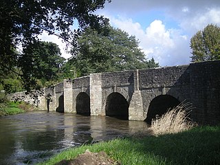
It is in the civil parish of Stoke Edith being west of the village of that name.

Civil parish territorial designation and lowest tier of local government in England, UK

In England, a civil parish is a type of administrative parish used for local government, they are a territorial designation which is the lowest tier of local government below districts and counties, or their combined form, the unitary authority. Civil parishes can trace their origin to the ancient system of ecclesiastical parishes which historically played a role in both civil and ecclesiastical administration; civil and religious parishes were formally split into two types in the 19th century and are now entirely separate. The unit was devised and rolled out across England in the 1860s.

Stoke Edith village in United Kingdom

Stoke Edith is a village in the English county of Herefordshire, situated on the A438 road between Hereford and Ledbury. The population in 1801 of Stoke Edith parish was 332.

Commons-logo.svg Media related to Perton, Herefordshire at Wikimedia Commons

Coordinates: 52°03′41″N2°35′21″W / 52.06140°N 2.58923°W / 52.06140; -2.58923

Geographic coordinate system Coordinate system

A geographic coordinate system is a coordinate system that enables every location on Earth to be specified by a set of numbers, letters or symbols. The coordinates are often chosen such that one of the numbers represents a vertical position and two or three of the numbers represent a horizontal position; alternatively, a geographic position may be expressed in a combined three-dimensional Cartesian vector. A common choice of coordinates is latitude, longitude and elevation. To specify a location on a plane requires a map projection.

Related Research Articles

South Staffordshire Non-metropolitan district in England

South Staffordshire is a local government district in Staffordshire, England. The district lies to the north and west of the West Midlands county, bordering Shropshire to the west and Worcestershire to the south. It contains no towns of major size, and many of the settlements within the district are considered dormitory villages for Stafford, Telford, and the West Midlands conurbation.

Leominster (district) local government district in England

Leominster (district) was a local government district in England from 1 April 1974 to 1 April 1998 with its administrative seat in the town of Leominster.

Thornbury, Herefordshire village in Herefordshire, England

Thornbury is a village in Herefordshire, England, 5.5 km (3.4 mi) north of the town of Bromyard. The population of the village as taken at the 2011 Census was 197.

Hereford and South Herefordshire (UK Parliament constituency) Parliamentary constituency in the United Kingdom

Hereford and South Herefordshire is a constituency of the House of Commons of the UK Parliament. It comprises the city of Hereford and most of south Herefordshire and is currently represented by Jesse Norman in the Conservative Party.

Herefordshire Council

Herefordshire Council is the local government authority for the county of Herefordshire in England. It is a unitary authority, combining the powers of a non-metropolitan county and district.

Stockton Wood and Down

Stockton Wood and Down is a 61.5 hectare biological Site of Special Scientific Interest in Wiltshire, notified in 1951.

A4113 road road in England

The A4113 road is a single-carriageway road that runs from Knighton in Powys to Bromfield in Shropshire, United Kingdom, passing through north Herefordshire.

Salteropterus is a genus of eurypterid, an extinct group of aquatic arthropods. Fossils of Salteropterus have been discovered in deposits of Late Silurian age in Britain. Classified as part of the family Slimonidae, the genus contains one known valid species, S. abbreviatus, which is known from fossils discovered in Herefordshire, England, and a dubious species, S. longilabium, with fossils discovered in Leintwardine, also in Herefordshire. The generic name honours John William Salter, who originally described S. abbreviatus as a species of Eurypterus in 1859.

Perton is a village in Staffordshire, England.

Nurton is a hamlet in the South Staffordshire District, in the English county of Staffordshire. Nearby settlements include the city of Wolverhampton and the villages of Perton and Pattingham.

Saint Guthlac's Priory was a Benedictine priory in Hereford, England at grid reference SO51534019. a site between the present day Bath Street and Commercial Road. Upon the dissolution of the monasteries John Prise bought the priory of St. Guthlac, Hereford.

Shobdon Priory human settlement in United Kingdom

Shobdon Priory was a priory in Herefordshire, England at grid reference SO40106284.

Ocle Priory was a priory near Ocle Pychard in Herefordshire, England at grid reference SO577464. It was a dependency of Lyre Abbey in Normandy and as such an alien priory.

Titley Priory was a priory near Titley in Herefordshire, England at grid reference SO32966011.

Upleadon Preceptory was a priory in Herefordshire, England at grid reference SO66504270.

Wormsley Priory was a monastic house in Herefordshire, England at grid reference SO43584847.

Poston Camp is an Iron Age hill fort located just south of Vowchurch, Herefordshire.

Ivington Camp is an Iron Age hill fort located at Brierley, 3 km south of Leominster, Herefordshire.

Wapley Hill hillfort in Herefordshire

Wapley Hill is an Iron Age hill fort located in Herefordshire, England, 3 km south-east of Presteigne.

Dormington human settlement in the United Kingdom

Dormington is a village and civil parish in Herefordshire, in the West Midlands of England. Dormington village is at the north of its parish, 5 miles (8 km) east from the centre of the city and county town of Hereford, and 8 miles (13 km) west-northwest from the town of Ledbury. The parish is a significant traditional centre for hop growing.