Pike, Pikes or The Pike may refer to:
Sunfish or sun-fish may refer to:
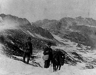
The Pike's Peak gold rush was the boom in gold prospecting and mining in the Pike's Peak Country of western Kansas Territory and southwestern Nebraska Territory of the United States that began in July 1858 and lasted until roughly the creation of the Colorado Territory on February 28, 1861. An estimated 100,000 gold seekers took part in one of the greatest gold rushes in North American history.
Spell(s) or The Spell(s) may refer to:
Algonquin or Algonquian—and the variation Algonki(a)n—may refer to:
Goldfield or Goldfields may refer to:

The Pikes Peak Ascent and Marathon is a trail running competition that begins at the base of Pikes Peak, in Manitou Springs, Colorado, and climbs over 7,815 feet to the top of the 14,115 foot peak. Since 1956, the event takes place each year in late summer, with the Ascent taking place on Saturday, and the round-trip marathon on Sunday.
Cache, caching, or caché may refer to:
App, Apps or APP may refer to:

The Denver Mint is a branch of the United States Mint that struck its first coins on February 1, 1906. The mint is still operating and producing coins for circulation, as well as mint sets and commemorative coins. Coins produced at the Denver Mint bear a D mint mark. The Denver Mint is the single largest producer of coins in the world.
Sati or SATI may refer to:
Phantom Canyon is the name of two canyons located in Colorado, in the Western United States.
High Peak or High Peaks may refer to:

The following outline is provided as an overview of and topical guide to the U.S. state of Kansas:

Pikes Peak is the highest summit of the southern Front Range of the Rocky Mountains in North America. The ultra-prominent 14,115-foot (4,302.31 m) fourteener is located in Pike National Forest, 12 miles (19 km) west of downtown Colorado Springs, Colorado. The town of Manitou Springs lies at its base.

Mount Rosa is a mountain summit of the Pikes Peak Massif in the southern Front Range of the Rocky Mountains of North America. The 11,504-foot (3,506 m) peak is located in Pike National Forest, 12.8 miles (20.6 km) southwest by west of downtown Colorado Springs in Teller County, Colorado, United States.
This page is based on this
Wikipedia article Text is available under the
CC BY-SA 4.0 license; additional terms may apply.
Images, videos and audio are available under their respective licenses.