
New Haven County is a county in the south central part of the U.S. state of Connecticut. As of the 2010 census, the population was 862,477 making it the third-most populous county in Connecticut. Two of the state's largest cities, New Haven (2nd) and Waterbury (5th), are part of New Haven County.

U.S. Route 5 is a north–south United States highway running through the New England states of Connecticut, Massachusetts, and Vermont. Significant cities along the route include New Haven, Connecticut; Hartford, Connecticut; and Springfield, Massachusetts. From Hartford northward to St. Johnsbury, Vermont, the road closely follows the route of the Connecticut River.

State Route 91 is a major east–west freeway located entirely within Southern California and serving several regions of the Greater Los Angeles urban area. Specifically, it currently runs from Vermont Avenue in Gardena, just west of the junction with the Harbor Freeway, east to Riverside at the junction with the Pomona, and Moreno Valley freeways.
The New Haven Green is a 16-acre (65,000 m2) privately owned park and recreation area located in the downtown district of the city of New Haven, Connecticut. It comprises the central square of the nine-square settlement plan of the original Puritan colonists in New Haven, and was designed and surveyed by colonist John Brockett. Today the Green is bordered by the modern paved roads of College, Chapel, Church, and Elm streets. Temple Street bisects the Green into upper (northwest) and lower (southeast) halves.
The New York Connecting Railroad or NYCR is a rail line in the borough of Queens in New York City. It links New York City and Long Island by rail directly to the North American mainland. Amtrak, CSX, Canadian Pacific Railway, Providence and Worcester Railroad and New York and Atlantic Railway (NYAR) currently use the line. It runs from the Hell Gate Bridge over the East River to Fresh Pond Junction yard in Glendale. It was completed in 1917. Amtrak uses the northernmost section of the line from Sunnyside Junction in the Woodside section of Queens to the Hell Gate Bridge into the Bronx from which it follows the line north to Boston.
Interstate 280 (I-280) is a 17.85-mile (28.73 km) Interstate Highway in the U.S. state of New Jersey. It provides a spur from I-80 in Parsippany-Troy Hills, Morris County to Newark, and I-95 in Kearny, Hudson County. In Kearny, access is provided toward the Holland Tunnel and Lincoln Tunnel to New York City. The western part of the route runs through suburban areas of Morris and Essex counties, crossing the Watchung Mountains. Upon reaching The Oranges, the setting becomes more urbanized and I-280 runs along a depressed alignment before ascending again in Newark. I-280 includes a lift bridge, the William A. Stickel Memorial Bridge over the Passaic River between Newark and East Newark/Harrison. The highway is sometimes called the Essex Freeway. I-280 interchanges with several roads, including the Garden State Parkway in East Orange and Route 21 in Newark.

The Park Avenue Tunnel, also called the Murray Hill Tunnel, is a 1,600-foot-long (488 m) tunnel that passes under seven blocks of Park Avenue in Murray Hill, in the New York City borough of Manhattan. Traffic currently goes northbound from 33rd Street toward the Park Avenue Viaduct. The tunnel is under the jurisdiction of the New York City Department of Transportation, and carries one lane of northbound car traffic from East 33rd Street to East 40th Street; from 40th Street north, traffic must follow the Park Avenue Viaduct around Grand Central Terminal to 46th Street. The vertical clearance is 8 ft 11 in (2.72 m).

509 Harbourfront is a streetcar route in Toronto, Ontario, Canada, operated by the Toronto Transit Commission.

LaSalle Street is a major north-south street in Chicago named for Robert de La Salle, an early explorer of Illinois. The portion that runs through the Chicago Loop is considered to be Chicago's financial district.

Connecticut's 3rd congressional district is a congressional district in the U.S. state of Connecticut. Located in the central part of the state, the district includes the city of New Haven and its surrounding suburbs.
The Imperial Highway is a west-east thoroughfare in the counties of Los Angeles, Orange, San Diego, and Imperial in California. The main portion of the existing route begins at Vista Del Mar in Los Angeles near the Los Angeles International Airport and ends at the Anaheim - Orange line at Via Escola where it becomes Cannon Street. Formerly, the Route used to extend from Vista Del Mar to Calexico, where a portion of the highway still exists, but the Route was replaced with other highways, rendering the older portions of the Imperial Highway to fall out of use.
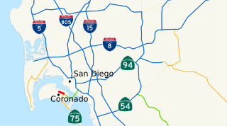
State Route 282 (SR 282) is an east–west state highway entirely within the city of Coronado, California. It is a spur of SR 75 and connects the rest of the state highway system with Naval Air Station North Island. The road is part of a link connecting to the metropolitan area of San Diego via SR 75 and the Coronado Bay Bridge. The entire route uses a one-way couplet, with Third Street in the westbound direction and Fourth Street in the eastbound direction.
The Genesee Tunnel is an underground water pipeline operated by the South Central Connecticut Regional Water Authority, part of the Authority's source water distribution system. Its main inlet is housed in a small brick building on the shore of the west fork of the northern end of the Hammonasset Reservoir on the Madison, Connecticut-Killingworth, Connecticut town line.
The tunnel runs westward about 5 miles to a pond sometimes known as Menunkatuck Reservoir which is on posted Regional Water Authority (RWA) land in northern Guilford.
The valley of Amity is an area located partly in the towns of Woodbridge, Bethany, and Orange, Connecticut and partly in the city of New Haven. It is bounded on the northeast by the West Rock ridge, on the south by the Westville neighborhood of New Haven, and on the northwest by an incline in elevation above which lies the highlands of Woodbridge, Connecticut. The official New Haven neighborhood planning maps include the traditionally separate neighborhoods of West Hills and Beverly Hills within the Amity neighborhood.

The Wabash Tunnel is a former railway tunnel and presently an automobile tunnel through Mt. Washington in the city of Pittsburgh, Pennsylvania, United States. Constructed early in the 20th century by railroad magnate George J. Gould for the Wabash Railroad, it was closed to trains and cars between 1946 and 2004.

West Rock Ridge State Park is a public recreation area located in New Haven, Hamden, and Woodbridge, Connecticut. The state park is named for the 400-to-700-foot trap rock West Rock Ridge, which is part of the Metacomet Ridge extending from Long Island Sound to the Vermont border. The park's 7 miles (11 km) of open west-facing cliffs offer vistas encompassing Metropolitan New Haven and suburban towns to the west. The park includes Judges Cave, a colonial era historic site; Lake Wintergreen; and the 7-mile (11 km) Regicides Trail, part of the Connecticut Forest and Park Association's Blue Trail system. The park is part of a larger area of protected open space including state, municipal, and non-profit owned land.
Whitney Avenue is a principal arterial connecting Downtown New Haven with the town center of Hamden in the U.S. state of Connecticut. Most of the road within the city of New Haven is included in the Whitney Avenue Historic District, which is listed on the National Register of Historic Places. The designation begins at Grove Street in the northern part of Downtown New Haven and extends through the town of Hamden up to the Cheshire town line. North of Dixwell Avenue in Hamden Center, the road is a state highway and designated as part of Route 10. From the New Haven town line to Dixwell Avenue, the road is state-maintained with an unsigned designation of State Road 707. Within New Haven, Whitney Avenue is a town road. The J route of Connecticut Transit New Haven, which connects New Haven to Waterbury, runs along Whitney Avenue.
West Rock is an official neighborhood of the city of New Haven, Connecticut.
Elm Street Historic District is a state historic district in the downtown area of New Haven, Connecticut. The area is eligible for listing, but not yet listed, on the National Register of Historic Places. The district is roughly bounded by Wall, Orange, Elm, and College streets. It includes the New Haven Free Public Library, the New Haven County Courthouse, The Eli, the Union and New Haven Trust Building, the Yale School of Music, and the Yale University Press building.
The Kennedy Mitchell Hall of Records is located in New Haven, Connecticut and houses many of the City of New Haven's governmental functions, including finance, vital statistics, offices of the town clerk, and public hearing rooms where city policy is debated.


