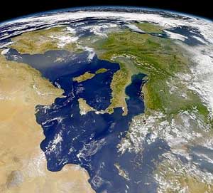
Albania is a small country in Southern and Southeastern Europe strategically positioned on the Adriatic and Ionian Sea inside the Mediterranean Sea, with a coastline of about 476 km (296 mi). It is bounded by Montenegro to the northwest, Kosovo to the northeast, North Macedonia to the east and Greece to the southeast and south.

Italy is located in southern Europe and comprises the long, boot-shaped Italian Peninsula, the southern side of Alps, the large plain of the Po Valley and some islands including Sicily and Sardinia. Corsica, although belonging to the Italian geographical region, has been a part of France since 1769. Italy is part of the Northern Hemisphere.

North Macedonia is a country situated in southeastern Europe with geographic coordinates 41°50′N22°00′E, bordering Kosovo and Serbia to the north, Bulgaria to the east, Greece to the south and Albania to the west. The country is part of the wider region of Macedonia and makes up most of Vardar Macedonia. The country is a major transportation corridor from Western and Central Europe to Southern Europe and the Aegean Sea. North Macedonia is a landlocked country but has three major natural lakes: Lake Ohrid, Lake Prespa and Lake Dojran. It has a water area of 857 km2, while its land area is 24,856 km2.

The Prespa lakes are two freshwater lakes in southeast Europe, shared by Albania, Greece, and North Macedonia. Of the total surface area, 176.3 km2 (68.07 sq mi) belongs to North Macedonia, 46.3 km2 (17.88 sq mi) to Albania and 36.4 km2 (14.05 sq mi) to Greece. They are the highest tectonic lakes in the Balkans, standing at an elevation of 853 m (2,798 ft).

Baba Mountain (Macedonian: Баба Планина/Baba Planina, or also known by the name of its highest peak, Pelister, is a mountain in North Macedonia. The Pelister (peak overlooks the city of Bitola. Baba Mountain is the third highest mountain in North Macedonia. Other peaks besides Pelister are Dva Groba, Veternica, Musa, Rzana, Shiroka, Kozji Kamen, Griva and Golema Chuka in North Macedonia, and Belavoda, Kirko. The Baba massif splits up the rivers in the region, so that they either flow towards the Adriatic.

Galičica is a mountain situated across the border between North Macedonia and Albania. There is a National park on the Macedonian side of the mountain, situated between the two biggest lakes in the republic: Lake Ohrid and Lake Prespa. It stretches over an area of 227 square kilometres (88 mi²).

Crnoljeva is a mountain in central Kosovo, dividing its two main geographical regions, the Kosovo Plain and Metohija. Crnoljeva is also a point where all three drainage basins of Serbia meet, making the mountain a major hydrographic knot. In Albanian it is named after the village of Crnoljevo.

Dolno Dupeni is a village in the Resen Municipality of North Macedonia. Located on Lake Prespa, its beach runs to the border with Greece.

Shebenik is a large mountain located in the Shebenik-Jabllanice National Park in eastern Albania. Shebenik has many peaks over 2,000 m (6,562 ft). The highest is Maja e Shebenikut at 2,253 m (7,392 ft) above sea level. It is found in the north-east of Shebenik. Around this peak are a number of small and large mountain lakes. Shebenik mountain is located west of Jablanica Mountain and northwest of Lake Ohrid. Shebenik is a great importance to wildlife preservation, especially because it is a home for the rare Eurasian lynx.

The Valamara is a mountain of the Central Mountain Range in Southeastern Albania. The mountain is roughly part of a series of mountains, extending from north-northeast to south-southwest between the valleys of Shkumbin in the north and Devoll in the south. It is one of the highest peaks in the European continent, in terms of topographic prominence.
Mali i Mesit is a mountain peak in the south of Albania and in the north of Greece. Mali i Mesit, which means 'Middle Peak' in English is, a peak in the mountain of Gramos. Mali i Mesit is 2,480 m (8,136 ft) high, making it one of the highest peaks of Gramos. It is also a place were Albanians used to travel to and from Greece.

The Central Mountain Range is a physiogeographical region encompassing the central and eastern edge of Albania. It comprises the mountainous inland extending all the way from the valley of Drin and the mountains of Sharr, Skanderbeg, Korab, and Shebenik-Jabllanicë, through the lakes of Ohrid and Prespa, until it reaches the village of Ersekë and the mountains of Pindus close to the border between the country and Greece.
Prespa was a medieval town, situated in the homonymous area in south-western Macedonia. It was a residence and burial place of the Bulgarian emperor Samuel and according to some sources capital of the First Bulgarian Empire and seat of the Bulgarian Patriarchate in the last decades of the 10th century.

Mali i Gjerë is a mountain in southern Albania. The highest peaks from north to south are Mali i Pusit, Mali i Frashërit and Mali i Nikollaqit.

Ohrid-Prespa Transboundary Biosphere Reserve is a biosphere reserve encompassing the area of Lake Ohrid and Lake Prespa, on North Macedonia and Albania.

The Prespa National Park is a national park in southeastern Albania lying on the border triangle shared with Greece and North Macedonia. At approximately 277.5 km2 (107.1 sq mi), the park encompasses the country's sections of Great and Small Prespa Lake that are surrounded by mountains. It is considerably marked by high mountains, small islands, vast freshwater wetlands, salt marshes, meadows, reed beds and dense forests.

The Albanian Ohrid Lake Coast is a coastline of the Western Ohrid Lake, that encompasses the southeastern border of the Republic of Albania, stretching from the north of the Bay of Lin nearby the northern border shared with the Republic of Macedonia, across the villages of Memëlisht, Buqezë, Piskupat and the city of Pogradec, to the southern border shared with Macedonia as well.


