Antigua and Barbuda is a country in the West Indies in the Americas, lying between the Caribbean Sea and the Atlantic Ocean. It consists of two major islands, Antigua and Barbuda, and a number of smaller islands. The permanent population numbers about 81,800 and the capital and largest port and city is St. John's on Antigua. Lying near each other, Antigua and Barbuda are in the middle of the Leeward Islands, part of the Lesser Antilles, roughly at 17°N of the equator.

Dyess Air Force Base (AFB) is a United States Air Force base located approximately 7 miles (11 km) southwest of Abilene, Texas.

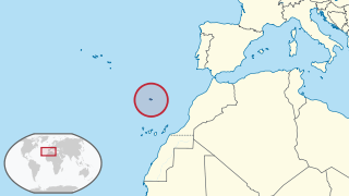
In geology, the places known as hotspots or hot spots are volcanic regions thought to be fed by underlying mantle that is anomalously hot compared with the surrounding mantle. Their position on the Earth's surface is independent of tectonic plate boundaries. There are two hypotheses that attempt to explain their origins. One suggests that hotspots are due to mantle plumes that rise as thermal diapirs from the core–mantle boundary. The other hypothesis is that lithospheric extension permits the passive rising of melt from shallow depths. This hypothesis considers the term "hotspot" to be a misnomer, asserting that the mantle source beneath them is, in fact, not anomalously hot at all. Well-known examples include the Hawaii, Iceland and Yellowstone hotspots.
Babine Lake Marine Provincial Park is a provincial park in British Columbia, Canada. The park was established by Order-in-Council in 1993, comprising two sites at Pendleton Bay totalling 36.9 hectares. Another was established in the same year at Smithers Landing, comprising approximately 157.8 hectares. Three more sites were added in 2001, Hook (Deep) Bay, Pierre Creek, Pinkut Creek and Sandpoint. All sites combined comprise approximately 492 hectares.
Laval-sur-le-Lac is a small sector on the western part of Laval and was a separate city until the municipal mergers on August 6, 1965. This community contains North America's oldest French speaking private golf club, Le Club Laval-sur-le-Lac, established in 1917.

The Casa Garden is a small parkette located in Santo António, Macau, China. The area is the headquarters of the Macau delegation of the Orient Foundation.

The River Swincombe is a tributary of the West Dart River that flows through
Dartmoor national park in Devon, south-west England. It rises south-east of Princetown, and flows 2 km south-east to Foxtor Mires, where it turns north-east to meet the West Dart near Hexworthy. The first 2 km are known as the Strane River. Some maps show that the source starts north of Nakers Hill and heads north west to the east of Foxtor Mires where it meets the Strane River which is its own river.
KNFM, branded as "Lonestar 92", is a Country music formatted radio station that serves the Midland–Odessa metropolitan area. The station broadcasts on FM frequency 92.3 and is under ownership of Townsquare Media.

The River Inny is a small river in east Cornwall, United Kingdom. It is a tributary of the River Tamar and is about twenty miles (32 km) long from its source near Davidstow on the eastern flank of Bodmin Moor to its confluence with the Tamar at Inny Foot near Dunterton.
The following radio stations broadcast on AM frequency 1090 kHz: 1090 AM is a United States and Mexican clear-channel frequency. KAAY Little Rock, WBAL Baltimore and XEPRS-AM Rosarito-Tijuana share Class A status on 1090 AM.

Moscow is an unincorporated community in Marengo County, Alabama, United States.
The United States Border Patrol operates 71 traffic checkpoints, including 33 permanent traffic checkpoints, near the Mexico–United States border. The stated primary purpose of these inspection stations is to deter illegal immigration and smuggling activities. After the September 11 attacks in 2001, they took on the additional role of terrorism deterrence. These checkpoints are located between 25 and 75 miles of the Mexico–United States border along major U.S. highways; near the southern border of the contiguous United States. Their situation at interior locations allow them to deter illegal activities that may have bypassed official border crossings along the frontier. The checkpoints are divided among nine Border Patrol sectors. There are a number of these checkpoints near the northern border of the contiguous U.S. as well ; within 100 miles (160 km) of the Canada–U.S. border.

Mayhill is a small unincorporated community in Otero County, New Mexico, United States. It is surrounded by the Lincoln National Forest on the eastern slope of the Sacramento Mountains, at the confluence of James Canyon and Rio Penasco, about 17 miles east of Cloudcroft. The elevation is 6581 feet.

Mount Laguna Air Force Station is a closed United States Air Force General Surveillance Radar station. It is located 24.3 miles (39.1 km) north-northeast of Tecate, California. It was closed in 1981 by the Air Force, and turned over to the Federal Aviation Administration (FAA).

Highway 45 is the official designation of a 3.3 km stretch of road forming a continuous connection between Route 443 from the Tel Aviv Metropolitan Area and Highway 50 to central Jerusalem and a 1.4 km spur serving the Atarot Industrial Park.

Las Americas Premium Outlets is a 560,000 square feet (52,000 m2) outlet mall in San Ysidro, San Diego, California located directly on the Mexico–United States border just west of the San Ysidro Port of Entry at the new PedWest crossing from Tijuana to Virginia Avenue on the U.S. side.

Hollenbeck Canyon Wildlife Area is located near Jamul in California. The former cattle ranch was designated a wildlife area in 2001, and forms a wildlife corridor between Otay Mountain Wilderness and Jamul Mountains under the protection of the California Department of Fish and Wildlife. The area is open to the public for activities including hunting, equestrian use, hiking, mountain-biking, and (hunting) dog training.

The George is a Grade II listed public house in Twickenham, in the London Borough of Richmond upon Thames. It is in three adjoining buildings at 32–36 King Street, parts of which date from the late 17th century.
Tordillo Mountain is a lone summit that rises to the elevation of 2,064 feet / 629 meters in Yuma County, Arizona.