| Pourakino River | |
|---|---|
 | |
| Location | |
| Country | New Zealand |
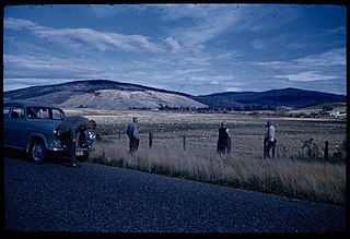
The Pourakino River is a river in New Zealand, flowing into the Jacobs River Estuary at Riverton.
| Pourakino River | |
|---|---|
| | |
| Location | |
| Country | New Zealand |
The Pourakino River is a river in New Zealand, flowing into the Jacobs River Estuary at Riverton.
The Commonwealth Range is a north-south trending range of rugged mountains, 60 nautical miles long, located within the Queen Maud Mountains on the Dufek Coast of the continent of Antarctica. The range borders the eastern side of Beardmore Glacier from Keltie Glacier to the Ross Ice Shelf. The range is southeast of the Queen Alexandra Range, which is to the west of the Beardmore Glacier. It is west of the Hughes Range and north of the Supporters Range and the Barton Mountains.
Borchgrevink Glacier is a large glacier in the Victory Mountains, Victoria Land, Antarctica. It drains south between Malta Plateau and Daniell Peninsula, and thence projects into Glacier Strait, Ross Sea, as a floating glacier tongue.
The Millen Range is a prominent northwest–southeast trending mountain range, located west of the Cartographers Range in the Victory Mountains of Antarctica. Peaks in the range include Inferno, Omega, Le Couteur, Head, Cirque, Gless, Turret, Crosscut and Mount Aorangi. It was named by the New Zealand Federated Mountain Clubs Antarctic Expedition (NZFMCAE) of 1962–63, for John M. Millen, leader of the expedition.
The Northumberland Islands are a scattered island chain off the eastern coast of Queensland, Australia.

Pahia is a small rural locality in coastal Southland, New Zealand, not to be confused with the North Island tourist resort of Paihia. Surrounding areas include Ruahine, Wakapatu, Round Hill, Colac Bay and Orepuki. The main road, Orepuki-Riverton Hwy, runs through it. Pahia is 15 minutes from Riverton, 20 minutes from Tuatapere and 45 minutes from Invercargill.
Lennox-King Glacier is a large valley glacier, about 40 nautical miles (70 km) long that flows east into the Ross Ice Shelf.
The Freshwater River is the longest river on Stewart Island, the third largest of New Zealand's islands. It arises close to the island's northwestern point, from which it is separated by a ridge, and flows southeastward through the Ruggedy Flat for 25 kilometres (16 mi) before reaching the Paterson Inlet on the island's central east coast. The Freshwater is the longest New Zealand river not to be located in either of the country's two main islands.

The Clifden Suspension Bridge is a historic suspension bridge near Clifden, New Zealand with a single lane. Built in 1899, it spans the Waiau River and is 111.5 m long.
The Ihungia River is a river of the northeastern North Island of New Zealand. It flows north from its source inland from Te Puia Springs, joining with the Mata River 15 kilometres (9 mi) southwest of Ruatoria.
The Orauea River is a river in New Zealand, a tributary of the Waiau River in Southland.
The Rakeahua River is a river in Stewart Island/Rakiura, New Zealand, flowing into Paterson Inlet.
The Toitoi River is a river in Stewart Island/Rakiura, New Zealand.
The Waipati River, alternatively known as the Chaslands River is a river in the eastern Catlins, New Zealand. It rises in the Maclennan Range and flows south-eastward into the Waipati Beach north of Chaslands Mistake.
Barnett Glacier is a large glacier in the Anare Mountains that flows east along the south side of Tapsell Foreland into Smith Inlet, northern Victoria Land, Antarctica.
The Malta Plateau is an ice-covered plateau of about 25 nautical miles extent in the Victory Mountains of Victoria Land, Antarctica. The plateau is irregular in shape and is bounded on the south and west by Mariner Glacier, on the north by tributaries to Trafalgar Glacier, and on the east by tributaries to Borchgrevink Glacier.
The Holland Range is a rugged coastal mountain range in the Ross Dependency, Antarctica, on the west coast of the Ross Ice Shelf. It is about 60 nautical miles (110 km) long.
The Longwood Range is a range of hills to the west of the Southland Plains, Southland, New Zealand. From the 1860s until the 1950s gold mining was prevalent in the Longwood Ranges. There are many small towns and localities situated around the periphery of these hills: clockwise from the south-east, these include Riverton, Pourakino Valley, Colac Bay, Pahia, Orepuki, Tuatapere, Otautau and Thornbury.
Stewarts Brook, a perennial stream of the Hunter River catchment, is located in the Hunter region of New South Wales, Australia.
Waipango is a farming locality in Southland, New Zealand, on the flat between the lower reaches of the Pourakino and Aparima Rivers. It is 8 km north-west of Riverton, 14 km south-west of Thornbury, and 14 km north-east of Colac Bay. The name, from the Māori language, literally translates as Wai meaning water, and pango meaning black.
"Place name detail: Pourakino River". New Zealand Gazetteer. New Zealand Geographic Board . Retrieved 12 July 2009.
46°20′S167°59′E / 46.333°S 167.983°E