You can help expand this article with text translated from the corresponding article in Spanish. (June 2015)Click [show] for important translation instructions.
|
Puerto Pinasco is a town located in the Presidente Hayes Department, of Paraguay.
You can help expand this article with text translated from the corresponding article in Spanish. (June 2015)Click [show] for important translation instructions.
|
Puerto Pinasco is a town located in the Presidente Hayes Department, of Paraguay.

The Arctic Archipelago, also known as the Canadian Arctic Archipelago, is an archipelago lying to the north of the Canadian continental mainland, excluding Greenland and Iceland.
The Ohio Range is a range in the Transantarctic Mountains of Antarctica. It is about 30 nautical miles long and 10 nautical miles wide, extending west-southwest – east-northeast from Eldridge Peak to Mirsky Ledge. The range forms the northeast end of the Horlick Mountains and consists primarily of a large snow-topped plateau with steep northern cliffs and several flat-topped ridges and mountains. The highest point, 2,990 metres (9,810 ft), is the summit of Mount Schopf.

The Priestley Glacier is a major valley glacier, about 60 nautical miles long, originating at the edge of the Polar Plateau of Victoria Land, Antarctica. The glacier drains southeast between the Deep Freeze Range and Eisenhower Range to enter the northern end of the Nansen Ice Sheet. It was first explored by the Northern Party of the British Antarctic Expedition, 1910–13, and named for Raymond Priestley, a geologist with the Northern Party.

Ingavi is a province in the La Paz Department in Bolivia. This is where the Battle of Ingavi occurred on November 18, 1841, and where the World Heritage Site of Tiwanaku is situated.

Charcas is a province in the northern parts of the Bolivian Potosí Department. Its capital is San Pedro de Buena Vista.
The Yuha Desert is a section of the Sonoran Desert located in the Imperial Valley of California; south of Interstate 8, west of El Centro, and north of the international border.
Drygalski Glacier is a broad glacier, 18 nautical miles long which flows southeast from Herbert Plateau through a rectangular re-entrant to a point immediately north of Sentinel Nunatak on the east coast of Graham Land, Antarctica.
Isoanala is a rural municipality in Madagascar. It belongs to the district of Betroka, which is a part of the Anosy Region. The population of the commune was estimated to be approximately 17,000 in the 2001 commune census.
Nionsomoridou is a town and sub-prefecture in the Beyla Prefecture in the Nzérékoré Region of south-eastern Guinea.

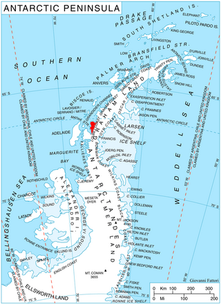
Wilkinson Glacier is a glacier on the south side of Protector Heights on Pernik Peninsula, Loubet Coast in Graham Land, flowing westward into Lallemand Fjord to the south of Holdfast Point. Mapped from air photos taken by Falkland Islands and Dependencies Aerial Survey Expedition (FIDASE) (1956–57). Named by United Kingdom Antarctic Place-Names Committee (UK-APC) for Captain John V. Wilkinson, Royal Navy, captain of HMS Protector in these waters, 1955–56 and 1956–57.
Curtiss Bay is a bay about 4 nautical miles wide, indenting the west coast of Graham Land between Cape Sterneck and Cape Andreas on the Davis Coast.
Greenville Valley is the large mainly ice-free valley lying south of Elkhorn Ridge in the Convoy Range of Victoria Land, Antarctica. A lobe of the Northwind Glacier flows a short distance west into the mouth of the valley. Near the head of the valley the south wall is breached by the entrance to Merrell Valley.
Domen Butte is a snow-topped butte with steep rock sides, just southwest of Hogskavlen Mountain in the Borg Massif of Queen Maud Land. It was mapped by Norwegian cartographers from surveys and air photos by the Norwegian–British–Swedish Antarctic Expedition (1949–52) and named Domen.

Matusevich Glacier is a broad glacier about 50 nautical miles long, with a well developed glacier tongue, flowing to the coast of East Antarctica between the Lazarev Mountains and the northwestern extremity of the Wilson Hills.

The Du Toit Nunataks are a group of nunataks between Cornwall Glacier and Glen Glacier, marking the western end of the Read Mountains in the Shackleton Range of Antarctica.
Heap Island is an island off the southeast coast of Renaud Island in the Biscoe Islands of the Graham Coast of Antarctica, between Jurva Point and Bates Island. In association with the names of sea-ice specialists grouped in this area, it was named by the UK Antarctic Place-Names Committee (UK-APC) in 1985 after John A. Heap, a sea-ice specialist with the Falkland Islands Dependencies Survey (FIDS), 1955–62, who worked in the Antarctic with FIDS, 1955–56, with the Commonwealth Trans-Antarctic Expedition, 1956–57, and with the United States Antarctic Research Program, 1962–63. He was later head of the Polar Regions Section at the Foreign and Commonwealth Office, and a member of the UK-APC from 1976.

Read Mountains is a group of rocky summits, the highest being Holmes Summit at 1,875 metres (6,152 ft), lying east of Glen Glacier in the south-central part of the Shackleton Range.
Krasnaya Rechka is the name of several rural localities in Russia:
22°43′S57°50′W / 22.717°S 57.833°W