
The Laramie Mountains are a range of moderately high peaks on the eastern edge of the Rocky Mountains in the U.S states of Wyoming and Colorado. The range is the northernmost extension of the line of the ranges along the eastern side of the Rockies, and in particular of the higher peaks of the Front Range directly to the south. North of the range, the gap between the Laramie range and the Bighorn Mountains provided the route for historical trails, such as the Oregon Trail, the Mormon Trail, and the Pony Express.

The Granite Mountains are a short subrange of the Rocky Mountains in central Wyoming of the United States. The range runs approximately 100 mi (160 km) E-W along the south side of the Shoshone Basin, and north of the Sweetwater River, in eastern Fremont County and western Natrona County. The highest point is McIntosh Peak at 8,058 feet (2,456 m). Independence Rock is at the east end of the range, and Split Rock was a prominent landmark on the Oregon Trail. The region is rich in uranium and other mineral deposits.

The Blue Mountains are a mountain range in the western United States, located largely in northeastern Oregon and stretching into southeastern Washington. The range has an area of 4,060 square miles (10,500 km2), stretching east and southeast of Pendleton, Oregon, to the Snake River along the Oregon-Idaho border. The Blue Mountains cover eight counties in Oregon and Washington; they are Union, Umatilla, Grant, Baker, and Wallowa counties in Oregon, and Walla Walla, Columbia and Garfield counties in Washington. They are home to the world's largest organism and fungal mycelial mat, the Armillaria ostoyae. The Blue Mountains were so named due to the color of the mountains when seen from a distance.

The Siskiyou Mountains are a coastal subrange of the Klamath Mountains, and located in northwestern California and southwestern Oregon in the United States. They extend in an arc for approximately 100 miles (160 km) from east of Crescent City, California, northeast along the north side of the Klamath River into Josephine and Jackson counties in Oregon. The mountain range forms a barrier between the watersheds of the Klamath River to the south and the Rogue River to the north.

The Sandia Peak Tramway is an aerial tramway located adjacent to Albuquerque, New Mexico, USA. It stretches from the northeast edge of the city to the crestline of the Sandia Mountains and has the world's third longest single span. It is the longest aerial tram in the United States.

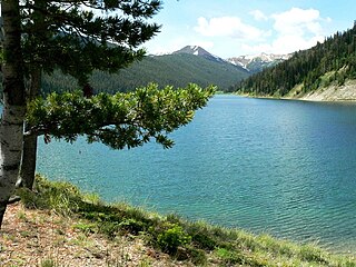
The Cirque of the Towers is located in the Wind River Range Wyoming, U.S., part of which is in the Bridger Wilderness in Bridger-Teton National Forest, while the remainder is in the Popo Agie Wilderness in Shoshone National Forest. Located in the southern section of the Wind River Range, the cirque is a very popular destination for technical rock climbers. Climber Orrin Bonney gave the area its current name in 1941 after his survey of the cirque. Prior to this, few if any visitors had ventured into the cirque due to the remote location. The cirque is an almost circular hole or valley carved by a glacier that retreated over 8,000 years ago. As is true with the rest of the Winds, the mountains are composed almost entirely of granite. The Continental Divide spans the crest of the main peaks.

Mount Frissell, 2,454 feet (748 m), located on the border of southwest Massachusetts and northwest Connecticut, is a prominent peak of the Taconic Range.

The Southern Nantahala Wilderness was designated in 1984 and currently consists of 23,473 acres (94.99 km2). Approximately 11,770 acres (47.6 km2) are located in Georgia in the Chattahoochee National Forest and approximately 11,703 acres (47.36 km2) are located in North Carolina in the Nantahala National Forest. The Wilderness is managed by the United States Forest Service and is part of the National Wilderness Preservation System. The highest elevation in the Southern Nantahala Wilderness is the 5,499-foot peak of Standing Indian Mountain in North Carolina and the lowest elevation is approximately 2,400 feet (730 m). The Appalachian Trail passes through the Wilderness in both states.

Hart Mountain is a fault-block mountain, in Lake County, Oregon, U.S. It lies about 30 miles (48 km) to the east of Lakeview.
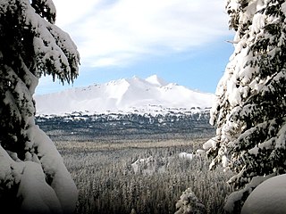
The Diamond Peak Wilderness is a wilderness area straddling the Cascade crest and includes the Diamond Peak volcano. It is located within two National Forests - the Willamette National Forest on the west and the Deschutes National Forest on the east.
The Wyoming Range is a mountain range located in western Wyoming. It is a range of the Rocky Mountains that runs north-south near the western edge of the state. Its highest peak is Wyoming Peak, which stands at 11,383 feet (3,470 m) above sea-level. The range is sometimes referred to as The Wyomings.

Eagle Cap Wilderness is a wilderness area located in the Wallowa Mountains of northeastern Oregon, within the Wallowa–Whitman National Forest. The wilderness was established in 1940. In 1964, it was included in the National Wilderness Preservation System. A boundary revision in 1972 added 73,000 acres (30,000 ha) and the Wilderness Act of 1984 added 66,100 acres (26,700 ha) resulting in a current total of 361,446 acres, making Eagle Cap by far Oregon's largest wilderness area.

Cape Perpetua is a large forested headland projecting into the Pacific Ocean on the central Oregon Coast in Lincoln County, Oregon. The land is managed by the United States Forest Service as part of the Siuslaw National Forest.

The Little Rincon Mountains are a small range of mountains, lying to the east of the Rincon Mountains, at Tucson, of eastern Pima County, Arizona. The range is located in northwest Cochise County and is part of the western border of the San Pedro River and Valley, the major valley and river of western Cochise County. The river is northward flowing to meet the Gila River; its headwaters are south of the US-Mexico border in northern Sonora. A small part of the Little Rincon range's southwest lies in Pima County.

The Little Burro Mountains are a short 15 mi (24 km) long, mountain range located in Grant County, New Mexico. The range lies adjacent to the southeast border of the larger Big Burro Mountains. The Little Burro Mountains are located 8 mi southwest of Silver City. State Road 90 from Silver City skirts the southern perimeter of the range on its route to Lordsburg.
The Cedar Mountain Range is a short 20 mi (32 km) long, mountain range in southwest Luna County, New Mexico, USA, just north of the Mexico-United States border with Chihuahua.

Graham Peak, at 8,867 feet (2,703 m) above sea level is the fourth highest peak in the Albion Mountains of Idaho. The peak is located in the City of Rocks National Reserve and Cassia County less than 0.2 mi (0.32 km) south of the Sawtooth National Forest border. It is located 5.13 mi (8.26 km) south-southwest of Cache Peak. Forest road 707 leads directly to the summit. The peak contains the smallest of the three known populations of Cymopterus davisii, estimated at 500–1000 individuals.
White Cloud Peak 1, also known as WCP 1, at 10,353 feet (3,156 m) above sea level is an unofficially named peak in the White Cloud Mountains of Idaho. The peak is located in Sawtooth National Recreation Area in Custer County 0.88 mi (1.42 km) from White Cloud Peak 3, its line parent. Hoodoo Lake is west of the peak.

Valentine Peak is a 11,361-foot (3,463 m) mountain located in the southern Wind River Range in the U.S. state of Wyoming. Valentine Peak is 0.42 mi (0.68 km) southeast of Valentine Mountain and 2.2 mi (3.5 km) northwest of Mount Chauvenet. Valentine Peak is in the Popo Agie Wilderness of Shoshone National Forest.


