Qazbölük

Last updated

Qazbölük is a village in the municipality of Meşəşambul in the Balakan Rayon of Azerbaijan. [1]

Meşəşambul Municipality in Balakan, Azerbaijan

Meşəşambul is a village and municipality in the Balakan Rayon of Azerbaijan. It has a population of 3,438. The municipality consists of the villages of Meşəşambul and Qazbölük.

Azerbaijan Country in the South Caucasus

Azerbaijan, officially the Republic of Azerbaijan, is a country in the South Caucasus region of Eurasia at the crossroads of Eastern Europe and Western Asia. It is bounded by the Caspian Sea to the east, Russia to the north, Georgia to the northwest, Armenia to the west and Iran to the south. The exclave of Nakhchivan is bounded by Armenia to the north and east, Iran to the south and west, and has an 11 km long border with Turkey in the northwest.

Related Research Articles

Moghegno

Moghegno is a village and former municipality in the district of Vallemaggia in the canton of Ticino, Switzerland.

Kilsəbuqov Place in Balakan, Azerbaijan

Kilsəbuqov is a village in the Balakan Rayon of Azerbaijan. The village forms part of the municipality of Sarıbulaq.

Ağkilsə Place in Balakan, Azerbaijan

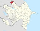
Ağkilsə is a village in the Balakan Rayon of Azerbaijan. The village forms part of the municipality of Sarıbulaq.

Raziyələr Place in Quba, Azerbaijan

Raziyələr is a village in the Quba Rayon of Azerbaijan. The village forms part of the municipality of Çiçi.

Ağarəhimoba Place in Khachmaz, Azerbaijan

Ağarəhimoba is a village in the Khachmaz Rayon of Azerbaijan. The village forms part of the municipality of Qadaşoba.

Tarakema Place in Zangilan, Azerbaijan

Tarakema is a village in the Zangilan Rayon of Azerbaijan.

Ashagy Kharasha Place in Quba, Azerbaijan

Ashagy Kharasha is a village in the Quba Rayon of Azerbaijan.

Kələntəroba Place in Qusar, Azerbaijan

Kələntəroba is a village in the Qusar Rayon of Azerbaijan.

Zeynəko is a village in the municipality of Bobla in the Lerik Rayon of Azerbaijan.

Uştalqışlaq is a village and municipality in the Ismailli Rayon of Azerbaijan. It has a population of 233.

Cillik is a village in the municipality of Qazma in the Balakan Rayon of Azerbaijan.

Öküzovtala is a village in the municipality of Qazma in the Balakan Rayon of Azerbaijan.

Yuxarı Fərəcan is a village in the Lachin Rayon of Azerbaijan.

Amsarqışlaq is a village and municipality in the Quba Rayon of Azerbaijan. It has a population of 825.

Küpçalqışlaq is a village and municipality in the Quba Rayon of Azerbaijan. It has a population of 352.

Mucuqoba is a village in the municipality of Aşağı İmamqulukənd in the Qusar Rayon of Azerbaijan.

Dükanlar is a village in the Shusha Rayon of Azerbaijan.

Qoçdərə is a village in the municipality of Əhmədabad in the Tovuz Rayon of Azerbaijan.

Avdal is a village in the municipality of Əhmədabad in the Tovuz Rayon of Azerbaijan.

Qayadibi is a village in the municipality of Qaradaş in the Tovuz Rayon of Azerbaijan.

References

  1. "Belediyye Informasiya Sistemi" (in Azerbaijani). Archived from the original on September 24, 2008.

Coordinates: 41°41′N46°14′E / 41.683°N 46.233°E / 41.683; 46.233

Geographic coordinate system Coordinate system

A geographic coordinate system is a coordinate system that enables every location on Earth to be specified by a set of numbers, letters or symbols. The coordinates are often chosen such that one of the numbers represents a vertical position and two or three of the numbers represent a horizontal position; alternatively, a geographic position may be expressed in a combined three-dimensional Cartesian vector. A common choice of coordinates is latitude, longitude and elevation. To specify a location on a plane requires a map projection.