A valley is a low area between hills or mountains typically with a river running through it. In geology, a valley or dale is a depression that is longer than it is wide. The terms U-shaped and V-shaped are descriptive terms of geography to characterize the form of valleys. Most valleys belong to one of these two main types or a mixture of them, at least with respect to the cross section of the slopes or hillsides.

Geologically, a fjord or fiord is a long, narrow inlet with steep sides or cliffs, created by a glacier. There are many fjords on the coasts of Alaska, Antarctica, British Columbia, Chile, Greenland, the Faroe Islands, Iceland, Kamchatka, the Kerguelen Islands, New Zealand, Norway, Novaya Zemlya, Labrador, Nunavut, Newfoundland, Quebec, Scotland, South Georgia Island, and Washington state. Norway's coastline is estimated at 29,000 kilometres (18,000 mi) with nearly 1,200 fjords, but only 2,500 kilometres (1,600 mi) when fjords are excluded.

Troms (pronounced [trʊms] or Romsa or Tromssa is a county in northern Norway. It borders Finnmark county to the northeast and Nordland county in the southwest. Norrbotten Län in Sweden is located to the south and further southeast is a shorter border with Lapland Province in Finland. To the west is the Norwegian Sea.

Oppland[²ɔplɑn](listen) is a county in Norway, bordering Trøndelag, Møre og Romsdal, Sogn og Fjordane, Buskerud, Akershus, Oslo and Hedmark. The county administration is in Lillehammer. Oppland is, together with Hedmark, one of the only two landlocked counties of Norway.
Mandal (help·info) is a municipality in Vest-Agder county, Norway. It is located in the traditional district of Sørlandet. Mandal is the southernmost municipality in all of Norway, with the tiny skerry of Pysen being the southernmost point of land in Norway.

Rauma is a municipality in Møre og Romsdal county, Norway. It is part of the traditional district of Romsdal. The administrative centre is the town of Åndalsnes. Other settlements in Rauma include the villages of Vågstranda, Måndalen, Innfjorden, Veblungsnes, Verma, Isfjorden, Eidsbygda, Rødven, Åfarnes, and Mittet. Most settlement in the municipality is located along the fjords and in the Romsdalen valley.

Lærdal is a municipality in the southeastern part of Sogn og Fjordane county, Norway. It is located on the south side of the Sognefjorden in the traditional district of Sogn. The administrative center of the municipality is the village of Lærdalsøyri. The old Filefjell Kongevegen road passes through Lærdal on its way to Valdres and later to Oslo.

Orkdal is a municipality in Trøndelag county, Norway. It is part of the Orkdalen region. The administrative centre of the municipality is the city of Orkanger. Some of the notable villages in the municipality include Kjøra, Geitastrand, Gjølme, Thamshavn, Fannrem, Vormstad, Svorkmo, and Hoston.

Holtålen is a municipality in Trøndelag county, Norway. It is part of the Gauldalen region. The administrative centre of the municipality is located in the Ålen area of the village of Renbygda. Other villages in the municipality include Hessdalen, Aunegrenda, and Haltdalen.

Namsskogan is a municipality in Trøndelag, Norway. Namsskogan is located in the upper part of the long Namdalen valley region. The administrative centre of the municipality is the village of Namsskogan. Other villages in the municipality include Brekkvasselv, Smalåsen, Skorovatn, and Trones.

Åndalsnes (help·info) is a town in Rauma Municipality in Møre og Romsdal county, Norway. Åndalsnes is the administrative center of Rauma Municipality. The 2.22-square-kilometre (550-acre) town has a population (2013) of 2,244, giving it a population density of 1,011 inhabitants per square kilometre (2,620/sq mi). The village of Isfjorden lies about 7 kilometres (4.3 mi) to the east, Veblungsnes lies just to the west across the Rauma River, and Innfjorden lies about 10 kilometres (6.2 mi) to the southwest via the European Route E136 highway.

European route E 136 is a European highway located entirely in Møre og Romsdal and Oppland counties in Norway. The highway begins in the town of Ålesund in Møre og Romsdal county on the west coast of Norway and it goes east up through the Romsdalen valley and crossing into the upper Gudbrandsdalen Valley to end at the village of Dombås in Oppland county.

Ånderdalen National Park is located on the large island of Senja in Troms county, Norway. The 125-square-kilometre (48 sq mi) park lies within the municipalities of Torsken and Tranøy. The park was established by royal decree on 6 February 1970 and it was enlarged in 2004. The national park preserves this Northern Norwegian coastal region in a natural state, including pine and birch forest and alpine plants.

Gagnåsvatnet or Gangåsvatnet is a lake in the municipality of Orkdal in Trøndelag county, Norway. The 5.49-square-kilometre (1,360-acre) lake is located about 9 kilometres (5.6 mi) southwest of the town of Orkanger and about 6 kilometres (3.7 mi) west of the village of Fannrem in the Orkdalen valley.

Reinevatn is a lake in the municipality of Bykle in Aust-Agder county, Norway. The 2.86-square-kilometre (1.10 sq mi) lake is located south of the lakes Store Urevatn and Vatndalsvatnet in the Setesdalsheiene mountains in the Setesdal valley, about 10 kilometres (6.2 mi) northwest of the village of Bykle. The lake has a dam on the southern edge which keeps the water level at an elevation of 1,170 metres (3,840 ft) above sea level. The dam's spillway flows into the nearby river Skargjesåni. The Snjoheinuten mountain lies just to the northeast of the lake.
Nasvatn is a lake in the municipality of Åmli in Aust-Agder county, Norway. It is located about 3.5 kilometres (2.2 mi) north of the village of Hillestad in the mountains above the Tovdal river valley. The lake has a small dam on the southwestern end, and the water leaving the lake goes down a large waterfall and eventually drains in the river Tovdalselva.

Hamlagrøvatnet is a lake on the border of the municipalities of Voss and Kvam in Hordaland county, Norway. The 10.3-square-kilometre (4.0 sq mi) lake is the largest lake in all of Hordaland county. The lake is located about 17 kilometres (11 mi) southeast of the village of Dalekvam and about 10 kilometres (6.2 mi) south of the village of Evanger.

Gjevillvatnet is a lake in the municipality of Oppdal in Trøndelag county, Norway. It is located in the Trollheimen mountain range, about 5 kilometres (3.1 mi) south of the mountain Blåhøa and about 5 kilometres (3.1 mi) northwest of the village of Vognillan.
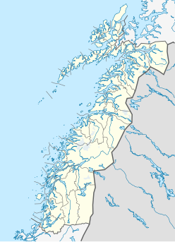
Grønligrotta is a karst cave in the municipality of Rana in Nordland, Norway. It is located in the valley of Røvassdalen, and was first explored in 1914. It has a total depth of 107 metres (351 ft) and explored length of 2 kilometres (1.2 mi). It is probably connected to the nearby Setergrotta. The cave is equipped with artificial lights and open for tourists.

Soknedal is a former municipality in the old Sør-Trøndelag county, Norway. The 440-square-kilometre (170 sq mi) municipality existed from 1841 until its dissolution in 1964. It is located in the western part of what is now the municipality of Midtre Gauldal in Trøndelag county. The administrative center of the municipality was the village of Soknedal, where the Soknedal Church is located. The municipality was named after the Soknedal valley in which it is located. The valley is named after the river Sokna which runs through the valley.