
U.S. Route 319 is a spur of US 19. It runs for 303 miles (488 km) from US 98 at the foot of the John Gorrie Memorial Bridge across from downtown Apalachicola, Florida to US 1/SR 4 in Wadley, Georgia, through the Panhandle of Florida and the southern portion of Georgia.

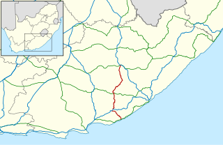
The R61 is a long provincial route in South Africa that connects Beaufort West with Port Shepstone via Graaff-Reinet, Komani, Mthatha and Port Edward.
The R67 is a provincial route in Eastern Cape, South Africa that connects Port Alfred with Komani via Grahamstown.

The R75 is a provincial route in Eastern Cape, South Africa that connects Graaff-Reinet with Gqeberha via Despatch, Kariega and Jansenville.
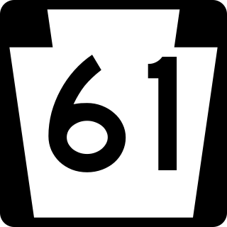
Pennsylvania Route 61 is an 81.8-mile-long (131.6 km) state highway that is located in Pennsylvania in the United States. The route is signed north-south despite running in a northwest-southeast direction from U.S. Route 222 Business in Reading to US 11/US 15/PA 147 in Shamokin Dam.

The N2 is a national route in South Africa that runs from Cape Town through George, Gqeberha, East London, Mthatha, Port Shepstone and Durban to Ermelo. It is the main highway along the Indian Ocean coast of the country. Its current length of 2,255 kilometres (1,401 mi) makes it the longest numbered route in South Africa.
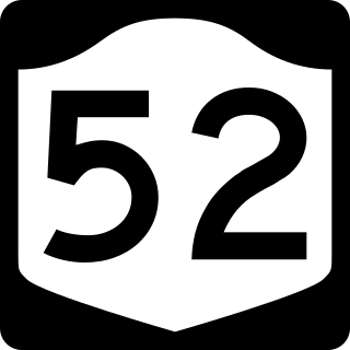
New York State Route 52 (NY 52) is a 108.72-mile-long (174.97 km) state highway in the southeastern part of the state. It generally runs from west to east through five counties, beginning at the Pennsylvania state line in the Delaware River near Narrowsburg, crossing the Hudson River on the Newburgh–Beacon Bridge, and ending in Carmel. NY 52 and NY 55, both major east–west routes of the Mid-Hudson Region, run parallel to each other, intersecting in downtown Liberty.

County Route 561 is a county highway in the U.S. state of New Jersey. The highway extends 50.95 miles (82.00 km) from New York Road in Galloway Township to Federal Street in Camden. Though it is designated a north-south county route by the New Jersey Department of Transportation, it is signed both north-south and east-west inconsistently.

Hogsback is a village in the Amathole Mountains in the Eastern Cape Province, South Africa.

The N12 is a national route in South Africa which runs from George through Beaufort West, Kimberley, Klerksdorp and Johannesburg to eMalahleni.

Several special routes of U.S. Route 1 (US 1) exist, from Florida to Maine. In order from south to north, separated by type, these special routes are as follows.

The N6 is a national route in South Africa that connects East London with Bloemfontein, via Komani and Maletswai. It runs roughly from north to south, connecting the N1 with the N2.

The N10 is a national route in South Africa connecting Gqeberha on the Eastern Cape coast with the Namibian border at Nakop, via Cradock, De Aar and Upington.
Hogsback Pass is situated in the Eastern Cape province of South Africa on the regional road R345, between Alice and Cathcart.
The bypass around Des Moines, Iowa, is a 25-mile-long (40 km) freeway around the south and east of the Des Moines metropolitan area. The route is made up of two state highways – Iowa Highway 5 (Iowa 5) and U.S. Highway 65 (US 65). The bypass begins in southwestern West Des Moines at Iowa 5's interchange with Interstate 35 (I-35). It heads to the east and then curves to the north near the southeastern side of Des Moines. It ends at the interchange of US 65 and I-80 in Altoona.

Several special routes of U.S. Route 25 (US 25) exist. In order from south to north, they are as follows.
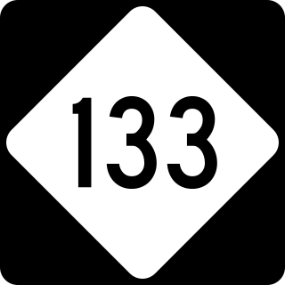
North Carolina Highway 133 (NC 133) is a primary state highway in the U.S. state of North Carolina. It traverses 46.6 miles (75.0 km) from Oak Island Drive in Oak Island to NC 210 in Bells Crossroads. The route serves communities such as Southport, Belville, Leland, Wilmington, and Castle Hayne. Additionally, NC 133 serves as an entry point for Military Ocean Terminal Sunny Point located to its east. Much of NC 133 runs parallel to the Cape Fear River and Brunswick River between Southport and Belville. West of Wilmington, NC 133 runs concurrently with U.S. Route 17 (US 17), US 74, and US 76. The road follows another concurrency along US 74 and US 421, west of Downtown Wilmington, and crosses into New Hanover County on the Isabel Holmes Bridge. North of Wilmington, NC 133 exits to the north, serving several suburban communities north of Wilmington. NC 133 runs concurrently with US 117 through Castle Hayne, before bearing northwest toward Bells Crossroads.


