Washington, D.C., formally the District of Columbia and also known as D.C. or just Washington, is the capital city of the United States of America. It is located on the Potomac River bordering Maryland and Virginia, with Congress holding its first session there in 1800. The city was named for George Washington, the first president of the United States and a Founding Father, and the federal district is named after Columbia, a female personification of the nation. As the seat of the U.S. federal government and several international organizations, the city is an important world political capital. It is one of the most visited cities in the U.S., with over 20 million visitors in 2016.

The Bureau of Engraving and Printing (BEP) is a government agency within the United States Department of the Treasury that designs and produces a variety of security products for the United States government, most notable of which is Federal Reserve Notes for the Federal Reserve, the nation's central bank. In addition to paper currency, the BEP produces Treasury securities; military commissions and award certificates; invitations and admission cards; and many different types of identification cards, forms, and other special security documents for a variety of government agencies. The BEP does not produce coins; all coinage is produced by the United States Mint. With production facilities in Washington, D.C., and Fort Worth, Texas, the Bureau of Engraving and Printing is the largest producer of government security documents in the United States.

Dupont Circle is a traffic circle, park, neighborhood, and historic district in Northwest Washington, D.C. The Dupont Circle neighborhood is bounded approximately by 16th Street NW to the east, 22nd Street NW to the west, M Street NW to the south, and Florida Avenue NW to the north. Much of the neighborhood is listed on the National Register of Historic Places. However, the local government Advisory Neighborhood Commission and the Dupont Circle Historic District have slightly different boundaries.

Connecticut Avenue is a major thoroughfare in the Northwest quadrant of Washington, D.C., and suburban Montgomery County, Maryland. It is one of the diagonal avenues radiating from the White House, and the segment south of Florida Avenue was one of the original streets in Pierre (Peter) Charles L'Enfant's plan for Washington.

16th Street Northwest is a prominent north–south thoroughfare in the northwest quadrant of Washington, D.C. Part of Pierre L'Enfant's design for the city, 16th Street begins just north of the White House across Lafayette Park at H Street and continues due north in a straight line passing K Street, Scott Circle, Meridian Hill Park, Rock Creek Park, and the Walter Reed Army Medical Center before crossing Eastern Avenue into Silver Spring, Maryland, where it ends at Georgia Avenue. From K Street to the District line, 16th Street is part of the National Highway System. The Maryland portion of the street is designated Maryland State Highway 390. The entire street is 6.4 miles (10.3 km) long.

Independence Avenue is a major east-west street in the southwest and southeast quadrants of the city of Washington, D.C., in the United States, running just south of the United States Capitol. Originally named South B Street, Independence Avenue SW was constructed between 1791 and 1823. Independence Avenue SE was constructed in pieces as residential development occurred east of the United States Capitol and east of the Anacostia River. Independence Avenue SW received its current name after Congress renamed the street in legislation approved on April 13, 1934. Independence Avenue SW originally had its western terminus at 14th Street SW, but was extended west to Ohio Drive SW between 1941 and 1942. The government of the District of Columbia renamed the portion of the road in the southeast quadrant of the city in 1950.

Florida Avenue is a major street in Washington, D.C. It was originally named Boundary Street, because it formed the northern boundary of the Federal City under the 1791 L'Enfant Plan. With the growth of the city beyond its original borders, Boundary Street was renamed Florida Avenue in 1890.
The streets and highways of Washington, D.C., form the core of the city's surface transportation infrastructure. Given that it is a planned city, streets in the capital of the United States follow a distinctive layout and addressing scheme. There are 1,500 miles (2,400 km) of public roads in the city, of which 1,392 miles (2,240 km) are owned and maintained by the district government.

The Embassy of the Philippines in Washington, D.C. is the diplomatic mission of the Republic of the Philippines to the United States. It is located at 1600 Massachusetts Avenue, Northwest, Washington, D.C. It predates the independence of the Philippines, and is the oldest Philippine legation overseas, though the distinction of the first Philippine embassy proper overseas, belongs to the Philippine Embassy in Tokyo.

Downtown is a neighborhood of Washington, D.C., as well as a colloquial name for the central business district in the northwest quadrant of the city. Historically, the Downtown has been defined as an area east of 16th Street NW, north of the National Mall/US Capitol complex, and south of Massachusetts Avenue, including the Penn Quarter. However, the city says that most residents, workers, and visitors think of Downtown in a broader sense—including areas as far north as Dupont Circle, the Golden Triangle, as far west as Foggy Bottom, and as far east as Capitol Hill. A small portion of this area is known as the Downtown Historic District and was listed on the NRHP in 2001.

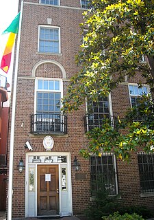
The Embassy of Mali in Washington, D.C. is the diplomatic mission of the Republic of Mali to the United States. The embassy is located at 2130 R Street Northwest in the Kalorama neighborhood of Washington, D.C.

The L. Ron Hubbard House, also known as the Original Founding Church of Scientology, is a writer's house museum and former Scientology church located at 1812 19th Street NW in the Dupont Circle neighborhood of Washington, D.C., United States. Public tours are given on a regular basis. The operating Founding Church is now located at 1424 16th Street for services, bookstore and classes. The home served as the residence of Scientology founder L. Ron Hubbard from 1955 until 1959, during which time he incorporated the Founding Church of Scientology and performed the first Scientology wedding. The building is a contributing property to the Dupont Circle Historic District, a neighborhood listed on the National Register of Historic Places.

The District Department of Transportation (DDOT) is an agency of the government of the District of Columbia, in the United States, which manages and maintains publicly owned transportation infrastructure in the District of Columbia. DDOT is the lead agency with authority over the planning, design, construction, and maintenance of alleys, bridges, sidewalks, streets, street lights, and traffic signals in the District of Columbia.

The Embassy of Afghanistan in Washington, D.C. is the Islamic Republic of Afghanistan's diplomatic mission to the United States. It is located at 2341 Wyoming Avenue N.W. in Washington, D.C.'s Kalorama neighborhood.

The Embassy of Cyprus in Washington, D.C. is the Republic of Cyprus's diplomatic mission to the United States. It is located at 2211 R Street N.W. in Washington, D.C.'s Kalorama neighborhood.

The Embassy of Myanmar in Washington, D.C. is the diplomatic mission of the Republic of the Union of Myanmar to the United States. The embassy is located at 2300 S Street NW, Washington, D.C., in the Kalorama neighborhood. The building is a 1905 former residence designed by noted architect Appleton P. Clark, Jr. The ambassadorial residence is in the Charles Evans Hughes House on R Street.

The Embassy of Niger in Washington, D.C. is the diplomatic mission of the Republic of Niger to the United States. The embassy is located at 2204 R Street, Northwest, Washington, D.C., just off Embassy Row.

The Embassy of Micronesia in Washington, D.C. is the diplomatic mission of the Federated States of Micronesia to the United States. It is located at 1725 N Street, Northwest, Washington, D.C., in the Dupont Circle neighborhood.
The Lion Building is an office building and the seat of the diplomatic missions of the Socialist Republic of Vietnam and the Republic of South Sudan to the United States. It is located at 1233 20th Street Northwest, Washington, D.C., in the Dupont Circle neighborhood.

An outdoor bronze bust of Alberto Santos-Dumont is installed near the Embassy of Brazil, Washington, D.C., at the corner of 22nd and R Street NW.


