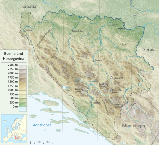
Bosnia and Herzegovina is located in Southeastern Europe. Situated in the western Balkans, it has a 932 km (579 mi) border with Croatia to the north and southwest, a 357 km (222 mi) border with Serbia to the east, and a 249 km (155 mi) border with Montenegro to the southeast. It borders the Adriatic Sea along its 20 km (12 mi) coastline.

The Herzegovina-Neretva Canton is one of 10 cantons of the Federation of Bosnia and Herzegovina in Bosnia and Herzegovina.

Treskavica is a mountain range in Bosnia and Herzegovina, situated in Trnovo municipality just south of city of Sarajevo. Mala Ćaba peak at 2088 m, which makes Treskavica the tallest of all the mountains circling Sarajevo, and only some 300 m shorter than the tallest mountain in the country. On clear days with good weather, climbers can see far into the distance, up to Montenegro and the Adriatic Sea.

The Neretva, also known as Narenta, is one of the largest rivers of the eastern part of the Adriatic basin. Four hydroelectric power plants with large dams provide flood protection, power and water storage. It is recognized for its natural environment and diverse landscapes.

Hutovo Blato is a nature reserve and bird reserve located in Bosnia and Herzegovina. It is primarily composed of marshlands that were created by the underground aquifer system of the Krupa River. It is fed from the limestone massif of Ostrvo that divides the Deransko Lake and Svitavsko Lake. The reserve is on the list of BirdLife International's Important Bird Areas. It is the largest reserve of its kind in the region, in terms of both size and diversity. It is home to over 240 types of migratory birds and dozens that make their permanent home in the sub-Mediterranean wetlands surrounding Deransko Lake. In the migration season, tens of thousands of birds fill the lake and its surroundings.

Jablaničko lake is a large artificially formed lake on the Neretva river, right below Konjic where the Neretva expands into a wide valley. The river provided lot of fertile, agricultural land there, before the lake flooded most of it. The lake was created in 1953 after construction of Jablanica Dam near Jablanica in central Bosnia and Herzegovina.

The Rama Dam is a concrete-face rock-fill dam on the Rama river, a tributary of the Neretva river, about 4 km (2.5 mi) southwest of the town of Prozor in the Herzegovina-Neretva Canton of Bosnia and Herzegovina.

Konjic is a City and a town located in the Herzegovina-Neretva Canton of the Federation of Bosnia and Herzegovina, one of two entities that make up Bosnia and Herzegovina. It is located in northern Herzegovina, around 60 kilometres (37 mi) southwest of Sarajevo, in a mountainous, heavily wooded area, and is 268 m (879 ft) above sea level. The municipality extends on both sides of the Neretva River. According to the 2013 census, the city of Konjic has a population of 10,732 inhabitants, whereas the municipality has 25,148.

Herzegovina is the southern and smaller of two main geographical regions of Bosnia and Herzegovina, the other being Bosnia. It has never had strictly defined geographical, cultural or historical borders, nor has it ever been defined as an administrative whole in the geopolitical and economic subdivision of Bosnia and Herzegovina.

Rakitnica is the main tributary of the first section of the Neretva river, also called Upper Neretva (Bosnian: Gornja Neretva). It meets Neretva from the right, flowing from north to south, between Bjelašnica and Visočica mountains.

The Trebižat is a river in the southern part of Bosnia and Herzegovina, and major right tributary of the Neretva River.
Buna is a populated settlement at the confluence of the Buna river and Neretva river some 10 km downstream the Neretva and south of Mostar, Herzegovina-Neretva Canton, Bosnia and Herzegovina.

Glavatičevo is a small village in Konjic Municipality, Bosnia and Herzegovina, which is a central village to a group of villages of a wider Glavatičevo, positioned 30 km southeast of Konjic, within a wide Župa Valley straddling the Neretva river. The village and its wider areal, with surrounding villages and the valley, is also referred to as Župa Glavatičevo, or Komska Župa, or simply Župa (transl. parish).

Upper Neretva, is the upper course of the Neretva river, including vast mountainous area surrounding the Neretva, with numerous human settlements, peaks and forests, numerous streams and well-springs, three major glacial lakes near the river and even more scattered across the mountains of Treskavica and Zelengora, in a wider area of the Upper Neretva with its flora and fauna.

Lištica is a sinking river in Bosnia and Herzegovina. It starts under the name Ugrovača, and end its course as the Jasenica in Mostarsko Polje, before spills into the Neretva as its right-bank tributary. It is listed as the second coldest river in Europe, and is prone to constant flooding mostly during winter. The Lištica river connects with the Borak wellspring, which rises at the base of the mountainside on the outskirts of town of Široki Brijeg. The town of Široki Brijeg was named Lištica after the Lištica River during the SFR Yugoslavia (1945–1990) but changed its name when the country dissolved back into Bosnia and Herzegovina.
Bijela, or also Bijela rijeka in case of rivers, may refer to:
The fish fauna of the Neretva river basin in the western Balkans is representative of the Dinaric karst region and characterized by several endemic and endangered species.

Ljuta, also called Dindolka, is one of the main tributaries of the first section of the Neretva river, also called Upper Neretva (Bosnian: Gornja Neretva). It meets Neretva from the right, flowing from north to south, between Treskavica and Visočica mountains.