See also
| This disambiguation page lists articles associated with the title Rancho San Gorgonio. If an internal link led you here, you may wish to change the link to point directly to the intended article. |
Rancho San Gorgonio, or San Gorgonio Rancho, might refer to;
| This disambiguation page lists articles associated with the title Rancho San Gorgonio. If an internal link led you here, you may wish to change the link to point directly to the intended article. |

Mission San Gabriel Arcángel is a fully functioning Roman Catholic mission and a historic landmark in San Gabriel, California. The settlement was founded by Spaniards of the Franciscan order on "The Feast of the Birth of Mary," September 8, 1771, as the fourth of what would become twenty-one Spanish missions in California. San Gabriel Arcángel, named after the Archangel Gabriel and often referred to as the "Godmother of the Pueblo of Los Angeles", was designed by Antonio Cruzado, who gave the building its capped buttresses and the tall narrow windows, which are unique among the missions of the California chain.

San Gorgonio Mountain, also known locally as Mount San Gorgonio, or Old Greyback, is the highest peak in Southern California and the Transverse Ranges at 11,503 feet (3,506 m).

The San Bernardino Mountains are a high and rugged mountain range in Southern California in the United States. Situated north and northeast of San Bernardino and spanning two California counties, the range tops out at 11,503 feet (3,506 m) at San Gorgonio Mountain – the tallest peak in all of Southern California. The San Bernardinos form a significant region of wilderness and are popular for hiking and skiing.

The San Jacinto Mountains are a mountain range in Riverside County, located east of Los Angeles in southern California in the United States. The mountains are named for one of the first Black Friars, Saint Hyacinth, who is popular patron in Latin America.
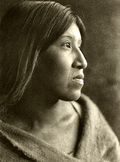
The Cahuilla, also known as ʔívil̃uqaletem or Ivilyuqaletem, are a Native American people of the various tribes of the Cahuilla Nation, living in the inland areas of southern California. Their original territory included an area of about 2,400 square miles (6,200 km2). The traditional Cahuilla territory was near the geographic center of Southern California. It was bounded to the north by the San Bernardino Mountains, to the south by Borrego Springs and the Chocolate Mountains, to the east by the Colorado Desert, and to the west by the San Jacinto Plain and the eastern slopes of the Palomar Mountains.

The San Gorgonio Wilderness is located in the eastern San Bernardino Mountains, in San Bernardino County and into northern Riverside County, Southern California.
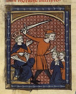
Saint Gorgonius of Nicomedia was a Christian martyr, part of the group Gorgonius, Peter Cubicularius and Dorotheus, who died in 304 AD at Nicomedia during the persecution of Emperor Diocletian.

The San Gorgonio Pass wind farm is a wind farm that stretches from the eastern slope of the San Gorgonio Pass, near Cabazon, to North Palm Springs, on the western end of the Coachella Valley, in Riverside County, California. Flanked by Mount San Gorgonio and the Transverse Ranges to the North, and Mount San Jacinto and the Peninsular Ranges to the South, the San Gorgonio Pass is a transitional zone from a Mediterranean climate west of the pass, to a Desert climate east of the pass. This makes the pass area one of the windiest places in the United States.
Rancho Jurupa was a 40,569-acre (164.18 km2) Mexican land grant in California, United States, that is divided by the present-day counties of Riverside and San Bernardino. The land was granted to Juan Bandini by Governor Juan B. Alvarado in 1838. Located along both banks of the Santa Ana River in southern California, the rancho included much of the land in the present day city of Jurupa Valley, as well as the downtown area in the city of Riverside.

San Timoteo Canyon is a river valley canyon southeast of Redlands, in the far northwestern foothills of the San Jacinto Mountains in the Inland Empire region of Southern California.
San Gorgonio is Spanish for "Saint Gorgonius";
Rancho La Purísima Concepción was a 4,439-acre (17.96 km2) Mexican land grant in present day Santa Clara County, California given in 1840 by Governor Juan Alvarado to José Gorgonio and his son José Ramon, Ohlone Indians. The granted extended from Matadero Creek to Adobe Creek and encompassed present day Los Altos Hills.
Rancho San Jacinto Sobrante was a 48,847-acre (197.68 km2) Mexican land grant in present-day Riverside County, California given in 1846 by Governor Pío Pico to María del Rosario Estudillo de Aguirre. The Rancho San Jacinto Sobrante grant was of the surplus or "sobrante" of Jose Antonio Estudillo's Rancho San Jacinto Viejo and Miguel Pedrorena's Rancho San Jacinto Nuevo y Potrero. The grant encompassed present day Lake Mathews. At the time of the US patent, Rancho San Jacinto Sobrante was a part of San Bernardino County. The County of Riverside was created by the California Legislature in 1893 by taking land from both San Diego and San Bernardino Counties.
Rancho San Jacinto Viejo was a 35,503-acre (143.68 km2) Mexican land grant in present-day Riverside County, California given in 1842 by Governor Pro-tem Manuel Jimeno to José Antonio Estudillo. At the time of the US Patent, Rancho San Jacinto Viejo was a part of San Diego County. The County of Riverside was created by the California Legislature in 1893 by taking land from both San Bernardino and San Diego Counties. The grant encompassed present-day Hemet and San Jacinto.
Rancho San Jacinto Nuevo y Potrero was a 48,861-acre (197.73 km2) Mexican land grant in present-day Riverside County, California given in 1846 by Governor Pío Pico to Miguel Pedrorena. At the time of the US Patent, Rancho San Jacinto Nuevo y Potrero was a part of San Diego County. The County of Riverside was created by the California Legislature in 1893 by taking land from both San Bernardino and San Diego Counties. The grant encompassed present-day Lake Perris.
Rancho San Jacinto y San Gorgonio was a 4,440-acre (18.0 km2) Mexican land grant in present day Riverside County, California given in 1843 by Governor Manuel Micheltorena to James (Santiago) Johnson. At the time of the US Patent, Rancho San Jacinto y San Gorgonio was a part of San Bernardino County. The County of Riverside was created by the California Legislature in 1893 by taking land from both San Bernardino and San Diego Counties. The grant encompassed San Timoteo Canyon.

Riverside County is a county located in the southern portion of the U.S. state of California. As of the 2010 census, the population was 2,189,641, making it the fourth-most populous county in California and the 10th-most populous in the United States. The name was derived from the city of Riverside, which is the county seat.
Juan Antonio (1783–1863), Cahuilla name: Cooswootna, Yampoochee,, was a major chief of the Mountain Band of the Cahuilla from the 1840s to 1863.
Politana or Apolitana was the first Spanish settlement in the San Bernardino Valley of California. It was established as a mission chapel and supply station by the Mission San Gabriel in the a rancheria of the Guachama Indians that lived on the bluff that is now known as Bunker Hill, near Lytle Creek. Besides the Guachama, it was also at various times the home for colonists from New Mexico and Cahuilla people. Its most prominent landmark today is the St. Prophet Elias Greek Orthodox Church on Colton Avenue, just southwest of the Inland Center Mall, in San Bernardino, California.

Purisima Creek is a 2-mile-long (3.2 km) eastward-flowing stream originating in Los Altos Hills in Santa Clara County, California, United States. It is a tributary of Adobe Creek which it joins just after entering Los Altos.