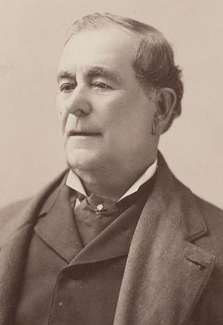
Don Mariano Guadalupe Vallejo was a Californio general, statesman, and public figure. He was born a subject of Spain, performed his military duties as an officer of the Republic of Mexico, and shaped the transition of Alta California from a territory of Mexico to the U.S. state of California. He served in the first session of the California State Senate. The city of Vallejo, California is named after him, and the nearby city of Benicia is named after his wife.
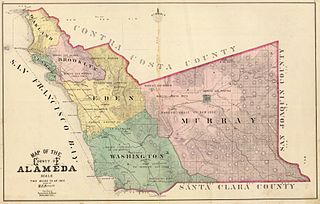
Eden Township is a former township of Alameda County, California in the San Francisco Bay Area region, which includes the present-day cities of Hayward and San Leandro, as well as the unincorporated census-designated areas of Ashland, Castro Valley, Cherryland, Fairview, and San Lorenzo. It was created from a group of Mexican land grants that were added to Alameda County when the county was established in 1853. Today there are several public and private agencies serving the region.
Juan Bautista Valentín Alvarado y Vallejo was a Californio politician that served as Governor of Alta California from 1837-42. Prior to his term as governor, Alvarado briefly led a movement for independence of Alta California from 1836-37, in which he successfully deposed interim governor Nicolás Gutiérrez, declared independence, and created a new flag and constitution, before negotiating an agreement with the Mexican government resulting in his recognition as governor and the end of the independence movement.

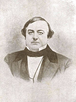
Don Guillermo Castro was a Californio ranchero, military officer, and surveyor who once owned vast land holdings in Alameda County. He is the namesake of the city of Castro Valley and his estate, Rancho San Lorenzo, is the namesake of the city of San Lorenzo.

Rancho San Lorenzo was a 26,722-acre (108.14 km2) Mexican land grant given in 1841 by Governor Juan Alvarado to Guillermo Castro a career soldier posted to the Pueblo of San José. The land grant included present day Hayward, San Lorenzo, and Castro Valley, including Crow Canyon, Cull Canyon, and Palomares Canyons.

Rancho San Ramon was a 20,968-acre (84.85 km2) Mexican land grant in the southern San Ramon Valley of present-day Contra Costa County, California. Rancho San Ramon (Pacheco-Castro) was adjacent in the northern San Ramon Valley.
Rancho San Ramon was a 8,917-acre (36.09 km2) Mexican land grant in the northern San Ramon Valley of present-day Contra Costa County, California. Rancho San Ramon (Amador) was adjacent in the southern San Ramon Valley.
Rancho El Alisal was a 8,912-acre (36.07 km2) Mexican land grant in present-day Monterey County, California, given in 1833 by Governor José Figueroa to the brothers Feliciano and Mariano Soberanes and to William Edward Petty Hartnell. Alisal means Alder tree (sycamore) in Spanish. The land is approximately four miles southeast of present-day Salinas.
Rancho Los Coches was a 8,794-acre (35.59 km2) Mexican land grant in present-day Monterey County, California given in 1841 by Governor Juan Alvarado to María Josefa Soberanes. The name means "the pigs". The grant was south of Soledad and extended along the Arroyo Seco.
Rancho Ex-Mission Soledad was a 8,900-acre (36 km2) Mexican land grant in the Salinas Valley, in present-day Monterey County, California. It was given in 1845 by Governor Pío Pico to Feliciano Soberanes.
Rancho San Lorenzo was a 21,884-acre (88.56 km2) Mexican land grant in the southern Salinas Valley, in present-day Monterey County, California, USA. It was given in 1841 by Governor Juan Alvarado to Feliciano Soberanes.
Rancho San Bernardo was a 13,346-acre (54.01 km2) Mexican land grant in present-day Monterey County, California given in 1841 by Governor Juan Alvarado to Mariano de Jesus Soberanes and Juan Soberanes. The grant extended along the west bank of the Salinas River. The grant encompassed present-day San Ardo.
Rancho San Francisquito was a 8,813-acre (35.66 km2) Mexican land grant in present-day Monterey County, California given in 1835 by Governor José Castro to Catalina Manzanelli de Munrás. The grant was located in the upper Carmel Valley. As of current day, it is part of The Santa Lucia Preserve, a gated community and nature preserve.
Rancho El Toro was a 5,668-acre (22.94 km2) Mexican land grant in present day Monterey County, California given in 1835 by Governor José Castro to José Ramón Estrada. The grant extended along Toro Creek south of Hill Town on the Salinas River.
Rancho San Agustin was a 4,437-acre (17.96 km2) Mexican land grant in present-day Santa Cruz County, California given in 1833 by Governor José Figueroa to José Antonio Bolcoff. The grant was bounded by the San Lorenzo River on the west and Rancho Carbonera on the south, and encompassed present-day Scotts Valley.
Rancho Cañada de la Segunda was a 4,367-acre (17.67 km2) Mexican land grant in present-day Monterey County, California given in 1839 by Governor José Castro to Lazaro Soto. The grant extended along the north bank of the Carmel River, from the Pacific coast and present day Carmel-by-the-Sea up into the Carmel Valley.
Rancho San Lorenzo was a 22,264-acre (90.10 km2) Mexican land grant in present-day Monterey County, California given in 1842 by Governor Juan Alvarado to Francisco Rico. The grant extended along San Lorenzo Creek in Peach Tree Valley.
Rancho San Lorenzo was a 48,286-acre (195.41 km2) Mexican land grant in present day San Benito and Monterey County, California given in 1846 by Governor Pío Pico to Rafael Sanchez. The grant was east of Soberanes Rancho San Lorenzo, and bounded on the north by Topo Creek.
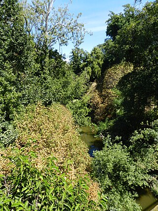
San Lorenzo Creek is a 10.7-mile-long (17.2 km) year-round natural stream flowing through Hayward, California and other neighboring unincorporated communities into San Francisco Bay at the Hayward Regional Shoreline.
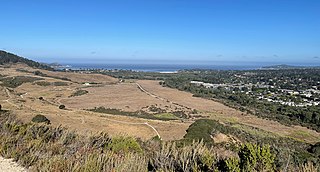
The Palo Corona Regional Park is a 4,500 acres (1,800 ha) park owned by the Monterey Peninsula Regional Park District on land east of Big Sur Coast Highway and Garrapata State Park in California. The 9,898 acres (4,006 ha) property stretches southeast about 11 miles (18 km) from the near the Carmel River State Beach to the Los Padres National Forest. The park is long from north to south, bordered on the northwest by Highway 1 and across from Carmel River State Beach. It wraps around Point Lobos Ranch and abuts Santa Lucia Preserve to the east. In the middle, it is sandwiched by Mitteldorf Preserve and Garrapata State Park. Its southern border abuts Joshua Creek Canyon Ecological Reserve. Environmental interests were concerned that it would be converted to an estate-type development like that done for Rancho San Carlos. In May 2002, the Big Sur Land trust and The Nature Conservancy joined to buy the Ranch. Overall, the park directly and indirectly connects nine conservation properties preserved for their biological, recreation and scenic values. The area includes the former Rancho Caňada Country Club and golf course in Carmel Valley.