Related Research Articles
Natural Resources Conservation Service (NRCS), formerly known as the Soil Conservation Service (SCS), is an agency of the United States Department of Agriculture (USDA) that provides technical assistance to farmers and other private landowners and managers.

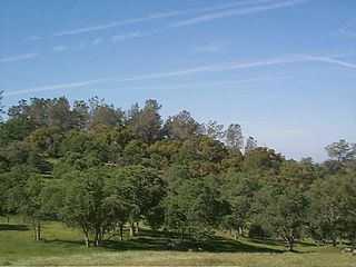
Rangelands are grasslands, shrublands, woodlands, wetlands, and deserts that are grazed by domestic livestock or wild animals. Types of rangelands include tallgrass and shortgrass prairies, desert grasslands and shrublands, woodlands, savannas, chaparrals, steppes, and tundras. Rangelands do not include forests lacking grazable understory vegetation, barren desert, farmland, or land covered by solid rock, concrete and/or glaciers.
The United States Navy Working Capital Fund (NWCF) is a branch of the family of United States Department of Defense (DoD) Working Capital Funds. The NWCF is a revolving fund, an account or fund that relies on sales revenue rather than direct Congressional appropriations to finance its operations. It is intended to generate adequate revenue to cover the full costs of its operations, and to finance the fund's continuing operations without fiscal year limitation. A revolving fund is intended to operate on a break-even basis over time; that is, it neither makes a profit nor incurs a loss.

The Elementary and Secondary Education Act (ESEA) was passed by the 89th United States Congress and signed into law by President Lyndon B. Johnson on April 11, 1965. Part of Johnson's "War on Poverty", the act has been one of the most far-reaching pieces of federal legislation affecting education ever passed by the United States Congress, and was further emphasized and reinvented by its modern, revised No Child Left Behind Act.

The black-tailed prairie dog is a rodent of the family Sciuridae found in the Great Plains of North America from about the United States-Canada border to the United States-Mexico border. Unlike some other prairie dogs, these animals do not truly hibernate. The black-tailed prairie dog can be seen above ground in midwinter. A black-tailed prairie dog town in Texas was reported to cover 25,000 sq mi (64,000 km2) and included 400,000,000 individuals. Prior to habitat destruction, the species may have been the most abundant prairie dog in central North America. It was one of two prairie dogs described by the Lewis and Clark Expedition in the journals and diaries of their expedition.

The U.S. Sheep Experiment Station (USSES) is an agricultural experiment station focusing on domestic sheep which is run by the United States Department of Agriculture's Agricultural Research Service. Its stated mission is "...to develop integrated methods for increasing production efficiency of sheep and to simultaneously improve the sustainability of rangeland ecosystems".

The Washington State Department of Natural Resources (DNR) manages over 3,000,000 acres (12,000 km2) of forest, range, agricultural, and commercial lands in the U.S. state of Washington. The DNR also manages 2,600,000 acres (11,000 km2) of aquatic areas which include shorelines, tidelands, lands under Puget Sound and the coast, and navigable lakes and rivers. Part of the DNR's management responsibility includes monitoring of mining cleanup, environmental restoration, providing scientific information about earthquakes, landslides, and ecologically sensitive areas. DNR also works towards conservation, in the form of Aquatic Reserves such as Maury Island and in the form of Natural Area Preserves like Mima Mounds or Natural Resource Conservation Areas like Woodard Bay Natural Resource Conservation Area.
Range Condition Scoring was developed as a way to quantify biodiversity in a given rangeland system. This practice is widely used in the Sand Hills region of Nebraska, as well as the tallgrass prairie regions, as evidenced by the authoritative book on the subject, "Range Judging Handbook and Contest Guide for Nebraska." This book outlines the steps required to evaluate, or score, a particular region of rangeland; and it serves as a baseline for the understanding of this method of judging rangeland health.
The San Joaquin Experimental Range is an ecosystem research experimental area in the foothills of the Sierra Nevada. The range is located in O'Neals, California, outside of the Sierra National Forest about 32 kilometres (20 mi) north of Fresno, California. The range includes a portion of California grassland and California woodlands with blue oak, interior live oak, and bull pine.
California Rangeland Trust is a nonprofit organization founded in 1998 by a group of innovative ranchers committed to conservation. The Rangeland Trust is now the largest land trust in California, having conserved nearly 300,000 acres (1,200 km2) of rangeland on 61 ranches across 24 counties.
The Public Rangelands Improvement Act of 1978 (PRIA) defines the current grazing fee formula and establishes rangeland monitoring and inventory procedures for Bureau of Land Management and United States Forest Service rangelands. The National Grasslands are exempt from PRIA.
A grazing fee is a charge, usually on a monthly basis, for grazing a specific kind of livestock.
The Granger-Thye Act of 1950 in the United States established a new direction for some aspects of National Forest System management; authorized the use of grazing fee receipts for rangeland improvement; authorized the Forest Service to issue grazing permits for terms up to 10 years; authorized the Forest Service to participate in funding cooperative forestry and rangeland resource improvements; established grazing advisory boards; and, authorized the Forest Service to assist with work on private forest lands.
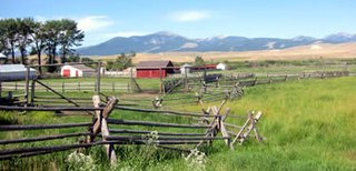
A ranch is an area of land, including various structures, given primarily to ranching, the practice of raising grazing livestock such as cattle and sheep. It is a subtype of a farm. These terms are most often applied to livestock-raising operations in Mexico, the Western United States and Western Canada, though there are ranches in other areas. People who own or operate a ranch are called ranchers, cattlemen, or stockgrowers. Ranching is also a method used to raise less common livestock such as horses, elk, American bison, ostrich, emu, and alpaca.
Tourism Improvement Districts (TIDs) are a type of business improvement district in the United States. The aim of TIDs is increasing the number of overnight visitors using business and services in that area. TIDs are formed through a public–private partnership between the local government and the businesses in a district. TID funds are usually managed by a nonprofit corporation, generally a Convention and Visitors' Bureau, hotel association, or similar destination marketing organization. Typical TID services include marketing programs to raise awareness of the destination, sponsorship of special events that attract overnight visitors, and sales programs to bring in large-group business. Synonymous terms for TIDs include: tourism marketing district, hotel improvement district, and tourism business improvement district.
The Wild and Free-Roaming Horses and Burros Act of 1971 (WFRHBA), is an Act of Congress, signed into law by President Richard M. Nixon on December 18, 1971. The act covered the management, protection and study of "unbranded and unclaimed horses and burros on public lands in the United States."
In the Western United States and Canada, open range is rangeland where cattle roam freely regardless of land ownership. Where there are "open range" laws, those wanting to keep animals off their property must erect a fence to keep animals out; this applies to public roads as well. Land in open range that is designated as part of a "herd district" reverses liabilities, requiring an animal's owner to fence it in or otherwise keep it on the person's own property. Most eastern states and jurisdictions in Canada require owners to fence in or herd their livestock.
Grazing rights in Nevada covers a number of rangeland Federal and state laws and regulations applicable to the state of Nevada. Rangelands are distinguished from pasture lands because they grow primarily native vegetation, rather than plants established by humans. Ranchers may lease or obtain permits to use portions of this public rangeland and pay a fee based on the number and type of livestock and the period for which they are on the land.

Rangeland management is a professional natural science that centers around the study of rangelands and the "conservation and sustainable management [of Arid-Lands] for the benefit of current societies and future generations." Range management is defined by Holechek et al. as the "manipulation of rangeland components to obtain optimum combination of goods and services for society on a sustained basis."

The Jornada Biosphere Reserve is a UNESCO Biosphere Reserve in southern New Mexico. It is one of three biosphere reserves representing the Chihuahuan Desert. The area extends from the crest of the San Andres Mountains, which are dominated by shrub woodlands, to the Jornada Plains characterized by semi-desert grasslands.
References
 This article incorporates public domain material from Jasper Womach. Report for Congress: Agriculture: A Glossary of Terms, Programs, and Laws, 2005 Edition (PDF). Congressional Research Service.
| | This United States government–related article is a stub. You can help Wikipedia by expanding it. |