Ranked list of Dominican provinces

Last updated

These are ranked lists of the Provinces of Dominican Republic. Population figures areas are taken from the report on the 2010 census. [1]

Provinces of the Dominican Republic first-level administrative divisions of the Dominican Republic

The Dominican Republic is divided into thirty–one provincias, while the national capital, Santo Domingo, is contained within its own Distrito Nacional.

Dominican Republic Country in the Caribbean

The Dominican Republic is a country located on the island of Hispaniola in the Greater Antilles archipelago of the Caribbean region. It occupies the eastern five-eighths of the island, which it shares with the nation of Haiti, making Hispaniola one of only two Caribbean islands, along with Saint Martin, that are shared by two sovereign states. The Dominican Republic is the second-largest Caribbean nation by area at 48,671 square kilometers (18,792 sq mi), and third by population with approximately 10,299,000 people, of whom approximately three million live in the metropolitan area of Santo Domingo, the capital city.

Contents

The percentages (%) mean how much of the country the province has (population and area).

Percentage Number or ratio as a fraction of 100

In mathematics, a percentage is a number or ratio expressed as a fraction of 100. It is often denoted using the percent sign, "%", or the abbreviations "pct.", "pct"; sometimes the abbreviation "pc" is also used. A percentage is a dimensionless number.

By population

RankProvincePopulation%Area%DensityMap
1 Santo Domingo 2,374,370   25.11,302.2   2.71,823.3530
2 Distrito Nacional 965,04010.291.60.210,535.37D.N.
3 Santiago 963,42210.22,806.35.8343.3128
4 San Cristóbal 569,9306.01,240.62.6459.4024
5 La Vega 394,2054.22,292.54.7171.9513
6 Puerto Plata 321,5973.41,805.63.7178.1120
7 San Pedro de Macorís 290,4583.11,254.32.6231.5727
8 Duarte 289,5743.11,649.53.4175.555
9 La Altagracia 273,2102.92,998.46.291.1211
10 La Romana 245,4332.6652.11.3376.3712
11 San Juan 232,3332.53,363.87.069.0726
12 Espaillat 231,9382.5843.01.7275.138
13 Azua 214,3112.32,682.55.679.891
14 Barahona 187,1052.01,660.23.4112.703
15 Monte Plata 185,9562.02,601.65.471.4817
16 Peravia 184,3442.0785.21.6234.7719
17 Monseñor Nouel 165,2241.7992.02.1166.5615
18 Valverde 163,0301.7823.01.7198.0931
19 Sánchez Ramírez 151,3921.61,185.82.5127.6723
20 María Trinidad Sánchez 140,9251.51,206.52.5116.8014
21 Monte Cristi 109,6071.21,885.83.958.1216
22 Samaná 101,4941.1862.81.8117.6322
23 Baoruco 97,3131.01,284.92.775.742
24 Hermanas Mirabal 92,1931.0427.40.9215.7121
25 El Seibo 87,6800.91,788.43.749.037
26 Hato Mayor 85,0170.91,319.32.764.449
27 Dajabón 63,9550.71,021.32.162.624
28 Elías Piña 63,0290.71,395.52.945.176
29 San José de Ocoa 59,5440.6853.41.869.7725
30 Santiago Rodríguez 57,4760.61,147.52.450.0929
31 Independencia 52,5890.62,007.44.226.2010
32 Pedernales 31,5870.32,080.54.315.1818

By area

RankProvincePopulation%Area%DensityMap
1 San Juan 232,3332.53,363.8   7.069.0726
2 La Altagracia 273,2102.92,998.46.291.1211
3 Santiago 963,42210.22,806.35.8343.3128
4 Azua 214,3112.32,682.55.679.891
5 Monte Plata 185,9562.02,601.65.471.4817
6 La Vega 394,2054.22,292.54.7171.9513
7 Pedernales 31,5870.32,080.54.315.1818
8 Independencia 52,5890.62,007.44.226.2010
9 Monte Cristi 109,6071.21,885.83.958.1216
10 Puerto Plata 321,5973.41,805.63.7178.1120
11 El Seibo 87,6800.91,788.43.749.037
12 Barahona 187,1052.01,660.23.4112.703
13 Duarte 289,5743.11,649.53.4175.555
14 Elías Piña 63,0290.71,395.52.945.176
15 Hato Mayor 85,0170.91,319.32.764.449
16 Santo Domingo 2,374,370   25.11,302.22.71,823.3530
17 Baoruco 97,3131.01,284.92.775.742
18 San Pedro de Macorís 290,4583.11,254.32.6231.5727
19 San Cristóbal 569,9306.01,240.62.6459.4024
20 María Trinidad Sánchez 140,9251.51,206.52.5116.8014
21 Sánchez Ramírez 151,3921.61,185.82.5127.6723
22 Santiago Rodríguez 57,4760.61,147.52.450.0929
23 Dajabón 63,9550.71,021.32.162.624
24 Monseñor Nouel 165,2241.7992.02.1166.5615
25 Samaná 101,4941.1862.81.8117.6322
26 San José de Ocoa 59,5440.6853.41.869.7725
27 Espaillat 231,9382.5843.01.7275.138
28 Valverde 163,0301.7823.01.7198.0931
29 Peravia 184,3442.0785.21.6234.7719
30 La Romana 245,4332.6652.11.3376.3712
31 Hermanas Mirabal 92,1931.0427.40.9215.7121
32 Distrito Nacional 965,04010.291.60.210,535.37D.N.

By population density

RankProvincePopulation%Area%DensityMap
1 Distrito Nacional 965,04010.291.6   0.210,535.37D.N.
2 Santo Domingo 2,374,370   25.11,302.22.71,823.3530
3 San Cristóbal 569,9306.01,240.62.6459.4024
4 La Romana 245,4332.6652.11.3376.3712
5 Santiago 963,42210.22,806.35.8343.3128
6 Espaillat 231,9382.5843.01.7275.138
7 Peravia 184,3442.0785.21.6234.7719
8 San Pedro de Macorís 290,4583.11,254.32.6231.5727
9 Hermanas Mirabal 92,1931.0427.40.9215.7121
10 Valverde 163,0301.7823.01.7198.0931
11 Puerto Plata 321,5973.41,805.63.7178.1120
12 Duarte 289,5743.11,649.53.4175.555
13 La Vega 394,2054.22,292.54.7171.9513
14 Monseñor Nouel 165,2241.7992.02.1166.5615
15 Sánchez Ramírez 151,3921.61,185.82.5127.6723
16 Samaná 101,4941.1862.81.8117.6322
17 María Trinidad Sánchez 140,9251.51,206.52.5116.8014
18 Barahona 187,1052.01,660.23.4112.703
19 La Altagracia 273,2102.92,998.46.291.1211
20 Azua 214,3112.32,682.55.679.891
21 Baoruco 97,3131.01,284.92.775.742
22 Monte Plata 185,9562.02,601.65.471.4817
23 San José de Ocoa 59,5440.6853.41.869.7725
24 San Juan 232,3332.53,363.87.069.0726
25 Hato Mayor 85,0170.91,319.32.764.449
26 Dajabón 63,9550.71,021.32.162.624
27 Monte Cristi 109,6071.21,885.83.958.1216
28 Santiago Rodríguez 57,4760.61,147.52.450.0929
29 El Seibo 87,6800.91,788.43.749.037
30 Elías Piña 63,0290.71,395.52.945.176
31 Independencia 52,5890.62,007.44.226.2010
32 Pedernales 31,5870.32,080.54.315.1818

Map

DominicanRepublicSubdivisions.png

Related Research Articles

Colombia Country in South America

Colombia, officially the Republic of Colombia, is a country largely situated in the north of South America, with land, and territories in North America. Colombia is bounded on the north by the Caribbean Sea and the west by the Pacific. It comprises thirty-two departments, with the capital in Bogotá.

Tekax City in Yucatán, Mexico

Tekax, sometimes spelled Tecax, is a small city in the Mexican state of Yucatán, located at 20°12′07″N89°17′17″W in the southernmost part of the state. Tekax means "Place of the Forests" in the Yucatec Maya language. Tekax was briefly declared the capital of Yucatán in 1845. Tekax is also the name of the surrounding municipality of which the city of Tekax serves as municipal seat of government.

Catholic Church by country Wikimedia list article

The Catholic Church is " the Catholic Communion of Churches, both Roman and Eastern, or Oriental, that are in full communion with the Bishop of Rome ." The Church is also known as the People of God, the Body of Christ, the "Temple of the Holy Spirit", among other names. According to Vatican II's Gaudium et spes, the "church has but one sole purpose -- that the kingdom of God may come and the salvation of the human race may be accomplished."

Largest cities in the Americas Wikimedia list article

This is a list of the 50 largest cities in the Americas by population residing within city limits as of 2015, the most recent year for which official population census results, estimates or short-term projections are available for most of these cities. These figures do not reflect the population of the urban agglomeration or metropolitan area which typically do not coincide with the administrative boundaries of the city. For a list of the latter, see List of metropolitan areas in the Americas by population. These figures refer to mid-2015 populations with the following exceptions:

  1. Mexican cities, whose figures derive from the 2015 Intercensal Survey conducted by INEGI with a reference date of 15 March 2015;
  2. Calgary, whose 2015 municipal census had a reference date of April 1.
Valle de Chalco Town & Municipality in State of Mexico ----, Mexico

Valle de Chalco, officially named Valle de Chalco Solidaridad, is a municipality located in the State of Mexico, Mexico, on the eastern outskirts of the metropolitan area of Mexico City. Formerly part of the municipality of Chalco, it was split off as a separate entity in 1994, during the presidency of Salinas de Gortari, under his Programa Nacional de Solidaridad. The municipality lies on the old bed of Lake Chalco, which was substantially drained in the nineteenth century. Technically, the municipal seat is Xico, after a high point of land that once formed an island, and now remains as a small hill within an otherwise monotonous, urban expanse. "Chalco" refers to the Chalca tribe, whose territory covered the area around the lake, prior to the Spanish Conquest of Mexico.

Coacalco de Berriozábal Town and municipality in Mexico, Mexico

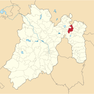
Coacalco de Berriozábal is a city and municipality located in the State of Mexico, Mexico. Its name comes from the Nahuatl, Coa-coatl (snake), cal-calli (home) and -co (at), meaning "at the house of the snake", and was first recorded in 1320. The municipality lies in the Greater Mexico City conurbation, and it is located next to the northern tip of the Mexico City. The official name of its municipal seat is San Francisco Coacalco, and the municipality is named after Felipe Berriozábal.

Bisonó City in Santiago, Dominican Republic

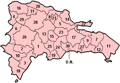
Navarrete is a municipality in northwestern Dominican Republic, created in 1961. It lies approximately 25 kilometres (16 mi) from Santiago de los Caballeros, Dominican Republic's second largest city. The administrative centre is in the town of Villa Bisonó.

Tecámac Town & Municipality in State of Mexico ----, Mexico

Tecámac is a municipality in State of Mexico in Mexico. The municipality covers an area of 157.34 km². The municipal seat lies in the town (locality) of Tecámac de Felipe Villanueva. Its largest town, Ojo de Agua, with a population of 242,283 inhabitants, is the largest locality in Mexico that is not a municipal seat.

Demographics of Colombia

This article is about the demographic features of the population of Colombia, including population density, ethnicity, education level, health of the populace, economic status, religious affiliations and other aspects of the population. It is the second-most populous country in South America after Brazil.

Ciudad de la Costa City and Municipality in Canelones, Uruguay

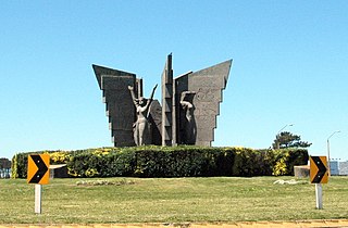
Ciudad de la Costa is a city in Canelones Department of Uruguay, on the banks of the Río de la Plata between the streams Arroyo Carrasco and Arroyo Pando. It is considered an extension of the metropolitan area of Montevideo which it borders to the west, while to the east it borders Costa de Oro. It was declared a city on 19 October 1994 and given its current name. At the 2011 census, it was the third most populated city of Uruguay.

Comapa, Veracruz Municipality in Veracruz, Mexico

Comapa is a municipality in the Mexican state of Veracruz, located about 40 kilometres (25 mi) south of the state capital Xalapa.

Citlaltépetl, Veracruz Municipality in Veracruz, Mexico

Citlaltépetl is a municipality in the Mexican state of Veracruz, located 223 kilometres (139 mi) northwest of the state capital of Xalapa and 99 kilometres (62 mi) south of the city of Tampico, Tamaulipas.

Tomatlán, Veracruz Municipality in Veracruz, Mexico

Tomatlán is a municipality in the Mexican state of Veracruz, located 58 kilometres (36 mi) south of the state capital of Xalapa.

References

  1. "IX Censo Nacional de Población y Vivienda 2010" (PDF) (in Spanish). Oficina Nacional de Estadística. June 2012. Archived from the original (PDF) on 27 September 2013. Retrieved 23 September 2013.