Thunder Bay is a bay in the U.S. state of Michigan on Lake Huron. The bay extends from North Point at 45°01′19″N83°15′58″W to South Point at 44°53′00″N83°18′51″W.

Pambak is a village in the Gegharkunik Province of Armenia. There are churches, a caravanserai, and cemeteries in the village.

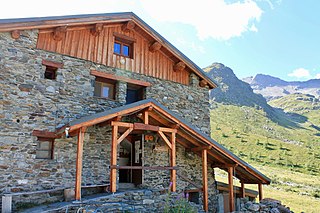
Refuge de l'Aigle is a refuge in the Alps in France. It opened in 1910 and was renovated during the summer 2014, and therefore closed between September 2013 and August 2014.

Refuge d'Ambin is a refuge in the Alps in France.
Refuge de l'Archeboc is a refuge in the Alps.

The Argentière Hut is a refuge in the Mont Blanc massif in the Alps. Built in 1974 by the Club Alpin Français, it is located above the north bank of the Argentière Glacier in France at an altitude of 2,691 meters above sea level.

Refuge du Couvercle is a refuge in the Alps.

The Durier Hut is a mountain hut in the Mont Blanc massif of the Alps. It is located in Haute-Savoie department of France on the French/Italian border at an altitude of 3358 m.

The Grands Mulets Hut is a mountain refuge in the Mont Blanc massif in the French Alps at an altitude of 3,051 m. It is owned by the Club Alpin Francais. The hut is located on a pyramidal rock island, at the junction of two streams of the Bossons Glacier on the north side of Mont Blanc. If the state of the glacier is not too severe, the hut is wardened in summer and can be used as an alternative route of ascent to the summit of Mont Blanc, following the original historic route by the first ascensionists. Nowadays the hut is used more frequently by ski-mountaineers in spring, or as a more sheltered and alternative route of descent from Mont Blanc than the much more popular Goûter route, though route-finding can be difficult in fog and requires prior knowledge of the crevassed state of the Bossons glacier below the hut.

The Leschaux Hut is a refuge in the Mont Blanc massif in the Alps. It is located at 2,431 m on the north side of the Glacier de Leschaux – a tributary of the Mer de Glace. It is owned by the CAF and can accommodate up to 19 people. The hut is used as a base by mountaineers climbing peaks such as Grandes Jorasses, Petites Jorasses and Mont Mallet. It is accessed by going up the Mer de Glace from Montenvers, and then up the Glacier de Leschaux. The first refuge was built in 1929. It was enlarged to 30 seats in 1934, but destroyed by an avalanche in 1954. A new hut was built in 1968 and was enlarged in 2003.
Refuge du Mont Jovet is a mountain hut ('refuge') in the Savoie region of the French Alps, opened in 1890 and now maintained by the Bozel municipality. It is located a three hour walk from La Cour, or a 45 minute drive from Bozel.

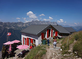
Refuge Mont-Blanc is a low-altitude refuge in the Alps in Val Veny, near Courmayeur, Italy. Despite its name, it is not used by climbers attempting to reach the summits of the Mont Blanc massif, but its location close to the valley bottom of Val Veny allows it to accommodate walkers undertaking the Tour du Mont Blanc, or winter skiers using the Courmayeur ski resort. It can be reached by car from Courmayeur.
The Refuge du Plan de l'Aiguille is a refuge in the Mont Blanc massif in the French Alps.
Refuge du Plan du Lac is a refuge in the Alps.
Refuge de Platé is a refuge in the Alps.
The Quintino Sella Hut is a very remote bivouac hut in the Mont Blanc massif of the Alps in Aosta Valley, Italy. Built in the 1920s, it is perched on rocks on the south-western flank of the Rocher du Mont Blanc at an altitude of 3,396 m. It is owned by the CAI and can accommodate up to sixteen people with bunk and blankets provided, but no stove or warden.
Refuge de Tré la Tête is a refuge in the Mont Blanc massif in the Alps.

The Tête Rousse Hut is a mountain hut in the Mont Blanc massif in the French Alps. It is located beside the Tête Rousse Glacier at an altitude of 3,167 m. Owned by the Club Alpin Francais (CAF), it is normally reached after a multi-hour climb from Nid d'Aigle, the highest stop on the Mont Blanc Tramway. It is commonly used by mountaineers attempting to climb the modern normal route on the French side or Goûter route to the summit of Mont Blanc. Staying here, rather than continuing to the higher Goûter Hut adds an extra 2–3 hours to the ascent of Mont Blanc, but is less cramped than the latter and also avoids having to climb the dangerous 'Grand Couloir' later in the day when the risk of injury from stonefall is at its greatest.

The Vallot Hut is a refuge in the Mont Blanc massif on the upper slopes of Mont Blanc in the Alps. It is located below the Bosses Ridge between the Dome du Gouter and Mont Blanc summit, at an altitude of 4,362 metres. Intended only as an emergency shelter, and not as a base for ascending Mont Blanc, this unheated duralumin box was designed to accommodate up to 12 people, but often contains considerably more.
Refuge de Véran is a refuge in the Alps.
This page is based on this
Wikipedia article Text is available under the
CC BY-SA 4.0 license; additional terms may apply.
Images, videos and audio are available under their respective licenses.


