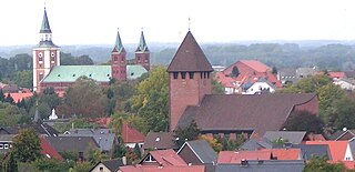
Lohne (Oldenburg) (Northern Low Saxon: Lohn) is a town in the district of Vechta, in Lower Saxony, Germany. It is located approximately 8 km south-west of Vechta. The town lies on the A1 freeway between Bremen and Osnabrück.
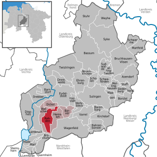
Rehden is a municipality in the district of Diepholz, in Lower Saxony, Germany. It is situated approximately eight km east of Diepholz. The 44 TWh Rehden natural gas storage facility connects to the Rehden–Hamburg gas pipeline.
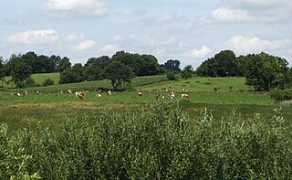
Geest is a type of landform, slightly raised above the surrounding countryside, that occurs on the plains of Northern Germany, the Northern Netherlands and Denmark. It is a landscape of sandy and gravelly soils formed as a glacial outwash plain and now usually mantled by a heathland vegetation on the glacial deposits left behind after the last ice age during the Pleistocene epoch.

Barver is a municipality in the district of Diepholz, Lower Saxony, Germany.
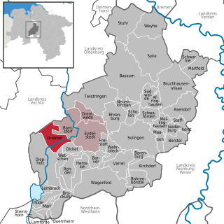
Drebber is a municipality in the district of Diepholz, in Lower Saxony, Germany.
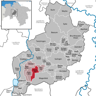
Hemsloh is a municipality in the district of Diepholz, in Lower Saxony, Germany.

Wetschen is a municipality in the district of Diepholz, in Lower Saxony, Germany.

The Südheide Nature Park is a large protected area of forest and heathland in the southern part of the Lüneburg Heath in North Germany. It has been designated as a protected nature park since 1964.

The Großes Moor near Becklingen is a nature reserve in Germany with an area of 850 hectares, of which 666 hectares lie in Celle district and 184 hectares in Soltau-Fallingbostel district. Since 16 December 1985 the area has been protected under conservation law. An area of 776.6 hectares is designated as a special area of conservation (FFH-Gebiet). The name literally means "Large Bog near Becklingen" and it lies on the Lüneburg Heath, south of Wietzendorf and east of Becklingen, part of the borough of Bergen. The River Meiße has its source in this raised bog.

The Grundloses Moor is the largest, virtually intact raised bog in the district of Heidekreis and a nature reserve in Walsrode in the German state of Lower Saxony.

The Großes Moor near Gifhorn is part of the Northwest German raised bog region, which stretches from the Netherlands to the eastern border of Lower Saxony on the sandy areas (geest) left behind by the ice age. The moor has a total area of about 6,100 hectares, of which around 5,000 hectares are raised bog and some 1,100 hectares are fen. The peat layer is up to almost 6 metres (20 ft) thick in places. Individual parts of the moor have their own names like Stüder Moor, Hestenmoor or Weißes Moor.

The White Polled Heath is a small breed and landrace of North German sheep and belongs to the Heidschnucke family, part of the Northern European short-tailed sheep group. However, unlike the other Heidschnucke types, it is entirely white and polled (hornless).

The Maujahn or Maujahn Moor is a kettle bog in North Germany which began as a sinkhole. It is located a good two kilometres west of the town of Dannenberg between the villages of Thunpadel and Schmarsau in northeastern Lower Saxony.

The Hanoverian Moor Geest is a gently rolling landscape between Hanover and Nienburg in the German state of Lower Saxony covering an area of around 800 square kilometres (310 sq mi). It belongs to the raised bog regions of northwest Germany, which cover the geest terrain formed during the ice age and which stretch from the Netherlands to the eastern border of Lower Saxony. The geest tract on the Hanoverian Moor Geest consists of a ground moraine plateau with a height of 50–85 metres (164–279 ft) above sea level that is dominated by bog. Its natural boundaries are the Aller glacial valley to the north and the Burgdorf-Peine Geest to the east.

The Dümmer Nature Park in North Germany is located in the Lower Saxon districts of Diepholz and Vechta and the North Rhine-Westphalian district of Minden-Lübbecke. It is about 34 kilometres (21 mi) northeast of Osnabrück and lies between Diepholz and Bohmte, Bersenbrück and Rahden.
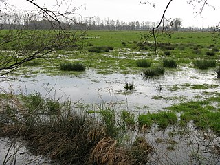
The Oppenwehe Moor is a raised bog in the natural region of Diepholz Moor Depression in North Germany. It covers a total area of around 870 ha and lies in the northeastern part of the German state of North Rhine-Westphalia as well as in Lower Saxony. It is one of the most important bogs in Northwest Germany and is one of the ten most important wet meadow reserves in North Rhine-Westphalia. It is part of the Dümmer Nature Park.
Großes Moor may refer to:

The Ewiges Meer is the largest raised bog lake in Germany, with an area of 91 hectares. Its surface lies at about 8.5 metres above sea level (NN). The lake is surrounded by an extensive complex of unutilised areas, that exhibit the actual raised bog profile and, together with the lake, form the Ewiges Meer Nature Reserve which covers an area of 1,290 hectares.

The Diepholz Moor Depression has a total area of around 105,000 ha and incorporates numerous smaller and larger nature reserves and protected landscapes. The region includes 24,000 ha of raised bogs, divides into 15 raised bogs, as well as the Dümmer and its depression in the southwest.

The Großes Moor is the proper name for a contiguous region of raised bog between the towns of Damme, Lohne and Vechta and the village of Goldenstedt in the county of Vechta on the one hand, and the villages of Diepholz and Barnstorf in Diepholz and Bramsche in Osnabrück in Lower Saxony on the other, all within Germany.


