Riley Creek (Ohio)

Last updated

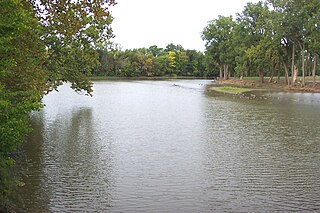
Riley Creek is a 22.2-mile (35.7 km) long stream in the U.S. state of Ohio. It is a tributary of the Blanchard River. [1]

U.S. state constituent political entity sharing sovereignty as the United States of America

In the United States, a state is a constituent political entity, of which there are currently 50. Bound together in a political union, each state holds governmental jurisdiction over a separate and defined geographic territory and shares its sovereignty with the federal government. Due to this shared sovereignty, Americans are citizens both of the federal republic and of the state in which they reside. State citizenship and residency are flexible, and no government approval is required to move between states, except for persons restricted by certain types of court orders. Four states use the term commonwealth rather than state in their full official names.

Ohio State of the United States of America

Ohio is a Midwestern state in the Great Lakes region of the United States. Of the fifty states, it is the 34th largest by area, the seventh most populous, and the tenth most densely populated. The state's capital and largest city is Columbus.

Blanchard River river in the United States of America

The Blanchard River is a 103-mile-long (166 km) tributary of the Auglaize River in northwestern Ohio in the United States. It drains a primarily rural farming area in the watershed of Lake Erie.

Riley Creek was named for James W. Riley, a pioneer who drowned while crossing the stream. [2]

See also

Related Research Articles

Auglaize River river in the United States of America

The Auglaize River is a 113-mile-long (182 km) tributary of the Maumee River in northwestern Ohio in the United States. It drains a primarily rural farming area in the watershed of Lake Erie. The name of the river comes from the French word for glaise (clay). The French called it "rivière à la Grande Glaize".

Ottawa River (Lake Erie) river in Ohio and Michigan, United States

The Ottawa River, also known as Ottawa Creek, is a short river, approximately 20 miles (32 km) long, in northwest Ohio and southeast Michigan in the United States. It drains an area on the Ohio-Michigan border along the eastern and northern fringes of the city of Toledo, goes through Ottawa Hills, and empties directly into Lake Erie. It is one of two rivers in northwestern Ohio that share the same name, along with the Ottawa River that is a tributary of the Auglaize River. The upper 4 miles (6 km) of the river in Michigan north of Sylvania, Ohio is called North Tenmile Creek on federal maps, while another branch rising in Fulton County, Ohio, is called Tenmile Creek.

Pee Pee Creek is a stream in Pike County, Ohio, in the United States.

Caesar Creek is a stream in Clinton, Greene, and Warren counties, Ohio, in the United States.

Wilson Creek is a stream in Clinton County, Ohio, in the United States.

North Creek is an unincorporated community in Putnam County, in the U.S. state of Ohio.

Townwood is an unincorporated community in Putnam County, in the U.S. state of Ohio.

McKees Creek is a stream in the U.S. state of Ohio. It is a tributary of Stony Creek.

Georges Creek is a stream in the U.S. state of Ohio. It is a tributary of Ohio Brush Creek.

Deer Creek is a stream in Putnam County, Ohio. The 2.4-mile (3.9 km) long stream is a tributary of Blanchard River.

Jennings Creek is a stream in the U.S. state of Ohio. The 14.5-mile (23.3 km) long stream is a tributary of the Auglaize River.

Cranberry Creek is a stream in the U.S. state of Ohio. This 19.4-mile (31.2 km) long stream is a tributary of the Blanchard River.

Wolf Creek is a stream in the U.S. state of Ohio. It is a tributary of the Sandusky River.

Mallet Creek is a stream located entirely within Medina County, Ohio. The 11.4-mile (18.3 km) long stream is a tributary of the West Branch Rocky River.

Cossett Creek is a stream located entirely within Medina County, Ohio. The 5.2-mile (8.4 km) long stream is a tributary of the West Branch Rocky River.

Fulton Creek is a stream in the U.S. state of Ohio.

Hopsons Creek is a stream located entirely within Geauga County, Ohio.

Turkey Creek is a stream in the U.S. state of Ohio. It is a tributary of the Ohio River.

Big Creek is a stream in the U.S. state of Iowa. It is a tributary to the Des Moines River.

References

Coordinates: 41°00′41″N83°59′54″W / 41.01139°N 83.99833°W / 41.01139; -83.99833

Geographic coordinate system Coordinate system

A geographic coordinate system is a coordinate system that enables every location on Earth to be specified by a set of numbers, letters or symbols. The coordinates are often chosen such that one of the numbers represents a vertical position and two or three of the numbers represent a horizontal position; alternatively, a geographic position may be expressed in a combined three-dimensional Cartesian vector. A common choice of coordinates is latitude, longitude and elevation. To specify a location on a plane requires a map projection.