See also
| This disambiguation page lists articles associated with the title Rio Nuevo. If an internal link led you here, you may wish to change the link to point directly to the intended article. |
Rio Nuevo , or the New River, is a river that flows north from the Mexicali Valley in Mexico, into the United States towards the Salton Sea.
Rio Nuevo may also refer to:
| This disambiguation page lists articles associated with the title Rio Nuevo. If an internal link led you here, you may wish to change the link to point directly to the intended article. |

Bayamón is a municipality of Puerto Rico located in the northern coastal valley, north of Aguas Buenas and Comerío; south of Toa Baja and Cataño; west of Guaynabo; and east of Toa Alta and Naranjito. Bayamón is spread over 11 wards and Bayamón Pueblo. It is part of the San Juan-Caguas-Guaynabo Metropolitan Statistical Area.

Gurabo is a municipality in eastern Puerto Rico (U.S.) located in the central eastern region, north of San Lorenzo; south of Trujillo Alto; east of Caguas; and west of Carolina and Juncos. Gurabo is spread over 9 wards and Gurabo Pueblo. It is part of the San Juan-Caguas-Guaynabo Metropolitan Statistical Area.
New River may refer to:

Camuy is a municipality of Puerto Rico, bordering the Atlantic Ocean, north of Lares and San Sebastián; east of Quebradillas; and west of Hatillo. Camuy is spread over 12 wards and Camuy Pueblo. The town celebrated its 200th anniversary in 2007.
Corozal is a municipality of Puerto Rico (U.S.) located in the central-eastern region, north of Orocovis and Barranquitas; south of Vega Alta; southwest of Toa Alta; east of Morovis and Orocovis; and west of Naranjito. Corozal is spread over 12 wards and Corozal Pueblo. It is part of the San Juan-Caguas-Guaynabo Metropolitan Statistical Area.
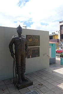
Río Grande is a municipality of Puerto Rico located in the Northern Coastal Valley, north of Las Piedras, Naguabo and Ceiba; east of Loíza and Canóvanas and west of Luquillo. Río Grande is spread over eight wards and Río Grande Pueblo. It is part of the San Juan-Caguas-Guaynabo Metropolitan Statistical Area.

Santa Isabel is a municipality of Puerto Rico located in the southern coast, south of Coamo; east of Juana Díaz; and west of Salinas. Santa Isabel is spread over 7 wards and Santa Isabel Pueblo. It is the principal city of the Santa Isabel Micropolitan Statistical Area and is part of the Ponce-Yauco-Coamo Combined Statistical Area.
Toa Baja is a city and municipality of Puerto Rico located in the northern coast, north of Toa Alta and Bayamón; east of Dorado; and west of Cataño. Toa Baja is spread over 5 wards, including Toa Baja Pueblo. It is part of the San Juan-Caguas-Guaynabo Metropolitan Statistical Area.

Vega Baja is a municipality located on the coast of north central Puerto Rico (U.S.). It is north of Morovis, east of Manatí, and west of Vega Alta. Vega Baja is spread over 12 wards and Vega Baja Pueblo. It is part of the San Juan–Caguas–Guaynabo metropolitan statistical area.
Hipódromo Camarero, formerly known as El Nuevo Comandante, is a horse racing building located in Canóvanas, Puerto Rico, to the east of San Juan and Carolina. It is about a fifteen-minute drive from Carolina's Luis Muñoz Marín International Airport, and 25 minutes east from the Isla Verde hotel area. The new administration of Camarero Race Track Corporation start operations on January 5, 2007.
Rio Grande is a river flowing to the Gulf of Mexico, forming a part of the Mexican-United States border.

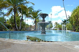
The San Juan Botanical Garden, also known as the Botanical Garden of the University of Puerto Rico, is located in the Caribbean city of San Juan, capital of Puerto Rico. This lush 300-acre (1.2 km2) “urban garden” of native and exotic flora serves as a laboratory for the study, conservation and enrichment of plants, trees, flowers, grasses and many other plants. Seventy-five acres are landscaped and open to the general public as well as researchers.

Río Portugués is a river in the municipality of Ponce, Puerto Rico. In the 19th century, it was also known as Río de Ponce. Twenty-one bridges for motor vehicle traffic span Río Portugués in the municipality of Ponce alone. The river is also known as Río Tibes in the area where it flows through barrio Tibes in the municipality of Ponce. Río Portugués has a length of nearly 30 kilometers (19 mi) and runs south from the Cordillera Central mountain range into the Caribbean Sea. The Portugués is one of the best-known rivers in Ponce because of its prominent zigzagging through the city and its historical significance. The river is historically significant because the city of Ponce had its origins on its banks. It was originally known as Río Baramaya. It has its mouth at 17°58′51″N66°37′26″W. This river is one of the 14 rivers in the municipality.
The Nuevo River is a river of Puerto Rico.

Río Pastillo is a river in the municipality of Ponce, Puerto Rico. It is also known as Río Marueño in the area of the municipality where it runs through barrio Marueño. Together with Cañas River, Pastillo forms Matilde River. Pastillo is one of the 14 rivers in the municipality. The river originates at an altitude of 435 feet. Its tributaries are Quebrada Limon and Quebrada del Agua brooks and the river runs for 19 kilometers before feeding into Río Matilde at a height of 15 feet in Barrio Canas Urbano.
The Río Puerto Nuevo is a river of Puerto Rico.

Portugués Rural or, more commonly, simply Portugués, is one of the 31 barrios in the municipality of Ponce, Puerto Rico. Along with Magueyes, Tibes, Montes Llanos, Maragüez, Machuelo Arriba, Sabanetas, and Cerrillos, Portugués is one of the municipality's eight rural interior barrios. It was founded in 1831.

Cerrillos River is a river in the municipality of Ponce, Puerto Rico. Río Cerrillos has its origin in barrio Anón and runs south until it feeds into Bucaná River. Río Cerrillos is commonly known by the locals as Maragüez River, because most of its course runs through Barrio Maragüez. This river is one of the 14 rivers in the municipality. The river has a discharge of 24,000 cubic feet per second, making it the second most affluent river in the municipality after Río Jacaguas.
Bodine Koehler Peña is a Dutch-born Puerto Rican musician, model and beauty pageant titleholder who represented the municipality of Río Grande at the Miss Universe Puerto Rico 2012 pageant and represented Puerto Rico at the Miss Universe 2012 pageant.