Related Research Articles

Pointe Michel is a small town on the southwest coast of Dominica. It is located to the south of the capital, Roseau, and is known for being the birthplace of Dominica's first female Prime Minister, Dame Eugenia Charles.
Rosalie is a village in Dominica. It is located in Saint David Parish at the northern end of Rosalie Bay, on the central east coast of the island, close to the mouth of the Rosalie River.

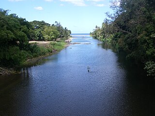
The Layou River is a river in Dominica. It rises in the interior of the country, flowing westward to reach the Caribbean Sea on the country's central western coast, very close to the town of St. Joseph. It is the longest and deepest river in Dominica.

Bataka is a small town in Dominica. It is located in the northeast of the island, between Pagua Bay and Salybia.
The Anse Du Mé River is a river on the Caribbean island of Dominica.
The Belle Fille River is a river on the Caribbean island of Dominica.
The Blenheim River is a river in Dominica.
The River Canari is a river on the Caribbean island of Dominica. The adjacent rock formation, which is a persistent 80 degrees Celsius much of the year, has been discussed as a potential site for an enhanced geothermal system for electricity generation.
The Castle Bruce River is a river in Dominica.
The Crayfish River is a river in Dominica.
The Good Hope River is a river in Dominica.

The Pagua River is one of the longest rivers on the Caribbean island of Dominica. It originates in the D'Leau Gommier area of the Central Forest Reserve, where it shares the same watershed as the Layou River. It flows northeastward, forming the western boundary of the Carib Territory. It empties into the Atlantic Ocean in Pagua Bay, on Dominica's east coast.
The Point Mulâtre River is a river in Dominica.
The Saint Sauveur River is a river in Dominica.
The Savane River is a river on the Caribbean island of Dominica.
The Taberi River is a river on the Caribbean island of Dominica.
The Tarou River is a river on the Caribbean island of Dominica near Mahaut.
The River Jack is a river in Dominica.
The River Subaya is a river on the Caribbean island of Dominica.
Layou is a small village on the western coast of Dominica located near the mouth of the Layou River, after which it was named. The dominant trade in the area is fishing, though a few scattered farms are still active.
References
- Map of Dominica
- GEOnet Names Server
- Water Resources Assessment of Dominica, Antigua and Barbuda, and St. Kitts and Nevis
Coordinates: 15°16′N61°23′W / 15.267°N 61.383°W

A geographic coordinate system is a coordinate system that enables every location on Earth to be specified by a set of numbers, letters or symbols. The coordinates are often chosen such that one of the numbers represents a vertical position and two or three of the numbers represent a horizontal position; alternatively, a geographic position may be expressed in a combined three-dimensional Cartesian vector. A common choice of coordinates is latitude, longitude and elevation. To specify a location on a plane requires a map projection.
| This article related to a river in Dominica is a stub. You can help Wikipedia by expanding it. |