Related Research Articles

Artibonite is one of the ten departments of Haiti. With an area of 4,887 km2 it is Haiti's largest department. As of 2015, its estimated population was 1,727,524. The region is the country's main rice-growing area. The main cities are Gonaïves and Saint-Marc. In February 2004 an insurgency tried unsuccessfully to declare Artibonite's independence.

Nord is one of the ten departments of Haiti. It has an area of 2,114.91 km² and a population of 1,067,177 (2015). Its capital is Cap-Haïtien.

Dessalines is an arrondissement in the Artibonite department of Haiti. The arrondissement is named after its main city, Dessalines. The city, in turn, is named after the Haitian Revolution leader Jean-Jacques Dessalines. The arrondissement contains four communes: the city of Dessalines, Desdunes, Grande Saline, and Petite Rivière de l'Artibonite.

Bahon, sometimes called Bohon, is a commune in Grande-Rivière-du-Nord Arrondissement in the Nord, department of Haiti. It is located on the Grand Rivière du Nord (river). It was formerly (1915) located on the railroad south from Cap-Haïtien.
Jean-Rabel is a commune located west of the city of Port-de-Paix and east of the city of the Môle-Saint-Nicolas Arrondissement, in the Nord-Ouest department of Haiti. As of 2015, the estimated adult population was 148,416.
Grande-Rivière-du-Nord is an arrondissement in the Nord Department of Haiti. As of 2015, the population was 64,613 inhabitants. Postal codes in the Grande-Rivière-du-Nord Arrondissement start with the number 13.
Saint-Raphaël is an arrondissement in the Nord department of Haiti. As of 2015, the population was 169,867 inhabitants. Postal codes in the Saint-Raphaël Arrondissement start with the number 14.
Grande Rivière du Nord is a small coastal river that has its mouth in the Atlantic Ocean located in the Nord department of Haiti.

The Grande Rivière de Jacmel or Rivière de la Cosse, is a river in Haiti. It is approximately 45 kilometers long.
The Rivière la Quinte is a river of Haiti.

The Les Trois Rivières is a river of Haiti. Its source is in the Massif du Nord. It then passes through the cities of Plaisance and Pilate.
The Rivière Canot is a river of Haiti.
The Rivière Lociane or L'Océane is a river of Haiti.
The Rivière Montrouis is a river of Haiti.
The Rivière de Bainet is a river of Haiti.
The Rivière de Fer à Cheval is a river of Haiti. It is the primary tributary of the Artibonite River. This means that excess flow of water into the river can indirectly cause pressure on the Péligre Dam. This is notably the case in the aftermath of large-scale storms and hurricanes that hit Haiti.
The Rivière de Grand Goâve is a river of Haiti.
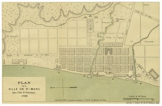
The Rivière de Saint-Marc is a river of Haiti.
The Rivière du Limbè is a river of Haiti.
Rivière Blanche is a river in Haiti in Artibonite of the Dessalines Arrondissement.
References
Coordinates: 19°10′N72°04′W / 19.167°N 72.067°W

A geographic coordinate system is a coordinate system that enables every location on Earth to be specified by a set of numbers, letters or symbols. The coordinates are often chosen such that one of the numbers represents a vertical position and two or three of the numbers represent a horizontal position; alternatively, a geographic position may be expressed in a combined three-dimensional Cartesian vector. A common choice of coordinates is latitude, longitude and elevation. To specify a location on a plane requires a map projection.
| This article related to a river in Haiti is a stub. You can help Wikipedia by expanding it. |