Robert Aitken was a Land Surveyor and a Cartographer who was born in Ayrshire circa 1786. In 1829 he surveyed and published "A new Parish Atlas of Ayrshire, Part 1, Cuninghame District"[1] in Beith, North Ayrshire.
The 'proposal' for potential subscribers at the beginning of the work gives information of the layout of the atlas, together with the detail that: "Each map will contain the names of every House within the Parish - the whole Roads, Turnpike, Parochial, and Private - and the Rivers and Streams. Each Map will contain the names of the principal Heritors, and sundry Statistical and Historical Notices".[2]
Aitken was successful in his attempt to attract sufficient subscribers, 86 being listed; he had stated that he needed 100 in the 1827 'proposal'. The list of subscribers is impressive in its coverage of the artistocracy and significant land owners in Ayrshire suggesting a degree of co-operation indicating close contacts within the landowners of Ayrshire. The titled subscribers and those with high military ranks are listed separately. From 1829 he started to publish the present work in Beith with surveys of all 16 parishes, on a scale of 2 inches to 1 statute mile. The atlas is dedicated to Archibald William Montgomerie, 13th Earl of Eglinton, 1st Earl of Winton (1812–1861), and contains a detailed distance table of towns within the county. The publication was a folio of 14 maps, surveyed by Robert Aitken and W. Ballantine of 14 Terrace, Leith Street, Edinburgh was the lithographer for all the parish maps.[2] It is not recorded how many atlases were printed, however 86 subscribers are listed.
One copy bears the unusual bookplate of a fellow contemporary land surveyor, Andrew Crawford of Dalry, a gentleman of some standing, who was the chairman of Dalry Burns club from 1828 to 1843.[3] He is not listed amongst the subscribers.
Aitken is also known to have published a plan of Cowieland for John Richmond in 1837. A Cowieland is recorded as part of the Lands of Cuff near Beith in Scotland's Places and on John Thomson's 1832 map.[2][4]
Bookplate by Andrew Crawford, Land Surveyor, Dalry, 1829.
The maps are rare and an atlas, minus the Cuninghamia map, in 2016 was auctioned by Lyon & Turnbull for £550.[5] The original price on the proposals sheet was 2/6s per sheet for those who subscribed for the whole and 5s for partial subscribers to parishes, to be paid on delivery.
By 1827 Aitken had completed his survey of the Parish of Beith and the response was that it "had met with the approbation of Gentlemen of Scientific knowledge and taste;" who had encouraged him to cover the other Cuninghame parishes. He had plans for surveying Kyle and Carrick depended upon the success of the Cuninghame atlas but they never came to fruition.[6]
The demand for Aitken's map would have been in question given that John Thomson's 1 1/4 mile = 1 inch map of the "Northern Part of Ayrshire." was issued as part of his Atlas of Scotland, published in Edinburgh: J. Thomson & Co., 1828. 1 map on 4 sheets; 1302 x 984mm., sheets 690 x 513mm.[7]
The supplementary information
Robert Aitken's map of Little Cumbrae.
In the 1827 'proposal' document Aitken had promised subscribers that the maps would also carry information such as the names of every house within the Parishes, whole Roads, Turnpike, Parochial, and Private; names of the Rivers and Streams; names of the principal Heritors, and "sundry Statistical and Historical Notices."[6] These 'sundry statistics' included the populations of the parishes in 1755, 1791, 1801, 1811 and 1821; the total rental value in pounds Scots of the parish or major towns; the surface area in square miles; sometimes the latitude and longitude of major towns; sometimes the extent in miles of parish roads and turnpikes with toll houses marked and named as such; a colour key to the roads is sometimes given; the maps have a scale in miles and furlongs at the bottom of the page. The extent of moorland and green pasture is sometimes shown; height of the principal hills and some significant buildings is shown; ruins are marked as such and even tumuli indicated. The surface area of Kilbirnie Loch is recorded as its old name 'Loch Thankart'. The number of lint, corn and wool mills in a parish is listed on occasions.
The maps are carefully hand coloured on wove paper with parish boundaries highlighted as are the turnpikes.[5] Maps north, south, east and west directions are indicated using different styles of compasses. A double page table of distances was included.[5]
The parish atlas map details
(1) Map of Ayrshire. D.Macdonald, sc. 171 x 133mm. 1830.
(2) Cuninghamia by Timotheo Pont. 419 x 546mm. Engraved 1837.
(3) Map of Cuninghame. 394 x 514mm. W.Ballantine, litho. 1830.
(4) Map of the Parishes of Ardrossan, Stevenston and Kilwinning. 406 x 514mm. 1m = 2 ins. 1828, litho 1829.
(5) Map of the Parish of Beith. 368 x 489mm. c.1m = 2 ins. Surveyed 1827, litho 1828.
(6) Map of the Parish of Dalry. 521 x 406mm. c.1m = 2 ins. Surveyed 1827.
(7) Map of the Parishes of Irvine, Dreghorn and Kilmaurs. 381 x 495mm. 1m = 2 ins. Surveyed & litho 1829.
(8) Map of the Parishes of Stewarton and Dunlop. 425 x 508mm. 1m = 2 ins. Surveyed & litho 1829.
(9) Map of the Parish of Fenwick. 381 x 502mm. 1m = 2 ins. Surveyed & litho 1829.
Robert Aitkens map of the Parish of Dalry.
(10) Map of the Parish of Kilbirnie. 502 x 375mm. 1m = 2 ins. Surveyed 1827; litho 1828.
(11) Map of the Parish of Kilbride. 387 x 508mm. 1m = 2 ins. Surveyed 1827; litho 1829.
(12) Maps of the Environs of Kilmarnock. 387 x 502mm. 1m = 2 ins. Surveyed 1828; litho 1829.
(13) Maps of the Parish of Largs. 527 x 394mm. 1m = 2 ins. Surveyed 1827.
(14) Map of the Parish of Loudoun. 387 x 521mm. 1m = 2 ins. Surveyed & litho 1829.
Life and family
Robert Aitken's map of Kilmaurs
Robert Aitken was recorded as a Land Surveyor in the 1841 Census and that shows that he was 55 years of age at the time, living at 35 New Street, Beith with his wife Mary, a flax throwster, aged 50 and a daughter Elizabeth, aged six.[8] A flax throwster was a textile worker on a machine which twisted together strands of flax into linen yarn.[9] The family are not listed at Beith on the 1851 Census.
Little is known of his time in Beith, but he was a member of the Beith Benficent Society.[1]
Beith is a small town in the Garnock Valley, North Ayrshire, Scotland approximately 20 miles south-west of Glasgow. The town is situated on the crest of a hill and was known originally as the "Hill o' Beith" after its Court Hill.
Lambroughton is a village in the old Barony of Kilmaurs, Scotland. This is a rural area famous for its milk and cheese production and the Ayrshire or Dunlop breed of cattle.
Cunninghamhead is a hamlet in North Ayrshire, Scotland. It was the centre of the lands of Cunninghamhead, Perceton and Annick Lodge in Cunninghame. This mainly rural area is noted for its milk and cheese production and the Ayrshire, Cunninghame or Dunlop breed of cattle.
The old Barony and castle of Corsehill lay within the feudal Baillerie of Cunninghame, near Stewarton, now East Ayrshire, Scotland.
Lugton is a small village or hamlet in East Ayrshire, Scotland with a population of 80 people. The A736 road runs through on its way from Glasgow, 15 miles (24.1 km) to the north, to Irvine in North Ayrshire. Uplawmoor is the first settlement on this 'Lochlibo Road' to the north and Burnhouse is to the south. The settlement lies on the Lugton Water which forms the boundary between East Ayrshire and East Renfrewshire as well as that of the parishes of Dunlop and Beith.
Cunninghamhead is a hamlet on the Annick Water in the Parish of Dreghorn, North Ayrshire, Scotland. The area was part of the old Cunninghamhead estate, and once contained several watermills.
Thorntoun School was opened by Barnardo's in September 1971 for children with emotional difficulties aged 11 to 16 years. The school closed in 1990 and Thorntoun is now a nursing home. The complex lies between the villages of Springside and Crosshouse, Kilmarnock in East Ayrshire, Scotland. The old Thorntoun mansion house was demolished in the late 1960s, leaving the West Lodge, some of the home farm outbuildings, the stables and the walled garden as 'memorials' to the ancient history of the site. Many fine trees remain from the estate policies and the surviving gardens are very well maintained (2007). An entrance with a slight deviation from the old course has been created to serve the large modern buildings which house the nursing home.
The village or hamlet of Gatehead is lin East Ayrshire, Kilmaurs, Scotland. It is one and a quarter miles from Crosshouse and one and a half miles from Kilmarnock. In the 18th and 19th centuries the locality was a busy coal mining district. The settlement runs down to the River Irvine where a ford and later a bridge was located.
Highfield is a small village or hamlet in North Ayrshire, Parish of Dalry, Scotland. It is situated between the settlements of Barkip and Dalry on the A737 at a junction with the B777. It lies in the lands of the old Barony of Kersland, the ruins of Kersland Castle and East Kersland Mill being situated nearby at East Kersland.
Spier's School (NS352533), at Beith, in North Ayrshire, Scotland was opened in 1888 and closed in 1972. The school, now demolished, was built using Ballochmyle red sandstone and was reminiscent of the ancient Glasgow University. The school motto was 'Quod verum tutum'. The gardens and woodlands are open to the public at all times.
Broadstone lies close to the small village of Gateside in North Ayrshire, Scotland about half a mile east of Beith in the old Barony of Giffen.
Monkredding formed a small estate in the Parish of Kilwinning, North Ayrshire lying between Kilwinning and Auchentiber on the B778. The property was originally held by the Tironensian monks of Kilwinning Abbey and was the 'Monk's Garden', the rest home for the brothers. Monkcastle near Dalgarven was the abbot's country retreat. Monkredding remains in good condition and is in use as a private house in 2010.
The old Barony and castle, fortalice, or tower house of Hill of Beith lay in the feudal Regality of Kilwinning, within the Baillerie of Cunninghame, and the Sherrifdom of Ayr, now the Parish of Beith, North Ayrshire, Scotland.
Burnhouse, sometimes known locally as The Trap from "Man Trap", is a small village or hamlet in North Ayrshire, Parish of Beith, Scotland. It lies on a crossroads of old B706 and the more recent A736 Lochlibo Road, between Lugton and Torranyard.
Greenhills is a small village or hamlet in North Ayrshire, Parish of Beith, Scotland. It lies between the settlements of Barrmill and the hamlet of Burnhouse on a crossroads of the B706 and the lanes to Nettlehirst and Tandlehill via the Third part. It is named after the 'Green Hill' an artificial mound, a Moot, Law or Justice hill that once stood here. The settlement lay within the old Barony of Giffen; the castle no longer exists. The village lies within Barrmill and District Community Association's area and is also covered by Beith Community Council.
Swindridgemuir House and estate were composed of the 'Lands of Swindridgemuir' and the dwelling house about two miles north-east of Dalry in the old Barony of Kersland, about a mile and a half north of the Blair Estate, North Ayrshire, Scotland. The spelling on the family memorials at Ayr Auld Kirk is 'Swindrigemuir'.
The ancient lands of Willowyard, Willieyeards, Williyard or Willizeards were part of the holdings of the Regality of Kilwinning, Barony of Beith, and Bailiary of Cuninghame. They later became the property of the Montgomerie family before being sold to the Simson family in 1723. The manor house still survives as part of a business premises and the nearby industrial estate and whisky bond carry the name 'Willowyards'.
The lands of Marshalland, Marsheland, Marsheyland or Marshyland were part of the holdings of the Barony of Beith, Regality of Kilwinning and Bailiary of Cuninghame. They became the property of the Lyle family, then the Shedden family, passing next to the Spier's family before finally becoming part of the Spier's Trust lands. The laird's house and farm were demolished in the 1960s.
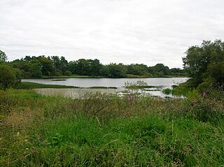
The lands of Threepwood were located in the Parish of Beith, at the eastern boundary between East Renfrewshire and North Ayrshire, Scotland. The settlements of Midtown, Townhead and Townend were part of the old Threepwood Estate. Cuffhill at 675 feet is the highest eminence in the parish and it overlooks the area with Little Hill and Cuff Hill and Little Hill plantations nearby, now situated next to the entirely artificial Cuffhill Reservoir.
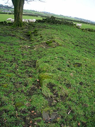
Nether Mill or the Nethermiln of Kilbirnie was originally the Barony of Kilbirnie corn mill and later became a meal mill as well, located in the Parish of Kilbirnie, near Kilbirnie Loch, North Ayrshire, south-west Scotland. The present ruins date from at least the start of the 20th century with structural evidence for at least three phases of development that finally ceased when the mill closed and abandoned c. 1938. The mill was probably a single storey building, developed to become a complex when at a later stage buildings such as a grain kiln, cottage and a wheel house enclosure may have been added. The mound near the site is locally known as the 'Miller's Knowe'. Kilbirnie Ladeside F.C. is named for the lade of the mill that has its confluence with the Garnock opposite the club's grounds.
References
Notes
1 2 Moir, D. (1983). The Early Maps of Scotland. Volume 2. Royal Scottish Geographical Society. p.171. ISBN0-904049-02-7.
This page is based on this Wikipedia article Text is available under the CC BY-SA 4.0 license; additional terms may apply. Images, videos and audio are available under their respective licenses.