Related Research Articles

The Tasman Sea is a marginal sea of the South Pacific Ocean, situated between Australia and New Zealand. It measures about 2,000 km (1,200 mi) across and about 2,800 km (1,700 mi) from north to south. The sea was named after the Dutch explorer Abel Janszoon Tasman, who in 1642 was the first known person to cross it. British explorer Lieutenant James Cook later extensively navigated the Tasman Sea in the 1770s during his three voyages of exploration.
The Admiralty Mountains is a large group of high mountains and individually named ranges and ridges in northeastern Victoria Land, Antarctica. This mountain group is bounded by the sea, and by the Dennistoun Glacier, Ebbe Glacier, and Tucker Glacier.

The Dennistoun Glacier is a glacier, 50 nautical miles long, draining the northern slopes of Mount Black Prince, Mount Royalist and Mount Adam in the Admiralty Mountains of Victoria Land, Antarctica. It flows northwest between the Lyttelton Range and Dunedin Range, turning east on rounding the latter range to enter the sea south of Cape Scott.

Shackleton Glacier is a major Antarctic glacier, over 60 nautical miles long and from 5 to 10 nautical miles wide, descending from the Antarctic Plateau from the vicinity of Roberts Massif and flowing north through the Queen Maud Mountains to enter the Ross Ice Shelf between Mount Speed and Waldron Spurs. Discovered by the United States Antarctic Service (USAS) (1939–41) and named by the Advisory Committee on Antarctic Names (US-ACAN) for Sir Ernest Shackleton, British Antarctic explorer.
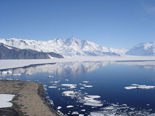
The Taylor Glacier is a glacier in Antarctica about 35 nautical miles long, flowing from the plateau of Victoria Land into the western end of Taylor Valley, north of the Kukri Hills. It flows to the south of the Asgard Range. The middle part of the glacier is bounded on the north by the Inland Forts and on the south by Beacon Valley.

The Scullin Monolith is a crescent-shaped rock fronting the sea 6 km (3.7 mi) west of the similar Murray Monolith, and 8 km (5.0 mi) from Torlyn Mountain, in Mac. Robertson Land, Antarctica. It is a steep massif of metasedimentary gneiss and granitic origin, with the adjacent coastline consisting of 40 m high ice cliffs. The monolith rises steeply to extend from 435 m high Mikkelsen Peak westward in a crescent that forms Douglas Bay.
Lennox-King Glacier is a large valley glacier, about 40 nautical miles (70 km) long that flows east into the Ross Ice Shelf.

Convoy Range is a broad range in Antarctica. It is south of the Kirkwood Range and north of the Clare Range.

The Waihao River is a natural watercourse in the Canterbury region of New Zealand's South Island. It flows into the Wainono Lagoon near Studholme.
Murray Monolith is a detached part of Torlyn Mountain in Mac.Robertson Land, Antarctica. It is a steep massif of metasedimentary gneiss and granitic origin, with the adjacent coastline consisting of 40 m high ice cliffs. The monolith is dome-shaped with steep sides, rising to a seaward summit of 339 m and an inland summit of 363 m at Torlyn Mountain.
The Poroporo River is a river of the Gisborne Region of New Zealand's North Island. It flows east from its sources in the eastern foothills of the Raukumara Range, reaching the Waiapu River close to its mouth, having shared the Waiapu's bed since the town of Tikitiki.
The Pūerua River, prior to 2018 spelled Puerua River, is a river in South Otago, New Zealand. A tributary of the Clutha River / Mata-Au, it rises east of Brown Dome and flows eastward to join that river near Port Molyneux.
The Rogerson River is a river of the north Canterbury region of New Zealand's South Island. It flows generally east, reaching the Chatterton River at the town of Hanmer Springs.

The Whenuakura River is a river of the Taranaki Region of New Zealand's North Island. It flows south from its origins northeast of Lake Rotorangi and reaches the coast five kilometres southeast of Patea.
Cape Bruce forms the northern tip of a small island lying at the eastern side of Oom Bay, separated from the mainland rocks just west of Taylor Glacier in Mac. Robertson Land, Antarctica.
Casey Range is a jagged, razor-backed ridge and a few nunataks in a line extending north–south, standing 8 miles (13 km) west of David Range, in the Framnes Mountains. It was discovered by the British Australian and New Zealand Antarctic Research Expedition (BANZARE), 1929–31, under Douglas Mawson, who named it for Rt. Hon. Richard G. Casey.
Nash Ridge is a high, massive ridge of eastern Eisenhower Range, about 10 nautical miles long and 5 nautical miles wide, projecting between the flow of the O'Kane Glacier and Priestley Glacier, in Victoria Land, Antarctica.
Cotton Plateau is a snow-covered plateau just east of the mouth of Marsh Glacier, in the Queen Elizabeth Range.
References
"Place name detail: Robertson River". New Zealand Gazetteer. New Zealand Geographic Board . Retrieved 12 July 2009.
47°11′S167°47′E / 47.183°S 167.783°E