
The Zuni (Zuñi) River is a tributary of the Little Colorado River in the southwestern United States. It has its origin in Cibola County, New Mexico, in the Zuñi Mountains at the Continental Divide. The river flows off the western slopes of the Zuñi Mountains in a generally southwesterly direction through the Zuni Indian Reservation to join the Little Colorado River in eastern Arizona. The Zuni River is approximately 90 miles (140 km) long, and has a drainage basin in New Mexico of approximately 1,300 square miles (3,400 km2).
Bullville, New York is a populated place located in the Town of Crawford in Orange County, New York, United States. It is located at the junction of routes NY-17K and NY-302. Bulville is the site of a United States Post Office and is served by the postal code 10915.

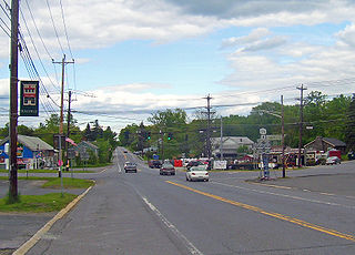
Dawson is a small unincorporated community located in DeKalb County, Alabama, United States. It is located atop Sand Mountain, approximately 4 miles (6 km) northeast of the town of Crossville.
Rock Township is a civil township in Benson County, North Dakota, United States. As of the 2000 census, its population was 39.
Johnson Cove is an unincorporated community in Northampton County, Virginia, United States.
Nechako Canyon Protected Area is a protected area of the BC Parks system, located on the Nechako River between Knewstubb Lake (formed by the Kenny Dam of the Nechako Diversion and Cheslatta Falls at the mouth of the Cheslatta River. The Nechako Canyon, also known as the Grand Canyon of the Nechako, is carved into a lava plateau and features erosive formations such as rock walls, overhanging cliffs, pinnacles and other formations, and the protected area includes Cheslatta Falls.
Good Grief is an unincorporated community in Boundary County, Idaho. It was "saluted" in the early 1970s on the television show Hee Haw as having "a population of three with two dogs and one old grouch".
Swampers is an unincorporated community in Franklin Parish, Louisiana. The name was collected between 1976 and 1980 by the United States Geological Survey, and entered into the Geographic Names Information System on June 4, 1980.

Vanderbilt Hill is a populated place in Juneau, Alaska, United States. Located on the eastern shore of Gastineau Channel, it is named for John W. Vanderbilt, a local businessman who lived in the area between 1906 and 1907.
Ryan is an unincorporated community in Lonoke County, Arkansas, United States. It is located along U.S. Route 165, 2 miles (3 km) west of Allport and 3 miles (5 km) west of Humnoke. It is 2 miles (3 km) east of the town of Coy and 6 miles (10 km) east of the city of England. It is 36 miles (58 km) southeast of Little Rock via Highway 165.
Ryan Acres is a populated place in Brazoria County, Texas, United States. The name was collected from Rand McNally's Houston/Galveston and Vicinity Streetfinder 2003 and entered into the Geographic Names Information System on July 16, 2008.

Tee Harbor refers to two adjacent populated places in the City and Borough of Juneau, Alaska. The area had a population of 32 in 1950. It is located 3 miles (4.8 km) northwest of Fairhaven and 17 miles (27 km) northwest of the main city of Juneau.
Crestview is a populated place in Honolulu County, Hawaii, United States. The name was collected by the United States Geological Survey between 1976 and 1981, and entered into the Geographic Names Information System on February 6, 1981.
Coffeepot is an unincorporated community in Gila County, Arizona, United States. Coffeepot is located at 34°02′22″N111°11′12″W.
Bar X Wash is a stream located in Graham County, Arizona. The name was collected by the United States Geological Survey between 1976 and 1980, and entered into the Geographic Names Information System on February 8, 1980.
Bis Ii Ah Wash is a stream located in Apache County, Arizona, southwest of the census-designated place of Nazlini. The name was collected by the United States Geological Survey between 1976 and 1980, and entered into the Geographic Names Information System on February 8, 1980.
Corn Creek Wash is a stream located in Coconino County, Arizona, southeast of the census-designated place of Leupp. The name was collected by the United States Geological Survey between 1976 and 1980, and entered into the Geographic Names Information System on February 8, 1980.
Granite Wash is a stream located in Mohave County, Arizona, north of Bullhead City. The name was collected by the United States Geological Survey between 1976 and 1980, and entered into the Geographic Names Information System on February 8, 1980.
Foster was a settlement in east San Diego County, California. It was located approximately 3.5 miles (5.6 km) north of Lakeside, near the present-day location of the San Vicente Dam. It was the terminus of the San Diego, Cuyamaca, and Eastern Railroad from 1889, when the railroad reached the town, until 1916, when parts of the railway between Lakeside and Foster were damaged by floods; this also marked the end of the town. There were 7 buildings in Foster in 1891-93, according to the 1893 USGS survey map. A road connecting Lakeside to Ramona and Julian ran through Foster until 1942, when the section just north of Foster was submerged to create San Vicente Reservoir and the road was rerouted further west, bypassing the settlement. The town was named after local rancher Joseph Foster.
Hawkinsville, Tennessee is an unincorporated community in Dyer County.
