Related Research Articles
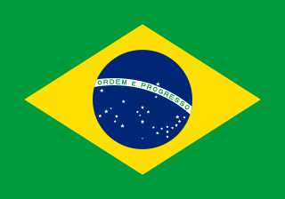
Brazil, officially the Federative Republic of Brazil, is the largest country in South America and in Latin America. At 8.5 million square kilometers (3,300,000 sq mi) and with over 217 million people, Brazil is the world's fifth-largest country by area and the seventh most populous. Its capital is Brasília, and its most populous city is São Paulo. The federation is composed of the union of the 26 states and the Federal District. It is the only country in the Americas to have Portuguese as an official language. It is one of the most multicultural and ethnically diverse nations, due to over a century of mass immigration from around the world, and the most populous Roman Catholic-majority country.

The country of Brazil occupies roughly half of South America, bordering the Atlantic Ocean. Brazil covers a total area of 8,514,215 km2 (3,287,357 sq mi) which includes 8,456,510 km2 (3,265,080 sq mi) of land and 55,455 km2 (21,411 sq mi) of water. The highest point in Brazil is Pico da Neblina at 2,994 m (9,823 ft). Brazil is bordered by the countries of Argentina, Bolivia, Colombia, Guyana, Paraguay, Peru, Suriname, Uruguay, Venezuela, and France.

Brasília is the federal capital of Brazil and seat of government of the Federal District. The city is located high in the Brazilian highlands in the country's Central-West region. It was founded by President Juscelino Kubitschek on 21 April 1960, to serve as the new national capital. Brasília is estimated to be Brazil's third-most populous city. Among major Latin American cities, it has the highest GDP per capita.

Tocantins is one of the 26 states of Brazil. It is the newest state, formed in 1988 and encompassing what had formerly been the northern two-fifths of the state of Goiás. Tocantins covers 277,620.91 square kilometres (107,190.03 sq mi) and had an estimated population of 1,496,880 in 2014. Construction of its capital, Palmas, began in 1989; most of the other cities in the state date to the Portuguese colonial period. With the exception of Araguaína, there are few other cities with a significant population in the state. The government has invested in a new capital, a major hydropower dam, railroads and related infrastructure to develop this primarily agricultural area. The state has 0.75% of the Brazilian population and is responsible for 0.5% of the Brazilian GDP.

São Carlos is a Brazilian municipality in the interior of the state of São Paulo, 254 kilometers from the city of São Paulo. With a population of 254,484 inhabitants, it is the 13th largest city in the state in terms of the number of residents, being almost in the center of the state of São Paulo. The municipality is formed by the headquarters and the districts of Água Vermelha, Bela Vista São-Carlense, Santa Eudóxia and Vila Nery.

The Federal District is one of 27 federative units of Brazil. Located in the Center-West Region, it is the smallest Brazilian federal unit and the only one that has no municipalities, being divided into 33 administrative regions. The federal capital of Brazil, Brasília, which is also the seat of government of the Federal District, is located in its territory.
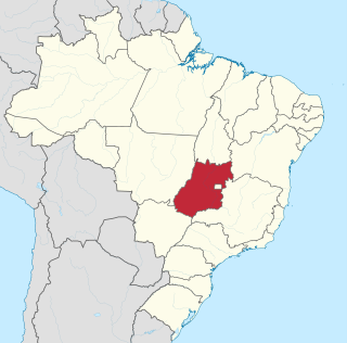
Goiás is a Brazilian state located in the Center-West region. Goiás borders the Federal District and the states of Tocantins, Bahia, Minas Gerais, Mato Grosso do Sul and Mato Grosso. The state capital is Goiânia. With 7.2 million inhabitants, Goiás is the most populous state in the Center-West and the 11th most populous in the country. It has the ninth largest economy among Brazilian federative units. In Brazil's geoeconomic division, Goiás belongs to the Centro-Sul (Center-South), being the northernmost state of the southern portion of Brazil. The state has 3.3% of the Brazilian population and is responsible for 2.7% of the Brazilian GDP.

The federative units of Brazil are subnational entities with a certain degree of autonomy and endowed with their own government and constitution, which together form the Federative Republic of Brazil. There are 26 states and one federal district. The states are generally based on historical, conventional borders which have developed over time. The states are divided into municipalities, while the Federal District assumes the competences of both a state and a municipality.

Rio de Janeiro is one of the 27 federative units of Brazil. It has the second largest economy of Brazil, with the largest being that of the state of São Paulo. The state, which has 8.2% of the Brazilian population, is responsible for 9.2% of the Brazilian GDP.

Sergipe, officially State of Sergipe, is a state of Brazil. Located in the Northeast Region along the Atlantic coast of the country, Sergipe is the smallest state in Brazil by geographical area at 21,910 square kilometres (8,460 sq mi), larger only than the Federal District. Sergipe borders Bahia to the south and west and Alagoas to the north. Aracaju is the capital and the largest city in the state; the state is divided into 75 municipalities. The state has 1.1% of the Brazilian population and produces only 0.6% of the Brazilian GDP.

The national flag of Brazil, is a blue disc depicting a starry sky spanned by a curved band inscribed with the national motto "Ordem e Progresso", within a yellow rhombus, on a green field. It was officially adopted on 19 November 1889 — four days after the Proclamation of the Republic, to replace the flag of the Empire of Brazil. The concept was the work of Raimundo Teixeira Mendes, with the collaboration of Miguel Lemos, Manuel Pereira Reis and Décio Villares.
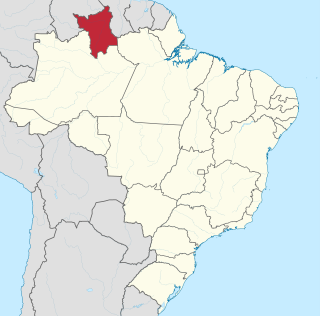
Roraima is one of the 26 states of Brazil. Located in the country's North Region, it is the northernmost and most geographically and logistically isolated state in Brazil. It is bordered by the state of Pará to the southeast, Amazonas to the south and west, Venezuela to the north and northwest, and Guyana to the east.

The National Congress of Brazil is the legislative body of Brazil's federal government. Unlike the state legislative assemblies and municipal chambers, the Congress is bicameral, composed of the Federal Senate and the Chamber of Deputies. The Congress meets annually in Brasília from 2 February to 22 December, with a mid-term break taking place between 17 July and 1 August.
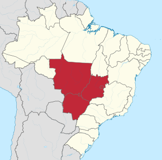
The Central-West or Center-West Region of Brazil is composed of the states of Goiás, Mato Grosso and Mato Grosso do Sul; along with Distrito Federal, where Brazil's national capital, Brasília, is situated. The region comprises 18.86% of the national territory.

Tabatinga, originally Forte de São Francisco Xavier de Tabatinga, is a municipality in the Três Fronteiras area of Western Amazonas. It is in the Brazilian state of Amazonas. Its population was 67,182 (2020) and its area is 3,225 km2.

The Departament of Federal Police is a federal law enforcement agency of Brazil and one of the three national police forces. The other two are the Federal Highway Police, and the National Force. From 1944 to 1967 it was called the Federal Public Safety Department.
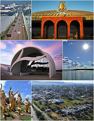
Palmas is the capital and largest city of the state of Tocantins, Brazil. According to IBGE estimates from 2020, the city had 306,296 inhabitants.

Unaí is a municipality in the Northern Region of Minas Gerais, in the Brazilian state of Minas Gerais, in the Southeast Region of Brazil. It is located 590 km from the capital of Minas Gerais and 164 km from the federal capital. Unaí is the main municipality of its micro-region of the same name and, together with Paracatu, the most important city of the said mesoregion of Minas Gerais. Due to its geopolitical location, because it is geographically and politically linked to Brasilia and politically to Belo Horizonte, the municipality has a strong economic dynamism for a municipality that still carries the typically mineiro custom.
Water resources management is a key element of Brazil's strategy to promote sustainable growth and a more equitable and inclusive society. Brazil's achievements over the past 70 years have been closely linked to the development of hydraulic infrastructure for hydroelectric power generation and just recently to the development of irrigation infrastructure, especially in the Northeast region.

Gama is an administrative region in the Federal District in Brazil.