
The Maryland Transit Administration (MTA) is a state-operated mass transit administration in Maryland, and is part of the Maryland Department of Transportation. The MTA operates a comprehensive transit system throughout the Washington-Baltimore metropolitan area. There are 80 bus lines serving the Baltimore Metropolitan Area, along with rail services that include the Light Rail, Metro Subway, and MARC Train. In 2023, the system had a ridership of 52,922,000, or about 219,600 per weekday as of the second quarter of 2024.

The Baltimore Metro SubwayLink is a rapid transit line serving Baltimore, Maryland, and its northwestern suburbs, operated by the Maryland Transit Administration. The segment in Downtown Baltimore is underground, while most of the line outside the central city is elevated or at surface grade. In 2023, the line had a ridership of 1,988,300, or about 16,900 per weekday as of the second quarter of 2024.

The Baltimore Light RailLink is a light rail system serving Baltimore, Maryland, United States, and its northern and southern suburbs. It is operated by the Maryland Transit Administration. In downtown Baltimore, it uses city streets. Outside the central portions of the city, the line is built on private rights-of-way, mostly from the defunct Northern Central Railway, Baltimore and Annapolis Railroad and Washington, Baltimore and Annapolis Electric Railway. The system had a ridership of 3,546,300, or about 13,700 per weekday, as of the second quarter of 2024.

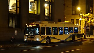
CityLink Navy is a bus route operated by the Maryland Transit Administration in Baltimore. It replaced Route 1 in 2017. The bus route is the successor to the 1 Gilmor Street, 2 Carey Street, and 2 Fort Avenue streetcar lines.

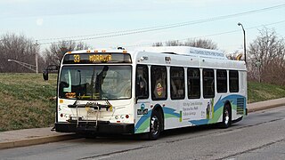
LocalLink 80 is a bus route operated by the Maryland Transit Administration in Baltimore, Maryland, in the United States. LocalLink 80 is part of the high frequency network of the local bus system. The route consists of a leg originating in Downtown Baltimore and goes on to serve the Garrison Boulevard corridor in the northwest of the city. Route 80 and its predecessor, route 91, has carried some of the highest ridership out of Baltimore's local bus network throughout its history. The line was the first in the city to be assigned articulated buses, which are now used to meet the higher capacity requirements of the frequent lines.
QuickLink 40 is a limited stop bus route operated by the Maryland Transit Administration in Baltimore and its suburbs. Formerly the Quickbus 40, the line was discontinued in June 2017 as part of the BaltimoreLink system rebranding along with the other "Quickbus" limited-stop routes. On August 27, 2023, QuickBus 40, was re-launched after it was discontinued in 2017.

LocalLink 75 is a bus route operated by the Maryland Transit Administration in Baltimore and its suburbs. The line currently runs from the Patapsco Light Rail Stop to Arundel Mills in Anne Arundel County, via BWI Airport. The line operates to University of Maryland during hours when the light rail is not operating.
CityLink Orange is a bus route operated by the Maryland Transit Administration in Baltimore and its suburbs. The line currently runs from the Wal-Mart parking lot in Catonsville, Maryland east through downtown Baltimore to the Fox Ridge community in Essex, serving the corridors of Edmondson Avenue on the west side and Eastern Avenue on the east, and the communities of Edmondson Village, Allendale, Rosemont, Patterson Park, and Eastpoint, and is one of the most heavily used bus routes operated by the MTA.

CityLink Red is a MTA BaltimoreLink bus route operated by the Maryland Transit Administration in Baltimore and its suburbs. The line currently runs from the University of Maryland Transit Center to the Lutherville Light Rail Stop along the corridors of York Road and Greenmount Avenue, and is the most heavily used MTA bus line. The CityLink Red bus replaced Route 8 bus route due to BaltimoreLink, and is the successor to the 8 Towson and 7 Govanstown streetcar lines.
Route 51 is a bus route operated by the Maryland Transit Administration in Baltimore and its suburbs. The line currently runs from the center of Towson to the Inner Harbor in Downtown Baltimore, serving the Charles Street corridor. Route 51 replaced Route 11 on June 18, 2017 due to the BaltimoreLink bus system overhaul.
LocalLink 95 is a bus route operated by the Maryland Transit Administration in Baltimore. The line currently runs from the intersection of Roland Avenue and Lake Avenue in Roland Park south to the Inner Harbor via Roland Avenue, University Parkway, Charles Street and St. Paul Street.

LocalLink Route 56 is a bus route operated by the Maryland Transit Administration in Baltimore and its suburbs. The line runs between the Park and Ride station in White Marsh and Charles Center in Downtown Baltimore. In June 2017, LocalLink 56 replaced the former local bus Route 35, which connected the city's downtown area with White Marsh, to the east of the city, and UMBC to the west. Route 35 was the successor to the No. 3 Wilkens Avenue and No, 6 Monument Street streetcar lines.
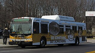
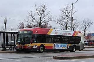
The Maryland Transit Administration provides the primary public bus service for the Baltimore metropolitan area and commuter bus service in other parts of the state of Maryland. There are currently 76 bus routes, which include 45 LocalLink routes, 12 High Frequency CityLink Routes routes, 8 express bus routes, 19 commuter bus routes, and 5 Intercounty Connector or "ICC" routes. The local and commuter bus routes operate in conjunction with one subway line, three light rail lines, MARC train service, and various connections to other transit agencies.
Route 52 is a bus route operated by the Maryland Transit Administration in Baltimore and its suburbs. The line is a dedicated service for employees of Stella Maris, a complex of long term care facilities in Timonium, Maryland. Route 52 replaced Route 12 under BaltimoreLink.
LocalLink 28 is a bus route operated by the Maryland Transit Administration in Baltimore. The line currently runs from the Rogers Avenue Metro Subway Station in Northwest Baltimore to a loop in Moravia in Northeast Baltimore. Service is provided about once every 10–15 minutes during rush hour, every 20 minutes midday, every 30 minutes on Saturdays, and hourly on Sundays. The line operates primarily along the cross-town corridor of Coldspring Lane and Moravia Road, transversing Arlington, Park Heights, Roland Park, Homeland, and Montebello. The line passes several universities, including Loyola College, Notre Dame, and Morgan State University.
LocalLink 59 is a bus route operated by the Maryland Transit Administration in Baltimore and its suburbs. The line operates hourly between the Moravia loop in Northeast Baltimore and Whispering Woods, just east of Bowleys Quarters.

Route 46 was a limited stop bus route, identified as a "Quickbus", operated by the Maryland Transit Administration in Baltimore. The line ran from the Cedonia Loop in Northeast Baltimore to the Paradise Loop, in Catonsville. Service operated every 15 minutes during rush hour only. The line served the corridors of Frederick Avenue in West Baltimore, and Sinclair Lane/Cedonia Ave in Northeast Baltimore including the communities of Yale Heights, and Gwynns Falls in West Baltimore, and Berea and Parkside in East Baltimore.

Hawkins Point is a neighborhood in the South District of Baltimore, located at the southern tip of the city between Curtis Bay (north) and the Anne Arundel County line (south) and Thoms Cove (east). Its land area covers 2.6 square miles (6.7 km2), and it had a population of 24 people according to the 2020 U.S. Census. The neighborhood is predominantly industrial.

Regional Transportation Agency of Central Maryland, locally referred to as the RTA, is a transit organization providing fixed-route and paratransit services across Central Maryland. The RTA is made up of multiple jurisdictions including Anne Arundel County, Howard County, the City of Laurel, Northern Prince George's County, and Baltimore County.