See also
| This disambiguation page lists articles associated with the title Route 69. If an internal link led you here, you may wish to change the link to point directly to the intended article. |
Route 69 may refer to:
| This disambiguation page lists articles associated with the title Route 69. If an internal link led you here, you may wish to change the link to point directly to the intended article. |

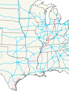
Interstate 69 (I-69) is an Interstate Highway in the United States currently consisting of seven disjointed parts with an original continuous segment from Indianapolis, Indiana, northeast to the Canada–US border in Port Huron, Michigan, at 355.8 miles (572.6 km). The remaining separated parts are variously completed and posted or unposted parts of an extension southwest to the Mexican border in Texas. Of this extension—nicknamed the NAFTA Superhighway because it would help trade with Canada and Mexico spurred by the North American Free Trade Agreement—five pieces near Corpus Christi, Houston, northwestern Mississippi, Memphis, and Evansville have been newly built or upgraded and signposted as I-69. A sixth segment of I-69 through Kentucky utilizing that state's existing parkway system and a section of I-24 was established by federal legislation in 2008, but only a portion is signposted. A section of the previously existing Western Kentucky Parkway from Eddyville to Nortonville was approved and signposted in late 2011, with the Pennyrile Parkway between Nortonville and Henderson being signed as I-69 in 2015, and the Purchase Parkway between Mayfield and Calvert City signed in July 2018. This brings the total length to about 720 miles (1,160 km).

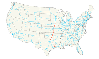
U.S. Route 69 (US 69) is a major north–south United States highway. When it was first created, it was only 150 miles (241 km) long, but it has since been expanded into a Minnesota to Texas cross-country route. The highway's southern terminus is in Port Arthur, Texas at an intersection with State Highway 87. Its northern terminus is in Albert Lea, Minnesota at Minnesota State Highway 13.

U.S. Route 59 is a north–south United States highway. A latecomer to the U.S. numbered route system, US 59 is now a border-to-border route, part of NAFTA Corridor Highway System. It parallels U.S. Route 75 for nearly its entire route, never much more than 100 miles (160 km) away, until it veers southwest in Houston, Texas. Its number is out of place since US 59 is either concurrent with or entirely west of U.S. Route 71.
King's Highway 69, commonly referred to as Highway 69, is a major north–south highway in the central portion of the Canadian province of Ontario, linking the northern terminus of Highway 400 north of Parry Sound with the city of Greater Sudbury at Highway 17. It is part of the Trans-Canada Highway and the National Highway System.

The 69th Street Transportation Center, also known as the 69th Street Terminal or 69th Street Station, is a SEPTA terminal in the Terminal Square section of Upper Darby, Pennsylvania, just outside the Philadelphia border. It is the other ground-level station on the Market Frankford Line besides Millbourne.

European route E69 is an E-road between Olderfjord and North Cape in northern Norway. The road is 129 km (80 mi) long. It contains five tunnels, totalling 15.5 km (9.6 mi). The longest, the North Cape Tunnel, is 6.9 km (4.3 mi) long and reaches 212 m (696 ft) below sea level.
Federal Route 69, or Jalan Bagan Datoh, is a federal road in Perak, Malaysia, connecting Simpang Empat Hutan Melintang to Bagan Datoh.
King's Highway 64, commonly referred to as Highway 64, is a provincially maintained highway in the Canadian province of Ontario, connecting Highway 69 north of the French River with Highway 11 at Marten River, via Highway 17 west of Sturgeon Falls. The route serves several communities along the north shore of the French River and west shore of Lake Nipissing as it travels from Highway 69 to Highway 17. North of Sturgeon Falls, the highway provides a shortcut between Highway 17 and Highway 11 northwest of North Bay.
Secondary Highway 637, commonly referred to as Highway 637 is a provincially maintained secondary highway in the Canadian province of Ontario. Located entirely within Sudbury District, the highway connects Highway 69 to the primary townsite of Killarney, 67.8 kilometres (42.1 mi) away, as well as providing access to Killarney Provincial Park.
Secondary Highway 537, commonly referred to as Highway 537, is a provincially maintained highway in the Canadian province of Ontario. The highway is 16.1 kilometres (10.0 mi) in length, connecting Highway 69 near Wanup with Finni Road. It once continued 3.6 km (2.2 mi) further to intersect Highway 17 in Wahnapitae, but was truncated in 1998; this portion of the route is now designated as Municipal Road 537. Highway 537 remains the only secondary highway in the province within a jurisdiction that also maintains a county/regional road network.

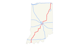
Interstate 69 (I-69) currently has two discontinuous segments of freeway in the U.S. state of Indiana. The original 157.3-mile-long (253.1 km) highway, completed in November 1971, runs northeasterly from the state capital of Indianapolis, to the city of Fort Wayne, and then proceeds north to the state of Michigan. This original section is also known as Segment of Independent Utility (SIU) 1 in the national plan for expansion of I-69.
Interstate 69 (I-69) is an Interstate Highway in the U.S. state of Texas that is planned to pass through the eastern part of the state and along the Gulf Coast to Victoria, where it will split into multiple segments with I-69E terminating in Brownsville, I-69C terminating in Pharr, and I-69W terminating in Laredo.
King's Highway 103, commonly referred to as Highway 103, was a provincially maintained highway in the Canadian province of Ontario. Located in the Muskoka District, the highway extended from Highway 12 at Waubaushene to Highway 69 at Foot's Bay. Opened in 1944, the highway existed until 1976, when a series of renumberings eliminated the designation, replacing it with Highway 69; Highway 400 has since been built over the majority of this former route.
Secondary Highway 529, commonly referred to as Highway 529, is a secondary highway in the Canadian province of Ontario. Located within Parry Sound District, the highway follows a 25.8-kilometre (16.0 mi) route, from its southern terminus at Highway 69 near Pointe au Baril to its northern terminus at Highway 69's crossing of the Magnetawan River near Byng Inlet. Two spur routes, Highway 529A and Highway 645, branch off the highway to serve the communities of Bayfield Inlet and Byng Inlet, respectively. The route was established along the present alignment of Highway 529A in 1956. It was relocated in 1961 when a bypass of Highway 69 opened through the area, with the former alignment being renumbered as Highway 529.

London Buses route 69 is a Transport for London contracted bus route in London, England. Running between Walthamstow Central and Canning Town stations, it is operated by Tower Transit.
Interstate 2 (I-2) is a partially completed Interstate Highway running through the Lower Rio Grande Valley of South Texas. It begins at the intersection of U.S. Highway 83 (US 83) and Business U.S. Highway 83 in Penitas and heads eastward before terminating at I-69E/US 77/US 83 in Harlingen. For its entire length, I-2 runs concurrently with US 83. I-2 also parallels Mexican Federal Highway 2, another major east–west route that traces the Mexico-U.S. border along the Mexican side of the Rio Grande. When completed, the western terminus will be the city of Laredo.