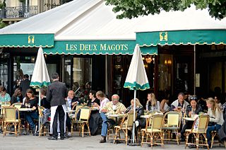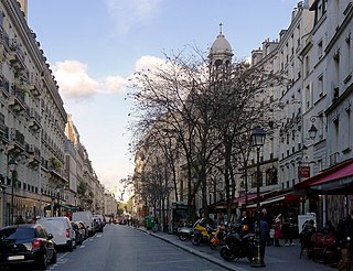
Ossip Zadkine was a Russian-French artist of the School of Paris. He is best known as a sculptor, but also produced paintings and lithographs.

The 6th arrondissement of Paris is one of the 20 arrondissements of the capital city of France. In spoken French, it is referred to as le sixième.

The 4th arrondissement of Paris is one of the twenty arrondissements of the capital city of France. In spoken French, this arrondissement is referred to as quatrième. Along with the 1st, 2nd and 3rd arrondissements, it is in the first sector of Paris, which maintains a single local government rather than four separate ones.

The 15th arrondissement of Paris is one of the 20 arrondissements of the capital city of France. In spoken French, it is referred to as le quinzième.

The 13th arrondissement of Paris is one of the 20 arrondissements of Paris. In spoken French, the arrondissement is referred to as le treizième.

Châtelet station is a station of the Paris Métro and Île-de-France's RER commuter rail service, located in the centre of medieval Paris, on the border between the 1st and 4th arrondissements. It serves RER A, B and D, as well as lines 1, 4, 7, 11, and 14 of the Paris Métro; it is the southern terminus of Line 11. The station is made up of two parts connected by a long corridor: lines 7 and 11 under the Place du Châtelet and the Quai de Gesvre, next to the Seine; lines 1, 4 and 14 towards Rue Saint-Denis and the Rue de Rivoli.

Bercy station is a station on lines 6 and 14 of the Paris Métro. It is located at the intersection of the Boulevard de Bercy and the Rue de Bercy in the neighbourhood of Bercy in the 12th arrondissement.

Passy is a station on Line 6 of the Paris Métro. Located in the 16th arrondissement, it is elevated at its eastern end, while its western end is in the mouth of a tunnel. Passy metro station lies above Rue de l'Alboni where the street becomes pedestrianised as a result of a steep grade.

Chevaleret is an elevated station of the Paris Métro serving line 6 at the intersection of the Rue du Chevaleret and the Boulevard Vincent Auriol in the 13th arrondissement.

The Rue de l'Abbaye is a residential street in the 6th arrondissement of Paris, named after the Abbey of Saint-Germain-des-Prés. It has a length of some 170 m and runs from the Rue Guillaume Apollinaire to the Rue de l'Echaudé. The street itself dates from 1800, although the land it runs over has a much longer history. The oldest and most prominent buildings on the street are the abbey's side entrance and former abbot's residence, built in 1586. It now is the home of the Catholic Institute of France.

The Boulevard Saint-Michel is one of the two major streets in the Latin Quarter of Paris, France, the other being the Boulevard Saint-Germain. It is a tree-lined boulevard which runs south from the Pont Saint-Michel on the Seine and Place Saint-Michel, crosses the Boulevard Saint-Germain and continues alongside the Sorbonne and the Jardin du Luxembourg, ending at the Place Camille Jullian just before the Port-Royal RER station and the Avenue de l'Observatoire. It was created by Baron Haussmann to run parallel to the Rue Saint-Jacques which marks the historical north-south axis of Paris. It is known colloquially as Boul'Mich' in French.

The Bibliothèque Mazarine, or Mazarin Library, is located within the Palais de l'institut de France, or the Palace of the Institute of France, at 23 quai de Conti in the 6th arrondissement, on the Left Bank of the Seine facing the Pont des Arts and the Louvre. Originally created by Cardinal Mazarin as his personal library in the 17th century, it today has one of the richest collections of rare books and manuscripts in France, and is the oldest public library in the country.

The Place Saint-Michel is a public square in the Latin Quarter, on the borderline between the fifth and sixth arrondissements of Paris, France. It lies on the left bank of the river Seine facing the Île de la Cité, to which it is linked by the Pont Saint-Michel.

The Rue du Chat-qui-Pêche is considered the narrowest street in Paris. It is only 1.80 m wide for the whole of its 29 m length.
This article presents the main landmarks in the city of Paris within administrative limits, divided by its 20 arrondissements. Landmarks located in the suburbs of Paris, outside of its administrative limits, while within the metropolitan area are not included in this article.
Guillot or Guiot of Paris was a late 13th or early 14th century French poet, author of the Le Dit des rues de Paris.

The Rue des Archives is a street in Le Marais at the border of 3rd and 4th arrondissements of Paris, France.

Pont Cardinet station is a station on Line 14 of the Paris Métro located in the Batignolles neighbourhood of the 17th arrondissement. It was opened on 14 December 2020 as part of the extension to Mairie de Saint-Ouen and is located nearby to Pont Cardinet station.
This page is based on this
Wikipedia article Text is available under the
CC BY-SA 4.0 license; additional terms may apply.
Images, videos and audio are available under their respective licenses.


