Related Research Articles

The O-Bahn Busway is a guided busway that is part of the bus rapid transit system servicing the northeastern suburbs of Adelaide, South Australia. The O-Bahn system was conceived by Daimler-Benz to enable buses to avoid traffic congestion by sharing tram tunnels in the German city of Essen.

Victoria Square, also known as Tarntanyangga, is the central square of five public squares in the Adelaide city centre, South Australia.

Rundle Mall is a pedestrian street mall located in Adelaide, South Australia. It was opened as a pedestrian mall in September 1976 by closing the section of Rundle Street between King William Street and Pulteney Street, to vehicular traffic. The street continues as Rundle Street to the east and Hindley Street to the west.

North Terrace is one of the four terraces that bound the central business and residential district of Adelaide, the capital city of South Australia. It runs east–west, along the northern edge of "the square mile". The western end continues on to Port Road, and the eastern end continues across the Adelaide Parklands as Botanic Road.

The Adelaide Park Lands are the figure-eight of land spanning both banks of the River Torrens between Hackney and Thebarton and separating the City of Adelaide area from the surrounding suburbia of greater metropolitan Adelaide, the capital city of South Australia. They were laid out by Colonel William Light in his design for the city, and originally consisted of 2,300 acres (930 ha) "exclusive of 32 acres (13 ha) for a public cemetery". One copy of Light's plan shows areas for a cemetery and a Post and Telegraph Store on West Tce, a small Government Domain and Barracks on the central part of North Tce, a hospital on East Tce, a Botanical Garden on the River Torrens west of North Adelaide, and a school and a storehouse south-west of North Adelaide.

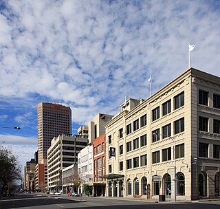
King William Street is the part of a major arterial road that traverses the CBD and centre of Adelaide, continuing as King William Road to the north of North Terrace and south of South Terrace. At approximately 40 metres (130 ft) wide, King William Street is the widest main street of all the Australian State capital cities. Named after King William IV in 1837, it is historically considered one of Adelaide's high streets, for its focal point of businesses, shops and other prominent establishments. The Glenelg tram line runs along the middle of the street through the city centre.
Kensington Gardens is an eastern suburb of Adelaide, in the City of Burnside. Inhabited by the Kaurna people before settlement by Europeans, it became known as Pile's Paddock, after James Pile, who was born in the county of Yorkshire, England, in 1800 and arrived in South Australia in 1849.

Hackney is an inner-eastern suburb of Adelaide, South Australia, in the City of Norwood Payneham St Peters. It is adjacent to the Adelaide Park Lands, the Adelaide city centre and North Adelaide. The O-Bahn Busway passes along Hackney Road, part of the City Ring Route, Adelaide, which forms its western boundary. Its other boundaries are the River Torrens (north), the continuation of North Terrace through Kent Town (south), and a series of small streets and lanes to the east.

Rundle Street, often referred to as "Rundle Street East" as distinct from Rundle Mall, is a street in the East End of the city centre of Adelaide, the capital of South Australia. It runs from Pulteney Street to East Terrace, where it becomes Rundle Road through the East Park Lands.. Its former western extent, which ran to King William Street, was closed in 1972 to form the pedestrian street of Rundle Mall. The street is close to Adelaide Botanic Gardens, Rundle Park / Kadlitpina, Rymill Park, Hindmarsh Square and North Terrace.

Montefiore Hill is a small hill in North Adelaide, South Australia, which affords a view over the Adelaide city centre.

Light Square, also known as Wauwi, is one of five public squares in the Adelaide city centre. Located in the centre of the north-western quarter of the Adelaide city centre, its southern boundary is Waymouth Street, while Currie Street crosses its northern tip, isolating about a quarter of its land. Morphett Street runs through the centre in a north-south direction.

Rymill Park / Murlawirrapurka, and numbered as Park 14, is a recreation park located in the East Park Lands of the South Australian capital of Adelaide. There is an artificial lake with rowboats for hire, a café, children's playground and rose garden, and the Adelaide Bowling Club is on the Dequetteville Terrace side. The Adelaide O-Bahn passes underneath it, to emerge at the western side opposite Grenfell Street.
Hindmarsh Square/Mukata is one of five public squares in the Adelaide city centre, South Australia. It is located in the centre of the north-eastern quarter of the city, and surrounds the intersection of Grenfell and Pulteney Streets, near the eastern end of the Rundle Mall. Pirie Street forms the southern boundary of the square.

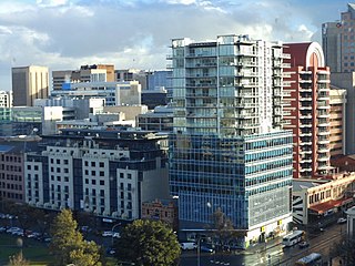
Adelaide city centre is the inner city locality of Greater Adelaide, the capital city of South Australia. It is known by locals simply as "the City" or "Town" to distinguish it from Greater Adelaide and from the City of Adelaide local government area. The population was 15,115 in the 2016 census.

Pulteney Street is a main road which runs north-south through the middle of the eastern half of the Adelaide city centre, in Adelaide, South Australia. It runs north-south from North Terrace, through Hindmarsh and Hurtle Squares, to South Terrace, where it becomes Unley Road, and subsequently,, becomes Belair Road.

Wellington Square, also known as Kudnartu, is a public square in the Adelaide suburb of North Adelaide, South Australia, in the City of Adelaide. It is roughly at the centre of the largest of the three grids which comprise North Adelaide.

Grenfell Street is a major street in the north-east quarter of the Adelaide city centre, South Australia. The street runs west-east from King William Street to East Terrace. On the other side of King William Street, it continues as Currie Street. Its intersection with Pulteney Street is encircled by Hindmarsh Square.

East Terrace marks the eastern edge of the Adelaide city centre. It is one of the main north–south thoroughfares through the east side of the city. Although the terrace essentially runs north–south between North Terrace and South Terrace, unlike Adelaide's other three terraces, its path is far from a straight line; travelling the entire length of East Terrace requires turning at right angles at most intersections from Pirie Street onwards. These days however, the traffic flow, after a swerve to the east between Grenfell and Pirie Streets, continues southwards over the Pirie intersection into Hutt Street and on down to South Terrace.
Currie Street is a main street in the Adelaide city centre, South Australia. It runs east–to–west from King William Street, through Light Square, to West Terrace on the western edge of the city centre.
Gawler Place is a single-lane road in the city centre of Adelaide, the capital of South Australia. It runs north to south from North Terrace to Wakefield Street, parallel to and approximately midway between King William and Pulteney Streets.
References
- ↑ Craig, F. W. S. (1989) [1977]. British parliamentary election results 1832–1885 (2nd ed.). Chichester: Parliamentary Research Services. p. 301. ISBN 0-900178-26-4.
- ↑ "Rundle Mall History". Rundle Mall. 12 April 2020. Retrieved 9 March 2021.
- ↑ Rundle, P.; et al. (2013). Farmers-Devon to South Australia: The story of James and Jane Rundle and their Family. Rundle History Group. p. 12,13. ISBN 9780646911311.
- 1 2 Amery, Rob; Williams, Georgina (2002). "Reclaiming through renaming: the reinstatement of Kaurna toponyms in Adelaide and the Adelaide Plains" (PDF). The land is a map: placenames of Indigenous origin in Australia. Pandanus. pp. 255–276. ISBN 1740760204 . Retrieved 7 March 2021– via Adelaide Research & Scholarship (University of Adelaide).
- ↑ Sign: site 13, Adelaide City Council, archived 20 November 2010 via web.archive.org
- ↑ "Kaurna Place Naming". City of Adelaide. Retrieved 14 December 2019.
- ↑ CLMP for Rundle Park / Kadlitpinna (Park 13), Adelaide City Council, archived 19 November 2010 (3Mb, 47 pages)
- ↑ "Park 13". Adelaide Park Lands Preservation Association. Retrieved 7 March 2021.
- ↑ "City squares recognise women from the past". City of Adelaide. 19 March 2018. Retrieved 28 November 2019.
- ↑ Hems, Owen (3 December 2015). "Light Square". Adelaidia. Retrieved 29 November 2019.
Revised 1 June 2017 to update Kaurna place name spelling...This work is licensed under a Creative Commons Attribution-NonCommercial 3.0 Australia License.
- ↑ Rundle Park / Kadlitpina (Park 13), adelaideparklands.com.au
- ↑ About The Garden, www.gardenofunearthlydelights.com.au
- ↑ "Tunnel vision is paying off". 12 December 2017.
- ↑ "'Beloved' trees chopped down for Adelaide's O-Bahn project". 5 April 2016.
- ↑ https://www.infrastructure.sa.gov.au/__data/assets/pdf_file/0017/322721/PROJECT_UPDATE_MAY_2017.pdf [ dead link ]
- ↑ "O-Bahn City Access Project".
- ↑ https://www.infrastructure.sa.gov.au/__data/assets/pdf_file/0008/258722/O-BAHN_-_EAST_TERRACE_REALIGNMENT_FACT_SHEET_12_MAY_2016.pdf [ dead link ]