Austin is the capital of the U.S. state of Texas and the county seat and most populous city of Travis County, with portions extending into Hays and Williamson counties. Incorporated on December 27, 1839, it is the 11th-most populous city in the United States, the fourth-most populous city in the state after Dallas, San Antonio and Houston, and the second-most populous state capital city after Phoenix, the capital of Arizona. It has been one of the fastest growing large cities in the United States since 2010. Downtown Austin and Downtown San Antonio are approximately 80 miles (129 km) apart, and both fall along the Interstate 35 corridor. This combined metropolitan region of San Antonio–Austin has approximately 5 million people. Austin is the southernmost state capital in the contiguous United States and is considered a Gamma-level global city as categorized by the Globalization and World Cities Research Network.

The Republic of Texas, or simply Texas, was a breakaway state in North America that existed from March 2, 1836, to February 19, 1846. It shared borders with Mexico, the Republic of the Rio Grande, and the United States of America.

The Sabine River is a 360-mile (580 km) long river in the Southern U.S. states of Texas and Louisiana, From the 32nd parallel north and downstream, it serves as part of the boundary between the two states and empties into Sabine Lake, an estuary of the Gulf of Mexico.

Texas is the most populous state in the South Central region of the United States. It borders Louisiana to the east, Arkansas to the northeast, Oklahoma to the north, New Mexico to the west, and the Mexican states of Chihuahua, Coahuila, Nuevo León, and Tamaulipas to the south and southwest. Texas has a coastline on the Gulf of Mexico to the southeast. Covering 268,596 square miles (695,660 km2), and with over 30 million residents as of 2023, it is the second-largest U.S. state by both area and population.

The Rio Grande in the United States or the Río Bravo in Mexico, also known as P’osoge in Tewa and Tó Ba’áadi in Navajo, is one of the principal rivers in the southwestern United States and in northern Mexico. The length of the Rio Grande is 1,896 miles (3,051 km), making it the 4th longest river in the United States and in North America by main stem. It originates in south-central Colorado, in the United States, and flows to the Gulf of Mexico. The Rio Grande drainage basin (watershed) has an area of 182,200 square miles (472,000 km2); however, the endorheic basins that are adjacent to and within the greater drainage basin of the Rio Grande increase the total drainage-basin area to 336,000 square miles (870,000 km2).

San Marcos is a city and the county seat of Hays County, Texas, United States. The city is a part of the Greater Austin Metropolitan Area. San Marcos's limits extend into Caldwell and Guadalupe counties, as well. San Marcos is on the Interstate 35 corridor between Austin and San Antonio. Its population was 44,894 at the 2010 census and 67,553 at the 2020 census. Founded on the banks of the San Marcos River, the area is thought to be among the oldest continuously inhabited sites in the Americas. San Marcos is home to Texas State University and the Meadows Center for Water and the Environment.

The Colorado River is an approximately 862-mile-long (1,387 km) river in the U.S. state of Texas. It is the 11th longest river in the United States and the longest river with both its source and its mouth within Texas.

The Red River, or sometimes the Red River of the South to differentiate it from the Red River in the north of the continent, is a major river in the Southern United States. It was named for its reddish water color from passing through red-bed country in its watershed. It is known as the Red River of the South to distinguish it from the Red River of the North, which flows between Minnesota and North Dakota into the Canadian province of Manitoba. Although once a tributary of the Mississippi River, the Red River is now a tributary of the Atchafalaya River, a distributary of the Mississippi that flows separately into the Gulf of Mexico. This confluence is connected to the Mississippi River by the Old River Control Structure.

The Pecos River originates in north-central New Mexico and flows into Texas, emptying into the Rio Grande. Its headwaters are on the eastern slope of the Sangre de Cristo mountain range in Mora County north of Pecos, New Mexico, at an elevation of over 12,000 feet (3,700 m). The river flows for 926 miles (1,490 km) before reaching the Rio Grande near Del Rio. Its drainage basin encompasses about 44,300 square miles (115,000 km2).

The Brazos River, called the Río de los Brazos de Dios by early Spanish explorers, is the 14th-longest river in the United States at 1,280 miles (2,060 km) from its headwater source at the head of Blackwater Draw, Roosevelt County, New Mexico to its mouth at the Gulf of Mexico with a 45,000-square-mile (116,000 km2) drainage basin. Being one of Texas' largest rivers, it is sometimes used to mark the boundary between East Texas and West Texas.

The Texas panhandle is a region of the U.S. state of Texas consisting of the northernmost 26 counties in the state. The panhandle is a square-shaped area bordered by New Mexico to the west and Oklahoma to the north and east. It is adjacent to the Oklahoma Panhandle, land which Texas previously claimed. The 1820 Missouri Compromise declared no slavery would be allowed in states admitted from the Louisiana Purchase above 36°30′ north latitude. Texas was annexed in 1845 from still more westerly land. The Compromise of 1850 removed territory north of this line from Texas, and set the border between the Texas Panhandle and the New Mexico Territory at the 103rd meridian west. The eastern border at the 100th meridian west was inherited from the Adams–Onís Treaty of 1819, which defined the border between the United States and New Spain. The Handbook of Texas defines the southern border of Swisher County as the southern boundary of the Texas Panhandle region.

The Edwards Plateau is a geographic region forming the crossroads of Central, South and West Texas, United States. It is named in honor of Haden Edwards. It is bounded by the Balcones Fault to the south and east; the Llano Uplift and the Llano Estacado to the north; and the Pecos River and Chihuahuan Desert to the west. San Angelo, Austin, San Antonio and Del Rio roughly outline the area. The plateau, especially its southeast portion, is also known as the Texas Hill Country.

The Trinity River is a 710-mile (1,140 km) river, the longest with a watershed entirely within the U.S. state of Texas. It rises in extreme northern Texas, a few miles south of the Red River. The headwaters are separated by the high bluffs on the southern side of the Red River.

The Piney Woods is a temperate coniferous forest terrestrial ecoregion in the Southern United States covering 54,400 square miles (141,000 km2) of East Texas, southern Arkansas, western Louisiana, and southeastern Oklahoma. These coniferous forests are dominated by several species of pine as well as hardwoods including hickory and oak. Historically the most dense part of this forest region was the Big Thicket though the lumber industry dramatically reduced the forest concentration in this area and throughout the Piney Woods during the 19th and 20th centuries. The World Wide Fund for Nature considers the Piney Woods to be one of the critically endangered ecoregions of the United States. The United States Environmental Protection Agency (EPA) defines most of this ecoregion as the South Central Plains.

The Oklahoma–Texas football rivalry is a college football rivalry game between border rivals Texas and Oklahoma. The two teams first played each other in 1900, and the rivalry has been renewed annually since 1929 for a total of 119 games as of 2023. The rivalry is commonly referred to as the Red River Shootout, the Red River Rivalry, or the Red River Showdown. The name refers to the Red River, which forms part of the border between Oklahoma and Texas.

Texoma is an interstate region in the United States, split between Oklahoma and Texas. The name is a portmanteau of Texas and Oklahoma. Businesses use the term in their names to describe their intended service area. This includes 8 counties with a population estimate of 319,455.
These historic properties and districts in the state of Texas are listed in the National Register of Historic Places. Properties and/or districts are listed in most of Texas's 254 counties.

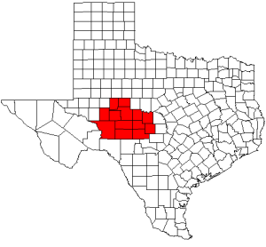
The Concho Valley is a region in West Texas. The region takes its name from the Concho River, named due to its abundance of freshwater mussels in the river.


