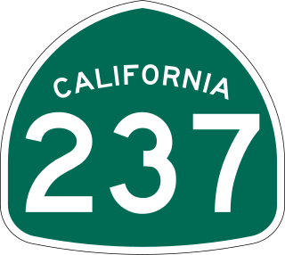
State Route 237 is a state highway in the U.S. state of California that runs from El Camino Real in Mountain View to Interstate 680 in Milpitas. Known as the Southbay Freeway for most of its length, SR 237 runs south of the San Francisco Bay, connecting the East Bay to the Peninsula.

Bicycle transportation planning and engineering are the disciplines related to transportation engineering and transportation planning concerning bicycles as a mode of transport and the concomitant study, design and implementation of cycling infrastructure. It includes the study and design of dedicated transport facilities for cyclists as well as mixed-mode environments and how both of these examples can be made to work safely. In jurisdictions such as the United States it is often practiced in conjunction with planning for pedestrians as a part of active transportation planning.
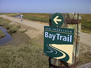
The San Francisco Bay Trail is a bicycle and pedestrian trail that when finished will allow continuous travel around the shoreline of San Francisco Bay. As of 2020, 356 miles (573 km) of the trail have been completed. When finished, the trail will be over 500 miles (800 km) of paved and gravel paths, bike lanes, and sidewalks, linking 47 cities across nine counties and crossing seven toll bridges. It is a project of the Association of Bay Area Governments (ABAG) and the Metropolitan Transportation Commission (MTC), in collaboration with other agencies, private companies, non-profit organizations, and advocacy groups.

The Arroyo Seco Bicycle Path is an approximately 2-mile (3.2 km) long Class I bicycle path along the Arroyo Seco river channel and canyon in the Northeast Los Angeles region of Los Angeles County, California. It parallels the Arroyo Seco Parkway, which is also a part of the canyon.
The Santa Clara River Trail is a paved bicycle and walking path in the city of Santa Clarita, California.

California Bicycle Coalition, also known as CalBike, is an advocacy organization based in Sacramento that seeks to expand bicycling in the U.S. state of California. A related organization, the California Bicycle Coalition Education Fund, conducts solely charitable functions. The California Bicycle Coalition was founded in 1994.

Toronto, Ontario, like many North American cities, has slowly been expanding its purpose-built cycling infrastructure. The number of cyclists in Toronto has been increasing progressively, particularly in the city's downtown core. As cycling conditions improve, a cycling culture has grown and alternatives such as automobiles are seen as less attractive. The politics of providing resources for cyclists, particularly dedicated bike lanes, has been contentious, particularly since the 2010s.

Bike East Bay, formerly known as East Bay Bicycle Coalition, is a Californian non-profit organization that worked since 1972 toward "promoting bicycling as an everyday means of transportation and recreation" in Alameda and Contra Costa counties of the California's East Bay.
Like many metropolitan regions in the United States, the San Francisco Bay Area is politically fragmented into many local jurisdictions. There is one regional transportation planning agency, the Metropolitan Transportation Commission, but there are 9 counties, 85 cities, and 16 towns, each separately responsible for making bicycle infrastructure improvements. A few of these jurisdictions publish and implement their own bicycle plans, while most defer this responsibility to the county or the region in which they are situated. Written bicycle plans are required to qualify for many sources of funding from regional, state, and federal agencies.

The Los Angeles River bicycle path is a Class I bicycle and pedestrian path in the Greater Los Angeles area running from north to east along the Los Angeles River through Griffith Park in an area known as the Glendale Narrows. The 7.4 mile section of bikeway through the Glendale Narrows is known as the Elysian Valley Bicycle & Pedestrian Path. The bike path also runs from the city of Vernon to Long Beach, California. This section is referred to as LARIO, or more formally, the Los Angeles River Bikeway.

The National Association of City Transportation Officials (NACTO) is a coalition of the Departments of Transportation in North American cities.

Cycling in Canada is experienced in various ways across a geographically huge, economically and socially diverse country. Among the reasons for cycling in Canada are for practical reasons such as commuting to work or school, for sports such as road racing, BMX, mountain bike racing, freestyle BMX, as well as for pure recreation. The amount and quality of bicycle infrastructure varies widely across the country as do the laws pertaining to cyclists such as bicycle helmet laws which can differ by province.

Cycling infrastructure is all infrastructure cyclists are allowed to use. Bikeways include bike paths, bike lanes, cycle tracks, rail trails and, where permitted, sidewalks. Roads used by motorists are also cycling infrastructure, except where cyclists are barred such as many freeways/motorways. It includes amenities such as bike racks for parking, shelters, service centers and specialized traffic signs and signals. The more cycling infrastructure, the more people get about by bicycle.

Los Angeles River Bikeway, also known as LARIO, is a 29.1 mi (46.8 km) bikeway along the lower Los Angeles River in southern Los Angeles County, California. It is one of the completed sections of the Los Angeles River Bicycle Path planned to run along the entire 51 miles (82 km) length of the LA River.

The Western Gwinnett Bikeway is a multi-use trail under construction along Peachtree Industrial Boulevard in Gwinnett County. The trail will be 10 feet to 14 feet wide and traverse the cities of Norcross, Peachtree Corners, Berkeley Lake, Duluth, Suwanee, Sugar Hill and Buford. It is intended to be the spine of West Gwinnett’s trails and greenways, connecting parks, trails, businesses, schools and neighborhoods to the urban core.

San Jose, California has various cycling routes on roads and trails used by both commuters and recreational riders. The city has plans to expand the current 285 miles (459 km) of bike lanes to 400 miles (640 km), and the current 60 miles (97 km) of trails to 100 miles (160 km). San Jose was ranked as a bronze-level bicycle-friendly community by the League of American Bicyclists.
The Chandler Boulevard Bike Path is a Class I rail trail off-street bike route that runs from North Hollywood to Burbank in Los Angeles County, California.