Saganing River

Last updated
Saganing River

Saganing River Standish Township Michigan.jpg

The Saganing River in Standish Township
Country United States
Physical characteristics
Main source Arenac County, Michigan
River mouth Saginaw Bay, Lake Huron
Basin features
Tributaries
  • Left:
    Budd Drain
  • Right:
    Saganing Creek,
    Saganing Drain

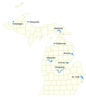
The Saganing River, also known as Saganing Creek, is a 10.0-mile-long (16.1 km) [1] stream in the U.S. state of Michigan.

U.S. state constituent political entity sharing sovereignty as the United States of America

In the United States, a state is a constituent political entity, of which there are currently 50. Bound together in a political union, each state holds governmental jurisdiction over a separate and defined geographic territory and shares its sovereignty with the federal government. Due to this shared sovereignty, Americans are citizens both of the federal republic and of the state in which they reside. State citizenship and residency are flexible, and no government approval is required to move between states, except for persons restricted by certain types of court orders. Four states use the term commonwealth rather than state in their full official names.

Michigan State of the United States of America

Michigan is a state in the Great Lakes and Midwestern regions of the United States. The state's name, Michigan, originates from the Ojibwe word mishigamaa, meaning "large water" or "large lake". With a population of about 10 million, Michigan is the tenth most populous of the 50 United States, with the 11th most extensive total area, and is the largest state by total area east of the Mississippi River. Its capital is Lansing, and its largest city is Detroit. Metro Detroit is among the nation's most populous and largest metropolitan economies.

It rises from the confluence of Saganing Creek and Budd Drain in the northwest corner of Pinconning Township just south of the Arenac County/Bay County boundary at 43°54′30″N84°01′39″W / 43.90833°N 84.02750°W / 43.90833; -84.02750 and flows in a gentle arc to the northeast through Lincoln Township and then bending to southeast in Standish Township before emptying into Saginaw Bay of Lake Huron just south of Whites Beach at 43°55′10″N83°53′45″W / 43.91944°N 83.89583°W / 43.91944; -83.89583 . [2]

Pinconning Township, Michigan Township in Michigan, United States

Pinconning Township is a civil township of Bay County in the U.S. state of Michigan. The township's population was 2,431 as of the 2010 census. It is included in the Bay City Metropolitan Statistical Area. Pinconning Township was organized on February 28, 1873. The city of Pinconning is surrounded by the township, but is administratively autonomous. The name "Pinconning" is said to come from the Native American word O-pin-nic-con-ing, meaning "potato place".

Arenac County, Michigan county in Michigan, United States

Arenac County is a county located in the U.S. state of Michigan. As of the 2010 United States Census, the population was 17,269. The county seat is Standish.

Bay County, Michigan county in Michigan, USA

Bay County is a county in the U.S. state of Michigan. As of the 2010 census, the population was 107,771. The county seat is Bay City.

Saganing Creek rises in the southeast corner on Grim Township in Gladwin County at 43°55′25″N84°10′17″W / 43.92361°N 84.17139°W / 43.92361; -84.17139 [3] and flows mostly eastward through Gibson Township and Mount Forest Township in Bay County. Its main tributary, Saganing Drain, rises in western Gibson Township south of Bentley and flows to the east-southeast. [4]

Grim Township, Michigan Township in Michigan, United States

Grim Township is a civil township of Gladwin County in the U.S. state of Michigan. The population was 129 at the 2000 census.

Gladwin County, Michigan county in Michigan, United States

Gladwin County is a county located in the U.S. state of Michigan. As of the 2010 United States Census, the population was 25,692. The county seat is Gladwin.

Gibson Township, Michigan Township in Michigan, United States

Gibson Township is a civil township of Bay County in the U.S. state of Michigan. The township's population was 1,210 as of the 2010 census. It is included in the Bay City Metropolitan Statistical Area.

The other main tributary of the Saganing River, Budd Creek, rises just east of Mount Forest at 43°53′16″N84°06′13″W / 43.88778°N 84.10361°W / 43.88778; -84.10361 . [5]

Related Research Articles

St. Joseph River (Maumee River tributary) tributary of the Maumee River in Ohio and Indiana

The St. Joseph River is an 86.1-mile-long (138.6 km) tributary of the Maumee River in northwestern Ohio and northeastern Indiana in the United States, with headwater tributaries rising in southern Michigan. It drains a primarily rural farming region in the watershed of Lake Erie.

Bear River (Michigan) small clear slow moving river in the U.S. state of Michigan

Bear River is a small clear slow-moving river in the U.S. state of Michigan. 14.7 miles (23.7 km) long, it is the largest tributary of Little Traverse Bay in the northwest of the lower peninsula. Traverse Bay is on Lake Michigan. The river is formed as the outflow of Walloon Lake on the boundary between Charlevoix County and Emmet County, draining from the southeast end of the lake at 45°15′40″N84°56′01″W near the community of Walloon Lake in Melrose Township. M-75 has its northern terminus in a junction with US 131 nearby.

The Belle River is a 73.5-mile-long (118.3 km) river in the U.S. state of Michigan, flowing into the St. Clair River in Marine City at 42°42′25″N82°29′50″W.

Pine River (Michigan) Wikimedia disambiguation page

Pine River may refer to any of the following streams in the U.S. state of Michigan:

  1. Pine River. The main branch forms with the confluence of the East and West Branches of the Pine River at 44°29′38″N83°23′16″W in Alcona County. The South Branch joins approximately 1.5 miles (2.4 km) to the south and flows into Iosco County, where it empties into Van Etten Lake at 44°29′38″N83°23′16″W northwest of Oscoda.
  2. Pine River. The main branch is formed by the confluence of the North and Middle Branches northeast of Standish and flows into the Saginaw Bay of Lake Huron at 43°58′32″N83°51′16″W. The South Branch Pine River joins the main stream at 43°59′08″N83°53′17″W.
  3. Pine River is a short waterway, which along with Round Lake, connects Lake Charlevoix with Lake Michigan at Charlevoix.
  4. Pine River rises in Chippewa County and flows south through Mackinac County into the St. Martin Bay of Lake Huron at 46°03′09″N84°39′22″W The North Pine River, also known as the North Branch Pine River, joins at 46°12′20″N84°36′17″W. Another tributary, Hemlock Creek, is also known as Pine River.
  5. Pine River, also known as the South Branch Manistee River, rises in southeast Wexford County, flows southwest across northwest Osceola County, then west and north through the northeast corner of Lake County and back into southwest Wexford County, emptying into the Tippy Dam Pond on the Manistee River at 44°13′37″N85°54′27″W. The main stream is formed from the confluence of the East Branch Pine River with the North Branch Pine River at 44°06′02″N85°31′40″W. Another tributary, the Spaulding Creek, is also known as the Little Pine River
  6. Pine River, in Marquette County, is a very short stream draining Pine Lake into Lake Superior at 46°53′27″N87°52′13″W, north of the Huron Mountains.
  7. Pine River rises in from Pine Lake in eastern Mecosta County, flows mostly south and east through Isabella County, then south along eastern edge of Montcalm County, then east and north through Gratiot County and Midland County, emptying into the Chippewa River at 43°36′06″N84°17′33″W, just about two miles before it joins the Tittabawassee River near Midland. The South Branch Pine River joins the main stream at 43°30′37″N85°00′02″W Another tributary, Miller Creek, is also sometimes known as Pine River or the West Branch Pine River. The North Branch Pine River joins the main stream at 43°26′03″N84°50′18″W.
  8. Pine River empties into the St. Clair River at 42°49′13″N82°29′08″W on the south side of St. Clair. The South Branch Pine River joins the main stream at 42°58′11″N82°37′10″W. Another tributary, Quakenbush Drain, is also sometimes known as Pine River.
  9. Pine Creek empties into Lake Superior and is also known as the Pine River.
Cass River (Michigan) river in the United States of America

The Cass River is a 61.5-mile-long (99.0 km) river in the Thumb region of the U.S. state of Michigan. It drains large portions of Sanilac and Tuscola counties and smaller portions of Genesee, Huron, Lapeer, and Saginaw counties.

Chippewa River (Michigan) river in Michigan

The Chippewa River is a stream in the U.S. state of Michigan that runs 91.8 miles (147.7 km) through the central Lower Peninsula. The Chippewa is a tributary of the Tittabawassee River and is thus part of the Saginaw River drainage basin. The river is named after the Chippewa people.

Cedar River (Gladwin County, Michigan) river in Clare and Gladwin counties, Michigan, United States

The Cedar River is a 29.0-mile-long (46.7 km) river in the U.S. state of Michigan, flowing through Clare County and Gladwin County.

Rocky River (Michigan)

The Rocky River is a 28.3-mile-long (45.5 km) stream located in the southwest part of the U.S. state of Michigan that flows into the St. Joseph River at 41°56′33″N85°37′59″W in the city of Three Rivers in St. Joseph County. The Rocky River, along with the St. Joseph River and the Portage River, are the three rivers from which the city of Three Rivers takes its name.

Devils Lake is the name of a few lakes in the U.S. state of Michigan.

Salt River is the name of two streams in the U.S. state of Michigan.

Coldwater River is a 29.5-mile-long (47.5 km) stream in the U.S. state of Michigan. Located in Branch County, the river rises in Ovid Township at 41°50′14″N84°59′13″W as the outflow of Coldwater Lake. Flowing north and west, it is joined by the outflow from the Lake of the Woods and continues north for several miles. West of the city of Coldwater, it flows through a series of lakes: South Lake, Messenger Lake, Cemetery Lake, North Lake, Randall Lake, Morrison Lake, Craig Lake, and Hodunk Pond. It then continues to the northwest and empties into the St. Joseph River in the village of Union City at 42°03′58″N85°07′48″W.

Coldwater River (Western Michigan)

The Coldwater River is a 19.4-mile-long (31.2 km) stream in the U.S. state of Michigan. Located in western Michigan, the river is a part of the Grand River drainage basin.

Coldwater River is a 13.1-mile-long (21.1 km) stream in the U.S. state of Michigan. Located in Isabella County, the river rises as the outflow of Littlefield Lake in western Gilmore Township. The river flows mostly south and empties into the Chippewa River at 43°37′22.231″N84°57′38.243″W on the western boundary of Deerfield Township, about two miles east of Lake Isabella.

Cedar Creek may refer to several small streams in the U.S. state of Michigan:

Ocqueoc River river in the United States of America

The Ocqueoc River is stream in Presque Isle County in the northeastern part of the lower peninsula in the U.S. state of Michigan. It is 34.2 miles (55.0 km) long and encompasses a watershed of approximately 94,394 acres (382.00 km2).

The Kawkawlin River is a 17.5-mile-long (28.2 km) stream in the U.S. state of Michigan that flows into Saginaw Bay of Lake Huron at 43°39′30″N83°53′00″W, approximately 1 mile (1.6 km) west of the mouth of the Saginaw River.

Portage River (Jackson County, Michigan)

The Portage River is a 15.5-mile-long (24.9 km) river in the U.S. state of Michigan, flowing mostly southwesterly through northeast Jackson County.

Little Cedar River is an 8.1-mile-long (13.0 km) river in Gladwin County in the U.S. state of Michigan.

Little Thornapple River (Eaton County) river in the United States of America

Little Thornapple River is a 9.1-mile-long (14.6 km) river in Eaton County in the U.S. state of Michigan.

Pine River (Chippewa River) tributary of the Chippewa River in the Lower Peninsula of the U.S. state of Michigan

The Pine River is a 103-mile-long (166 km) river in the Lower Peninsula of the U.S. state of Michigan. The Pine River is a tributary of the Chippewa River and is thus part of the Saginaw River drainage basin.

References