
Mount Everest, known locally as Sagarmatha or Qomolangma, is Earth's highest mountain above sea level, located in the Mahalangur Himal sub-range of the Himalayas. The China–Nepal border runs across its summit point. Its elevation of 8,848.86 m was most recently established in 2020 by the Chinese and Nepali authorities.
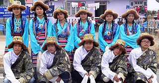
The Sherpas are one of the Tibetan ethnic groups native to the most mountainous regions of Nepal and Tibetan Autonomous Region of China.
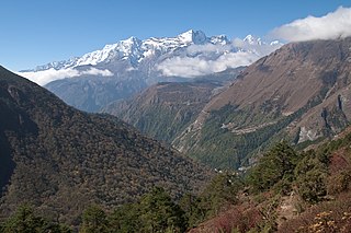
Sagarmāthā National Park is a national park in the Himalayas of eastern Nepal that was established in 1976 and encompasses an area of 1,148 km2 (443 sq mi) in the Solukhumbu District. It ranges in elevation from 2,845 to 8,848 m and includes Mount Everest. In the north, it shares the international border with Qomolangma National Nature Preserve in Tibet Autonomous Region. In the east, it is adjacent to Makalu Barun National Park, and in the south it extends to Dudh Kosi river. It is part of the Sacred Himalayan Landscape.
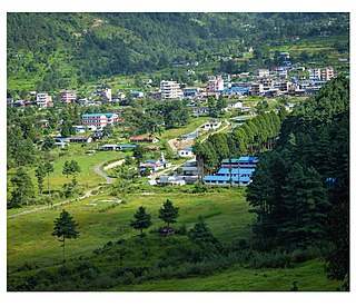
Jiri is a municipality in Dolakha District in the Bagmati Province of central Nepal. At the time of the 2011 Nepal census it had a population of 13,638 people. Jiri, which lies about 190 kilometers from Kathmandu, is the main gateway to the Everest Region. Almost all the Everest expeditions, including the one led by famous climber John Hunt, Edmund Hillary had passed through Jiri. A company of the Nepal Army is stationed in town and visitors' equipment and backpacks might be searched. There are a number of lodges available along either side of the main road mainly in Jiri Bazaar.

Khumbu is a region of northeastern Nepal on the Nepalese side of Mount Everest. It is part of the Solukhumbu District, which in turn is part of Koshi Pradesh. Khumbu is one of three subregions of the main Kirat Kulung and Sherpa settlement of the Himalaya, the other two being Solu and Pharak. It includes the town of Namche Bazaar as well as the villages of Thame, Khumjung, Pangboche, Pheriche and Kunde. The famous Buddhist monastery at Tengboche is also located in Khumbu.
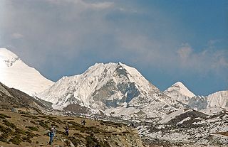
Imja Tse, better known as Island Peak, is a mountain in Sagarmatha National Park in the Himalayas of eastern Nepal. The peak was named Island Peak in 1953 by members of the British Mount Everest expedition because it appears as an island in a sea of ice when viewed from Dingboche. The peak was later renamed in 1983 to Imja Tse but Island Peak remains the popular choice. The peak is actually an extension of the ridge coming down off the south end of Lhotse Shar.
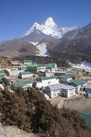
Sagarmāthā Zone was one of the fourteen zones of Nepal until the restructuring of zones into provinces. The headquarters of Sagarmatha is Rajbiraj. Sagarmāthā is a Nepali word which as per some sources, is derived from सगर and माथा.
Mount Everest is the Earth's highest mountain peak, located on the Nepal / China border in Asia.

Gorak Shep, also spelled Gorakshep, is a settlement nestled on the periphery of a frozen lakebed blanketed with sand in Nepal, sharing its name with the locale. Situated at an elevation of 5,164 meters near Mount Everest, it remains uninhabited for most of the year, reopening only for the Mount Everest trekking season.

The North Col refers to the sharp-edged pass carved by glaciers in the ridge connecting Mount Everest and Changtse in Tibet. It forms the head of the East Rongbuk Glacier.

Solukhumbu District (Nepali: सोलुखुम्बु जिल्ला, Sherpa: ཤར་ཁུམ་བུ་རྫོང་།, Wylie: shar khum bu dzong) is one of 14 districts of Koshi Province of eastern Nepal. As the name suggests, it consists of the sub-regions Solu and Khumbu. The closest post office to Solukhumbu with a postal code assigned to it is the Sindhuli D.P.O., which has the postal code 56000.

Bachendri Pal is an Indian mountaineer. In 1984, she became the first Indian woman to climb the summit of the world's highest mountain, Mount Everest. She was awarded the third highest civilian award in India, Padma Bhushan by the Government of India in 2019.
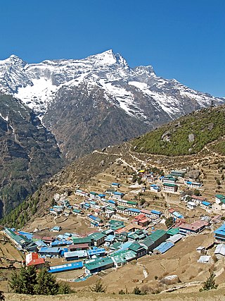
Tourism is the largest industry in Nepal and its largest source of foreign exchange and revenue. Home to eight of the ten highest mountains in the world, Nepal is a destination for mountaineers, rock climbers and adventure seekers. The Hindu and Buddhist heritages of Nepal and its cool weather are also strong attractions.
Radio Sagarmatha is an FM radio station in Kathmandu Valley of Nepal. Established in May 1997, Radio Sagarmatha is the first independent community radio broadcasting station in South Asia. The meaning of Sagarmatha is Mount Everest. It airs its programs in FM 102.4 MHz.
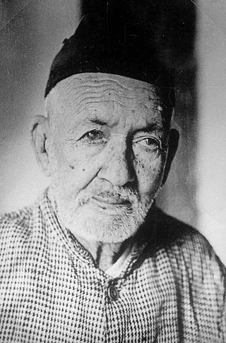
Baburam Acharya was a Nepalese historian and literary scholar. He is known as the historian laureate of Nepal. The four part biography of King Prithivi Narayan Shah, founder of Modern Nepal is a key series of work he created. He is known for the study of ancient Nepalese inscriptions.
Siraha is the headquarters and municipality of Siraha District, a part of Madhesh Province, Nepal. Siraha had a population of 28,442 according to the census of 2011. and a population of 82,531 as of 2015. The current population of Siraha municipality as of census 2022, is 96,543. It has a male population of 47,306 and female population of 49,237. The present mayor of Siraha Municipality is Dr. Nabin Kumar Yadav and Deputy Mayor is Babita Kumari Sah. Both assumed office on 25 May 2022. His predecessor mayor was Asheswor Yadav and the deputy mayor was Dr. Namita Yadav. Both assumed office on 25 September 2017 and their last working day was on 24 May 2022. The town is at 80 metres (260 ft) altitude, 29 kilometres (18 mi) ESE of Janakpur.
Mirchaiya formerly known as Ramnagar Mirchaiya is a municipality in Siraha District in the Madhesh Province of south-eastern Nepal. The municipality was established on 18 May 2014 by merging the existing Rampur Birta, Malhaniyakhori, Radhopur, Ramnagar Mirchaiya, Phulbariya, Sitapur PraDa and Maheshpur Gamharia Village Development Committees. At the time of the 2017 municipality records, it had a population of approx. 52,000 people living in approx 8,496 individual households. This is one of the main business markets for Katari and the southern part of the Siraha district. Raw material produced here includes padday, miazem, and sugar cane.

Khumbu Pasanglhamu is one of 7 rural municipalities (Gaunpalika) in Solukhumbu district of Province No. 1 of Nepal. Khumjung, Namche & Jubing and Chaurikharka were incorporated while creating it. It has the total population of 9,133 according to the 2011 Nepal census and area of 1,539.11 square kilometres (594.25 sq mi). The admin centre of this gaunpalika is that of the Chaurikharka.


