The Arctic Archipelago, also known as the Canadian Arctic Archipelago, is an archipelago lying to the north of the Canadian continental mainland, excluding Greenland and Iceland.

Sunbury County is located in central New Brunswick, Canada. A large military base is located in the western part of the county south of the town of Oromocto. The county also hosts forestry and mixed farming. Burton is the county shire town.
The Patuxent Range or macizo Armada Argentina is a major range of the Pensacola Mountains, comprising the Thomas Hills, Anderson Hills, Mackin Table and various nunataks and ridges bounded by the Foundation Ice Stream, Academy Glacier and the Patuxent Ice Stream. Discovered and partially photographed on January 13, 1956 in the course of a transcontinental nonstop plane flight by personnel of U.S. Navy Operation Deep Freeze I from McMurdo Sound to Weddell Sea and return.
The team dressage event, part of the equestrian program at the 2004 Summer Olympics, used the results of the first round of the individual dressage to award rankings. That round was held on 20 August and 21 August 2004 at the Olympic Equestrian Centre on the outskirts of Markópoulo, in the Attica region of Greece. Like all other equestrian events, the dressage competition was mixed gender, with both male and female athletes competing in the same division. 10 teams, each consisting of four horse and rider pairs, entered the contest.

Ayopaya is a province in the Cochabamba Department, Bolivia. Its capital is Ayopaya.

Tiraque is a province in the Cochabamba Department in central Bolivia. Its capital is Tiraque.

Belisario Boeto is a province in the Bolivian department of Chuquisaca.
Airy Castle is a village in the Jamaican parish of Saint Thomas.

Hornillos del Camino is a municipality located in the province of Burgos, Castile and León, Spain. According to the 2004 census (INE), the municipality has a population of 70 inhabitants.
Stenen is a village in the Canadian province of Saskatchewan within the Rural Municipality of Clayton No. 333 and Census Division No. 9.
Bassana is a village in the Bana Department of Balé Province in south-western Burkina Faso. In 2008, The village had a population of 918.
Lagoa do Itaenga is a municipality located in the state of Pernambuco, Brazil. Located 78 km from Recife, capital of the state of Pernambuco. As of 2020, it has an estimated population of 21,460.
Nogolí is a village and municipality in San Luis Province in central Argentina.
El Pantanillo is a village and municipality in San Luis Province in western Argentina.
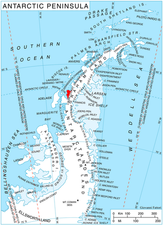
Orford Cliff is a coastal cliff of Pernik Peninsula, Loubet Coast in Graham Land, overlooking the east side of Lallemand Fjord just east of Andresen Island. Surveyed by Falkland Islands Dependencies Survey (FIDS) in 1956. Named for Michael J.H. Orford, FIDS assistant surveyor at Detaille Island in 1956, a member of the party which found a route from Detaille Island to Avery Plateau, via Orford Cliff and Murphy Glacier.

McCance Glacier is the 30-km long and 5 km wide glacier draining the Hutchison Hill area on the west slopes of Avery Plateau on Loubet Coast in Graham Land, Antarctica. It flows north-northwestwards along the west side of Osikovo Ridge, Kladnitsa Peak and Rubner Peak and enters Darbel Bay.
Steinemann Island is an island off the northeast coast of Adelaide Island, about 10 nautical miles (18 km) southwest of Mount Velain. Mapped from air photos taken by Ronne Antarctic Research Expedition (RARE) (1947–48) and Falkland Islands and Dependencies Aerial Survey Expedition (FIDASE) (1956–57). Named by United Kingdom Antarctic Place-Names Committee (UK-APC) for Samuel Steinemann, Swiss physicist who has made laboratory investigations on the flow of single and polycrystalline ice.

Rickmers Glacier is a glacier flowing into Hugi Glacier just northwest of Ezerets Knoll, on the west coast of Graham Land. Photographed by Hunting Aerosurveys Ltd. in 1955–57, and mapped from these photos by the Falkland Islands Dependencies Survey (FIDS). Named by the United Kingdom Antarctic Place-Names Committee (UK-APC) in 1959 for W. Rickmer Rickmers, German pioneer exponent of skiing and joint author of the first English manual on skiing. He also improved the design of ice axes, introducing the characteristic shape still in use.
Romulus Glacier is a glacier, 7 nautical miles (13 km) long and 2 nautical miles (3.7 km) wide, which flows from the north slopes of Mount Lupa westward to Rymill Bay between the Blackwall Mountains and Black Thumb, on the west coast of Graham Land. First surveyed in 1936 by the British Graham Land Expedition (BGLE) under Rymill. Resurveyed in 1948-49 by the Falkland Islands Dependencies Survey (FIDS), who so named it for its association with Remus Glacier, whose head lies near the head of this glacier.


