
San Jacinto Heights is a neighborhood of Amarillo, Texas.
San Jacinto Heights is a neighborhood of Amarillo, Texas.
San Jacinto Heights was established in 1909 by the Amarillo Improvement Company. In 1910, a trolley service was established between San Jacinto and downtown, operating until 1926. The neighborhood also had a newspaper, The Booster, established in 1925. [1]
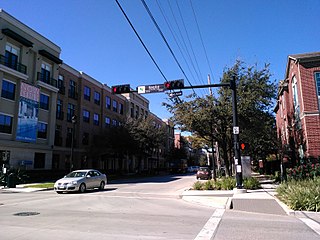
The neighborhood intersects with U.S, Route 66, and houses the U.S. Route 66-Sixth Street Historic District, which includes the Amarillo Natatorium inside San Jacinto. [2]

U.S. Route 66 or U.S. Highway 66 was one of the original highways in the United States Numbered Highway System. It was established on November 11, 1926, with road signs erected the following year. The highway, which became one of the most famous roads in the United States, ran from Chicago, Illinois, through Missouri, Kansas, Oklahoma, Texas, New Mexico, and Arizona before terminating in Santa Monica in Los Angeles County, California, covering a total of 2,448 miles (3,940 km).

San Jacinto County is a county in the U.S. state of Texas. As of the 2020 census, its population was 27,402. Its county seat is Coldspring. The county's name comes from the Battle of San Jacinto which secured Texas' independence from Mexico and established a republic in 1836.

Shamrock is a city in Wheeler County, Texas, United States. As of the 2020 Census, the city had a total population of 1,789. The city is located in the eastern portion of the Texas Panhandle, centered along the crossroads of Interstate 40 and U.S. Route 83. It is 110 miles (180 km) east of Amarillo, 188 miles (303 km) west of Oklahoma City, and 291 miles (468 km) northwest of Dallas.

Amarillo is a city in the U.S. state of Texas and the seat of Potter County. It is the 14th-most populous city in Texas and the most populous city in the Texas panhandle. A portion of the city extends into Randall County. The estimated population of Amarillo was 200,393 as of April 1, 2020, comprising nearly half of the population of the panhandle. The Amarillo metropolitan area had an estimated population of 308,297 as of 2020.
Midtown is a central neighborhood of Houston, located west-southwest of Downtown. Separated from Downtown by an elevated section of Interstate 45, Midtown is characterized by a continuation of Downtown's square grid street plan, anchored by Main Street and the METRORail Red Line. Midtown is bordered by Neartown (Montrose) to the west, the Museum District to the south, and Interstate 69 to the east. Midtown's 325 blocks cover 1.24 square miles (3.2 km2) and contained an estimated population of nearly 8,600 in 2015.

U.S. Highway 87 is a north–south United States highway that runs for 1,998 miles (3,215 km) from northern Montana to southern Texas, making it the longest north-south road to not have a "1" in its number and the third longest north-south road in the country, behind U.S. 41 and U.S. 1. Most of the portion from Billings, Montana to Raton, New Mexico is co-signed along Interstates 90 and 25. It is also co-signed along the majority of I-27 in Texas and future plans call for the interstate to be extended along the US 87 corridor. As of 2004, the highway's northern terminus is in Havre, Montana, at US 2 and its southern terminus is in Port Lavaca, Texas, at SH 238.

Manuel Lorenzo Justiniano de Zavala y Sánchez, known simply as Lorenzo de Zavala, was a Mexican and later Tejano physician, politician, diplomat and author. Born in Yucatán under Spanish rule, he was closely involved in drafting the constitution for the First Federal Republic of Mexico in 1824 after Mexico won independence from Spain. Years later, he also helped in drafting a constitution for Mexico's rebellious enemy at the time, the Republic of Texas, to secure independence from Mexico in 1836. Zavala was said to have had a keen intellect and was fluent in multiple languages.

Normal Heights is a neighborhood in the mid-city region of San Diego, California.

The Houston Ship Channel, in Houston, Texas, is part of the Port of Houston, one of the busiest seaports in the world. The channel is the conduit for ocean-going vessels between Houston-area terminals and the Gulf of Mexico, and it serves an increasing volume of inland barge traffic.
The Buffalo Bayou, Brazos, and Colorado Railway, also called the Harrisburg Road or Harrisburg Railroad, was the first operating railroad in Texas. It completed its first segment of track between Harrisburg, Texas and Stafford's Point, Texas in 1853. The company established a western terminus at Alleyton, Texas prior to the Civil War. The railroad was sold after the war and reincorporated as the Galveston, Harrisburg, & San Antonio Railroad. This right of way was acquired by the Southern Pacific Railroad and is today a property of the Union Pacific Railroad.

San Jacinto High School was a secondary school located at 1300 Holman Street in Houston, Texas; now part of the Houston Community College Central College, Central Campus. San Jacinto High School was located in the area now known as Midtown. It was a part of the Houston Independent School District (HISD). It was listed on the National Register of Historic Places (NRHP) on December 4, 2012.

In the US state of Texas, Interstate 40 (I-40) runs west–east through the panhandle in the northwest part of the state. The only large city it passes through is Amarillo, where it meets the north end of I-27. The entire section of I-40 in Texas is designated as a Purple Heart Trail route.
U.S. Route 66 in the state of Texas extended across the Texas Panhandle from its designation in 1926 to its decommissioning in 1985.
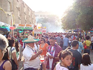
Fiesta San Antonio has been since its 1891 inception an annual festival held in April in San Antonio, Texas. It is the city's signature event, along with some events held in the neighboring cities: Boerne, Schertz, Windcrest, Balcones Heights, and Alamo Heights). The festival, also known as the Battle of Flowers, commemorates of the Battle of the Alamo, which took place in San Antonio, and the Battle of San Jacinto, which led to Texas' independence from Mexico in April 1836.

For a period of over 7000 years, humans have inhabited the Galveston Bay Area in what is now the United States. Through their history the communities in the region have been influenced by the once competing sister cities of Houston and Galveston, but still have their own distinct history. Though never truly a single, unified community, the histories of the Bay Area communities have had many common threads.
Soncy was an unincorporated community in Potter County, located in the U.S. state of Texas. It is now largely within the city limits of Amarillo. Soncy joins St. Francis Boulevard, which runs east to west in the northern section of town, with Hollywood Road routing west to east in the southern section of town.

U.S. Route 366 or US 366 was the designation of two child routes of the former U.S. Route 66 in New Mexico and Texas in the United States during the late 1920s and 1930s. Both alignments of US 366 were original U.S. Routes created in 1927. The first alignment was a route from El Paso, Texas to Amarillo, Texas crossing through New Mexico that existed until 1931. The second was a route from Albuquerque, New Mexico to Willard, New Mexico that was previously assigned a different route number before 1932. That alignment was canceled in 1939.

Heights Neighborhood Library is a public library facility in the Houston Heights area of Houston, Texas. It is a part of Houston Public Library (HPL) and is located at 1302 Heights Boulevard, in Heights block 170. It has a pink Stucco Italian Renaissance façade and arches in its doors and windows. Jason P. Theriot wrote in the Houston Review that the ceilings are "high" and that the arches were "beautifully" done. The library has 14,500 square feet (1,350 m2) of space.
The Amarillo Natatorium, at 2705 W. 6th Avenue, often referred to as "The Nat", is a historic swimming pool in San Jacinto Heights, Amarillo, Texas.

The US Route 66-Sixth Street Historic District is a historic district in Amarillo, Texas. The district is centered around the main section of the historic Route 66 in the San Jacinto Heights district of the city, which includes the Amarillo Natatorium.