Related Research Articles
Basketball at the 1948 Summer Olympics was the second appearance of the sport as an official medal event. A total number of 23 nations entered the competition.

The Río Negro is the most important river in Uruguay. It originates in the southern highlands of Brazil, just east of Bagé, and flows west across the entire width of Uruguay to the Uruguay River. The course of the Río Negro across Uruguay effectively divides the south of the country from the north. The Río Negro's principals tributaries are Yí River and Tacuarembó River.

Sault Ste. Marie is a provincial electoral district in the Legislative Assembly of Ontario, representing the City of Sault Ste. Marie.

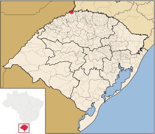
Derrubadas is a municipality of the Brazilian state of Rio Grande do Sul.

The Chamber of Representatives is the lower house of the General Assembly of Uruguay. The Chamber has 99 members, elected for a five-year term by proportional representation with at least two members per department. As of the last election, the Broad Front has retained its majority with 50 Deputies with the National Party receiving 31, the Colorado Party receiving 17, and the Independent Party electing two.

The Yí River is a river in Uruguay. The Yí and the Tacuarembó Rivers are the principal tributaries of the Río Negro.

The Jaguarão or Yaguarón River is a Brazilian and Uruguayan river. It forms the border between Uruguay and Rio Grande do Sul state in southernmost Brazil.

The Jezzine District is a district in the South Governorate of Lebanon. The capital is Jezzine.

Planalto is a municipality in the state of Rio Grande do Sul, Brazil, located at 27°19′44″S53°03′31″W, at an altitude of 568 meters above sea level. It has a total area of 237.35 km². Its estimated population in 2004 was of 11,702 inhabitants, and in 2007 it was of 10,589 inhabitants.
Wólka is a village in the administrative district of Gmina Ruciane-Nida, within Pisz County, Warmian-Masurian Voivodeship, in northern Poland.

The Cebollatí River is a Uruguayan river that rises in Cuchilla Grande, flows southwest to northeast and forms a border between Treinta y Tres and Rocha.

The Río Olimar River is a river in the Treinta y Tres Department of Uruguay.
The Rio da Várzea is a river of Rio Grande do Sul state in southern Brazil. It is a tributary of the Uruguay River.
The Chuí, or Chuy, Stream, is a short stream on the Brazilian–Uruguayan border that is celebrated as Brazil's southernmost point.
Lontras is a municipality in the state of Santa Catarina in the South region of Brazil.

Huaquechula Municipality is a municipality in Puebla in south-eastern Mexico.
Radojčići (Maglaj) is a village in the municipality of Maglaj, Bosnia and Herzegovina.

Nicaro-Levisa, also Levisa-Nicaro, is a Cuban town and consejo popular of the municipality of Mayarí, in Holguín Province, formed by the settlements of Nicaro and Levisa. With a population of about 20,000, it is the most populated village in the municipality after Mayarí.

This is a list of the extreme points of Uruguay, the points that are farther north, south, east or west than any other location, and the highest and lowest points. It is also notable that Uruguay's northernmost point is farther south than the northernmost point of any other nation.
References
- Rand McNally, The New International Atlas, 1993.
- GEOnet Names Server
Coordinates: 33°31′22″S53°32′31″W / 33.5228°S 53.5419°W

A geographic coordinate system is a coordinate system that enables every location on Earth to be specified by a set of numbers, letters or symbols. The coordinates are often chosen such that one of the numbers represents a vertical position and two or three of the numbers represent a horizontal position; alternatively, a geographic position may be expressed in a combined three-dimensional Cartesian vector. A common choice of coordinates is latitude, longitude and elevation. To specify a location on a plane requires a map projection.
| This article related to a river in Uruguay is a stub. You can help Wikipedia by expanding it. |