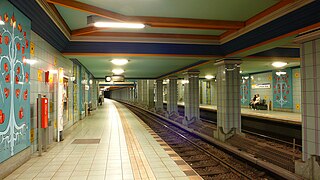
Lindauer Allee is a Berlin U-Bahn station located on the U8 in Berlin, Germany. Designed by Rainer G. Rümmler, the station opened on 24 September 1994, as part of the extension of the U8 to Wittenau. The station is tiled in green, violet, light blue and yellow with trees depicted on the walls as a reference to road's name Lindau where Lindenbaum = lime tree, Lindau is a town at Lake Constance. Mentionable is the gallery with the balustrade from where the whole station is visible. The only similar galleried view in Berlin is at the station Rathaus Spandau.

The Rawang railway station is a railway station in Rawang, Gombak District, Selangor, Malaysia that is served by the KTM Komuter and the KTM ETS train services.

The Russian route M3 is a major trunk road that runs across a distance of about 490 kilometres from Moscow to Russia's border with Ukraine.

Cubillos is a municipality located in the province of Zamora, Castile and León, Spain. According to the 2009 census (INE), the municipality has a population of 363 inhabitants.
İkinci Alxasava is a village in the Goychay Rayon of Azerbaijan.
Abdinli is a village in the Yardymli Rayon of Azerbaijan. The village forms part of the municipality of Yeni Abdinli.
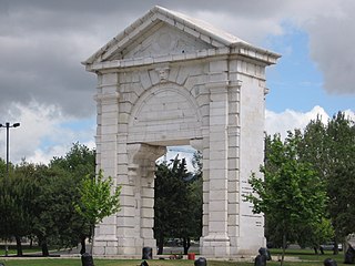
Praça de Espanha is a square in Lisbon, from which vehicles can proceed to the South bank of the river Tejo.
Dinkey Creek is an unincorporated community in Fresno County, California. It is located on Dinkey Creek, at an elevation of 5987 feet.
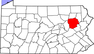
Waterton is an unincorporated community in Huntington Township, Luzerne County, Pennsylvania, United States. It lies between the boroughs of New Columbus and Shickshinny.
Aïn Fras is a town and commune in Mascara Province, Algeria. According to the 1998 census it has a population of 1,628.
Klisurica is a village in the municipality of Prokuplje, Serbia. According to the 2002 census, the village has a population of 250 people.
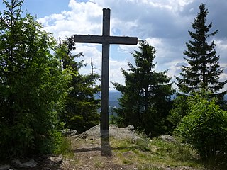
Siebensteinkopf is a mountain of Bavaria, Germany.

Brünlasberg is a mountain of Saxony, southeastern Germany.

Vishnuprayāg is the confluence of India's Alaknanda and Dhauliganga rivers—the first of five major confluences of the Alakanda known as the Panch Prayag. It is located at an elevation of 1,372 metres (4,501 ft) in the Chamoli district in the state of Uttarakhand.

St. John's Church in the north German town of Plön was built in 1685 as an independent parish church when Plön's new town, Neustadt, was developed by Duke John Adolphus.

Mistberget is a mountain in Akershus in southeastern Norway, and is visible from most places in Romerike. Near the top is a fire tower dating from 1938 and a TV transmitter mast.

Aphrodisias, sometimes called Aphrodisias of Cilicia to distinguish it from the town of the same name in Caria, was a port city of ancient Cilicia whose ruins now lie near Cape Tisan in Mersin Province, Turkey.
Marmara Town is found in Nasarawa Local Government Area of Nasarawa State in central Nigeria. The town sits along the Keffi–Nasarawa road in the western part of Nasarawa state.

The Shopping mall Fünf Höfe in the center of Munich was created from 1998 to 2003 after the coring of a HypoVereinsbank building complex. In 2004, the Fünf Höfe was sold to DIFA and since then the official name has been CityQuartier Fünf Höfe.

Chatham is an unincorporated community in Licking County, in the U.S. state of Ohio.
