Schothorst is the second largest district by population in the Dutch city of Amersfoort. It is located in central Amersfoort, between the districts of Liendert, Landgoed Schothorst (an estate) and De Koppel. The neighbourhood was built in the 1970s and 1980s and today forms a quiet, leafy area of the city. Housing consists of a mixture of detached houses with gardens, terraced houses and apartment buildings, including two of the highest residential towers in Amersfoort: De Waaier, at 14 storeys, and De Vuurtoren, at 16 storeys, both located along the Valleikanaal.
The district has numerous facilities, including a shopping mall, several primary and secondary schools, the Amersfoort Schothorst railway station, doctors' offices, sports halls, a recreation area, and several green areas including parks.
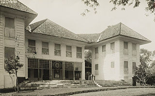
The district is named after the farm on Landgoed Schothorst. The name Schothorst is composed of the words "schot" (an area that is enclosed by a wooden fence) and 'horst' (a sandy hill) and means, referring to the sandy terrain (left by the last ice age) on which the district is located. The Schothorst Estate was founded in 1780 and a villa, also named Schothorst, was constructed there in the mid-19th century.
Amersfoort is a city and municipality in the province of Utrecht, Netherlands. As of 31 January 2023, the municipality had a population of 160,902, making it the second-largest of the province and fifteenth-largest of the country. Amersfoort is also one of the largest Dutch railway junctions with its three stations—Amersfoort Centraal, Schothorst and Vathorst—due to its location on two of the Netherlands' main east to west and north to south railway lines. The city was used during the 1928 Summer Olympics as a venue for the modern pentathlon events. Amersfoort marked its 750th anniversary as a city in 2009.
Hoogland is a village and former free-standing municipality in the province of Utrecht in the Netherlands. It is located north of the Amersfoort city centre. The village population is 10,587 people (2006).
Queenstown is a planning area and satellite residential town situated on the south-westernmost fringe of the Central Region of Singapore. It borders Bukit Timah to the north, Tanglin to the northeast, Bukit Merah to the east and southeast, as well as Clementi to the northwest and west. Its southern and southwesternmost limits are bounded by the Pandan Strait.
Flemington is an inner-city suburb in Melbourne, Victoria, Australia, 5 km (3.1 mi) north-west of Melbourne's Central Business District, located within the Cities of Melbourne and Moonee Valley local government areas. Flemington recorded a population of 7,025 at the 2021 census.
Berceni is a district, of southern Bucharest.
Amsterdam Zuid is a railway station situated in the borough of Amsterdam-Zuid in Amsterdam, Netherlands. For a number of years, it was named Amsterdam Zuid WTC, in reference to the neighbouring World Trade Center Amsterdam. During 2006, in conjunction with the rapid development of the area surrounding the station, the station was enlarged and the reference to the WTC was formally dropped from the name.
Lok Wah Estate is a public housing estate located in Ngau Tau Kok, Kwun Tong, Kowloon, Hong Kong.
Leusden-Zuid is a neighbourhood and former village in the Dutch province of Utrecht. It is a part of the municipality of Leusden, and lies about 6 km south of Amersfoort. The village is now part of Leusden.
Wesoła is one of the districts of Warsaw, and has been as such since October 27, 2002. Wesoła is located in the south-eastern part of city.
Jagakarsa is the southernmost district in the administrative city of South Jakarta, Indonesia. Jagakarsa is bounded by Ciliwung River to the east, Krukut River to the west, and Margasatwa-Sagu-Joe-T.B.Simatupang-Poltangan Road to the north, while the boundary marches with Depok city to the south.
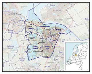
The Gooi is an area around Hilversum, in the centre of the Netherlands. It is a slightly hilly area characterised by its green landscape, its historical charm, the wealth of its inhabitants and its villas. The Gooi is known in the country as the home of the rich and famous.
Amersfoort Centraal is the main railway station in Amersfoort in the province of Utrecht, Netherlands. The station was an important link between the western part of the Netherlands and the north and east of the country until December 2012 when the Hanzelijn opened.
Amersfoort Schothorst is a railway station on the Utrecht–Kampen railway between Amersfoort and Zwolle. It is located in north Amersfoort, Netherlands. The station is operated by Nederlandse Spoorwegen (NS).
Friar Park is a residential area of Wednesbury, West Midlands, England. It is also a ward of Sandwell Council.
Storey's Way is a mainly residential road, approximately 650 metres to the west of the city centre in Cambridge, England. It falls within the Castle Electoral Ward of Cambridge City Council, and feeds on to the major arterial roads Huntingdon Road to the north and Madingley Road to the west.
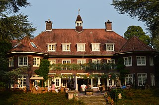
Clingendael is the name of a 17th-century manor house and surrounding parkland just outside The Hague, Netherlands, in the municipality of Wassenaar. Since 1982, it houses the Netherlands Institute of International Relations Clingendael.
Tandjong Oost, also known as Groeneveld, was a particuliere land, or private domain, in modern-day Pasar Rebo, East Jakarta, Indonesia. It was one of two estates located on the banks of the Ciliwung river: Tandjong Oost to the east of the river, and Tandjong West to the west.
The Persijn Estate in Maartensdijk is an estate with a white villa just west of the A27 motorway.
Esbeek is a village with 1,200 inhabitants. It is one of the six church villages of the municipality of Hilvarenbeek, which has a total of 15,000 inhabitants. Esbeek is located on the high sandy soils in the south of the Netherlands in the province of North Brabant, on the border with Belgium.
This page is based on this Wikipedia article Text is available under the CC BY-SA 4.0 license; additional terms may apply. Images, videos and audio are available under their respective licenses.