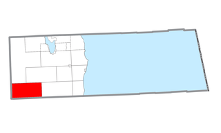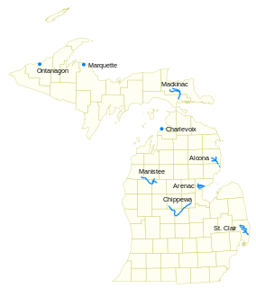
Huron County is a county in the U.S. state of Michigan. As of the 2010 United States Census, the population was 33,118. The county seat is Bad Axe. Huron County is at the northern tip of the Thumb, which is a sub region of Mid Michigan. It is a peninsula, bordered by Saginaw Bay to the west and Lake Huron to the north and east, and has over 90 miles (140 km) of shoreline, from White Rock on Lake Huron to Sebewaing on the Saginaw Bay. Huron County's most important industry is agriculture, as with most of the other Thumb counties. Huron County enjoys seasonal tourism from large cities such as Detroit, Flint, and Saginaw.

Curtis Township is a civil township of Alcona County in the U.S. state of Michigan. The population was 1,236 at the 2010 census.

Brookfield Township is a civil township of Huron County in the U.S. state of Michigan. As of the 2000 census, the township population was 914.

Sebewaing is a village in Huron County in the U.S. state of Michigan. The population was 1,759 at the 2010 census. The village is within Sebewaing Township. This community is known as the Sugar Beet Capital, due to the Michigan Sugar slicing mill located within the village and the yearly Michigan Sugar Festival. The Sebewaing area, the Thumb, and the state of Michigan overall are major beet sugar producers, mostly for domestic consumption. Sebewaing is also the first gigabit village in the state of Michigan. In 2014–15, Sebewaing completed its fiber to the home network, offering up to gigabit/second speeds over their fiber optic network.

Erie Township is a civil township of Monroe County in the U.S. state of Michigan Within the Toledo Metropolitan Area. The population was 4,517 at the 2010 census. The township is served by Mason Consolidated Schools. The city of Luna Pier sits outside the northeast corner of the township. The township is also home to the unincorporated community of Erie, situated at the intersection of Erie Rd and M-125.

The Thumb is a region and a peninsula of the U.S. state of Michigan, so named because the Lower Peninsula is shaped like a mitten. The Thumb area is generally considered to be in the Central Michigan region, located east of the Tri-Cities, and north of Metro Detroit. The region is also branded as the Blue Water Area of Michigan.

Pine River may refer to any of the following streams in the U.S. state of Michigan:
- Pine River. The main branch forms with the confluence of the East and West Branches of the Pine River at 44°29′38″N83°23′16″W in Alcona County. The South Branch joins approximately 1.5 miles (2.4 km) to the south and flows into Iosco County, where it empties into Van Etten Lake at 44°29′38″N83°23′16″W northwest of Oscoda.
- Pine River. The main branch is formed by the confluence of the North and Middle Branches northeast of Standish and flows into the Saginaw Bay of Lake Huron at 43°58′32″N83°51′16″W. The South Branch Pine River joins the main stream at 43°59′08″N83°53′17″W.
- Pine River is a short waterway, which along with Round Lake, connects Lake Charlevoix with Lake Michigan at Charlevoix.
- Pine River rises in Chippewa County and flows south through Mackinac County into the St. Martin Bay of Lake Huron at 46°03′09″N84°39′22″W The North Pine River, also known as the North Branch Pine River, joins at 46°12′20″N84°36′17″W. Another tributary, Hemlock Creek, is also known as Pine River.
- Pine River, also known as the South Branch Manistee River, rises in southeast Wexford County, flows southwest across northwest Osceola County, then west and north through the northeast corner of Lake County and back into southwest Wexford County, emptying into the Tippy Dam Pond on the Manistee River at 44°13′37″N85°54′27″W. The main stream is formed from the confluence of the East Branch Pine River with the North Branch Pine River at 44°06′02″N85°31′40″W. Another tributary, the Spaulding Creek, is also known as the Little Pine River
- Pine River, in Marquette County, is a very short stream draining Pine Lake into Lake Superior at 46°53′27″N87°52′13″W, north of the Huron Mountains.
- Pine River rises in from Pine Lake in eastern Mecosta County, flows mostly south and east through Isabella County, then south along eastern edge of Montcalm County, then east and north through Gratiot County and Midland County, emptying into the Chippewa River at 43°36′06″N84°17′33″W, just about two miles before it joins the Tittabawassee River near Midland. The South Branch Pine River joins the main stream at 43°30′37″N85°00′02″W Another tributary, Miller Creek, is also sometimes known as Pine River or the West Branch Pine River. The North Branch Pine River joins the main stream at 43°26′03″N84°50′18″W.
- Pine River empties into the St. Clair River at 42°49′13″N82°29′08″W on the south side of St. Clair. The South Branch Pine River joins the main stream at 42°58′11″N82°37′10″W. Another tributary, Quakenbush Drain, is also sometimes known as Pine River.
- Pine Creek empties into Lake Superior and is also known as the Pine River.

Bronner's Christmas Wonderland is a retail store in Frankenmuth, Michigan that promotes itself as the "World's Largest Christmas Store".
White Lake is the name of several lakes in the U.S. state of Michigan. The largest one is formed by the White River flowing to its mouth on Lake Michigan in Muskegon County.

The Cass River is a 61.5-mile-long (99.0 km) river in the Thumb region of the U.S. state of Michigan. It drains large portions of Sanilac and Tuscola counties and smaller portions of Genesee, Huron, Lapeer, and Saginaw counties.
Wasa Lake Provincial Park is a provincial park in British Columbia, Canada.
Unionville-Sebewaing Area High School is a public high school located in Sebewaing, Michigan. It was formed in 1972 when Unionville High School and Sebewaing High School merged.

The Cheboygan River is a short but significant river in the Lake Huron drainage basin of the U.S. state of Michigan.
The Tip of The Thumb Heritage Water Trails is a nonprofit citizens organization working with the Huron County Parks to establish and maintain a water trail along Michigan’s Lake Huron’s shoreline. It is dependent on public support for its existence and growth. The Water Trail, which is best utilized via sea kayaks by people who have had proper sea kayaking instruction, consists of camp sites and rest areas spaced out along the shore. The trail is still being developed, so there are several large sections with no public landing sites.

Newport is an unincorporated community in Paint Township, Madison County, Ohio, United States. It is located at 39°50′06″N83°27′55″W, along Ohio State Route 38 between London and Midway.
The Michigan Sugar Festival is an event that occurs one weekend in the middle of June each year. It is held in the village of Sebewaing, Michigan.
The Rock River is a 17.5-mile-long (28.2 km) river in Alger County on the Upper Peninsula of Michigan in the United States. It flows through the Rock River Canyon Wilderness of Hiawatha National Forest, then turns north and flows to Lake Superior at the village of Rock River.
Tebo Creek is a stream in Benton and Henry Counties in the U.S. state of Missouri.


