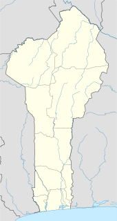
Bohicon is a city in Benin, and a conurbation of Abomey lying 9 kilometres east of the city on the railway line from Cotonou to Parakou and on Benin's main highway RNIE 2 which joins the RNIE 4. The commune covers an area of 139 square kilometres and as of 2002 had a population of 113,091 people.

Savè is a city in Benin, lying on the Cotonou-Parakou railway and the main north-south road. It is known for its local boulders, popular with climbers. "Savè" is the corrupted rendition of the historical Yoruba name Sabe

Comè is a town and arrondissement located in the Mono Department of Benin. The commune covers an area of 163 square kilometres and as of 2012 had a population of 33,507 people. It was home to a refugee camp for Togolese refugees until it was closed in 2006.

Savalou is a city located in the Collines Department of Benin. The commune covers an area of 2674 square kilometres and as of 2012 had a population of 35,433 people. It is the birthplace of Olympic Beninese hurdler Odile Ahouanwanou.
Mengkibol is a main town in Kluang District, Johor, Malaysia. Mengkibol River is a major river near Mengkibol town.

Say is a town in southwest Niger, situated on the Niger River. It is the capital of the Say Department in the Tillabéri Region. The municipality has 12,000 inhabitants, and its economy is dominated by agriculture, herding and small trade.
Capel Bangor is a small village in Ceredigion, in Wales. Its population is around 600-1000, and it is also approximately five miles from the seaside and university town of Aberystwyth.

Kpomassè is a town, arrondissement, and commune in the Atlantique Department of southern Benin. The commune covers an area of 305 square kilometres and as of 2002 had a population of 57,190 people.

Agbangnizoun is a town, arrondissement, and commune in the Zou Department of south-western Benin. The town lies 20 kilometres south-east of Abomey. The commune covers an area of 244 square kilometres and as of 2002 had a population of 55,001 people.
Dekanmè is a town and arrondissement in the Atlantique Department of southern Benin. It is an administrative division under the jurisdiction of the commune of Kpomassè. According to the population census conducted by the Institut National de la Statistique Benin on February 15, 2002, the arrondissement had a total population of 8,581.
Ségbohoué is a town and arrondissement in the Atlantique Department of southern Benin. It is an administrative division under the jurisdiction of the commune of Kpomassè. According to the population census conducted by the Institut National de la Statistique Benin on February 15, 2002, the arrondissement had a total population of 6,058.
Djanglanmè is a town and arrondissement in the Atlantique Department of southern Benin. It is an administrative division under the jurisdiction of the commune of Toffo. According to the population census conducted by the Institut National de la Statistique Benin on February 15, 2002, the arrondissement had a total population of 4,852.

Agoua is a town and arrondissement in the Collines Department of Benin. It is an administrative division under the jurisdiction of the commune of Bantè. According to the population census conducted by the Institut National de la Statistique Benin on February 15, 2002, the arrondissement had a total population of 6276.
Gouka is a town and arrondissement in the Collines Department of Benin. It is an administrative division under the jurisdiction of the commune of Bantè. According to the population census conducted by the Institut National de la Statistique Benin back in 2006, the arrondissement had a total population of 16.070.
Agatogbo is an arrondissement in the Mono department of Benin. It is an administrative division under the jurisdiction of the commune of Comè. According to the population census conducted by the Institut National de la Statistique Benin on February 15, 2002, the arrondissement had a total population of 9,758.
Ekpè is an arrondissement in the Ouémé department of Benin. It is an administrative division under the jurisdiction of the commune of Sèmè-Kpodji. According to the population census conducted by the Institut National de la Statistique Benin on February 15, 2002, the arrondissement had a total population of 34,917.
Tanvé is an arrondissement in the Zou department of Benin. It is an administrative division under the jurisdiction of the commune of Agbangnizoun. According to the population census conducted by the Institut National de la Statistique Benin on February 15, 2002, the arrondissement had a total population of 8,034.
Akiza is an arrondissement in the Zou department of Benin. It is an administrative division under the jurisdiction of the commune of Zogbodomey. According to the population census conducted by the Institut National de la Statistique Benin on February 15, 2002, the arrondissement had a total population of 8,477.
Sihi is a village panchayat, or village counsel, located in the Gurgaon district of Haryana state, India. The village is dominated by Yadavs and Dalits. Sihi is located 261.1 kilometres (162.2 mi) away from Chandigarh, the capital of Haryana. The nearest state capital to Sihi is Delhi which is 36.8 kilometres (22.9 mi) away. It lies on main Northern Peripheral Road also known as Dwarka expressway.


