
An earthquake – also called a quake, tremor, or temblor – is the shaking of the Earth's surface resulting from a sudden release of energy in the lithosphere that creates seismic waves. Earthquakes can range in intensity, from those so weak they cannot be felt, to those violent enough to propel objects and people into the air, damage critical infrastructure, and wreak destruction across entire cities. The seismic activity of an area is the frequency, type, and size of earthquakes experienced over a particular time. The seismicity at a particular location in the Earth is the average rate of seismic energy release per unit volume.
The Modified Mercalli intensity scale measures the effects of an earthquake at a given location. This is in contrast with the seismic magnitude usually reported for an earthquake.

A seismic hazard is the probability that an earthquake will occur in a given geographic area, within a given window of time, and with ground motion intensity exceeding a given threshold. With a hazard thus estimated, risk can be assessed and included in such areas as building codes for standard buildings, designing larger buildings and infrastructure projects, land use planning and determining insurance rates. The seismic hazard studies also may generate two standard measures of anticipated ground motion, both confusingly abbreviated MCE; the simpler probabilistic Maximum Considered Earthquake, used in standard building codes, and the more detailed and deterministic Maximum Credible Earthquake incorporated in the design of larger buildings and civil infrastructure like dams or bridges. It is important to clarify which MCE is being discussed.

The Japan Meteorological Agency (JMA) Seismic Intensity Scale is a seismic intensity scale used in Japan to categorize the intensity of local ground shaking caused by earthquakes.
The moment magnitude scale is a measure of an earthquake's magnitude based on its seismic moment. Mw was defined in a 1979 paper by Thomas C. Hanks and Hiroo Kanamori. Similar to the local magnitude/Richter scale (ML ) defined by Charles Francis Richter in 1935, it uses a logarithmic scale; small earthquakes have approximately the same magnitudes on both scales. Despite the difference, news media often use the term "Richter scale" when referring to the moment magnitude scale.
Peak ground acceleration (PGA) is equal to the maximum ground acceleration that occurred during earthquake shaking at a location. PGA is equal to the amplitude of the largest absolute acceleration recorded on an accelerogram at a site during a particular earthquake. Earthquake shaking generally occurs in all three directions. Therefore, PGA is often split into the horizontal and vertical components. Horizontal PGAs are generally larger than those in the vertical direction but this is not always true, especially close to large earthquakes. PGA is an important parameter for earthquake engineering, The design basis earthquake ground motion (DBEGM) is often defined in terms of PGA.

A response spectrum is a plot of the peak or steady-state response of a series of oscillators of varying natural frequency, that are forced into motion by the same base vibration or shock. The resulting plot can then be used to pick off the response of any linear system, given its natural frequency of oscillation. One such use is in assessing the peak response of buildings to earthquakes. The science of strong ground motion may use some values from the ground response spectrum for correlation with seismic damage.
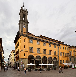
Pontedera is an Italian comune with a population of 30070 habitants, located in the province of Pisa, Tuscany, central Italy.

The Indian subcontinent has a history of devastating earthquakes. The major reason for the high frequency and intensity of the earthquakes is that the Indian Plate is driving into Asia at a rate of approximately 47 mm/year. Geographical statistics of India show that almost 58% of the land is vulnerable to earthquakes. A World Bank and United Nations report shows estimates that around 200 million city dwellers in India will be exposed to storms and earthquakes by 2050. The latest version of seismic zoning map of India given in the earthquake resistant design code of India [IS 1893 2002] assigns four levels of seismicity for India in terms of zone factors. In other words, the earthquake zoning map of India divides India into 4 seismic zones unlike its previous version, which consisted of five or six zones for the country. According to the present zoning map, Zone 5 expects the highest level of seismicity whereas Zone 2 is associated with the lowest level of seismicity.

Vico del Gargano is a village and comune in the province of Foggia in the Apulia region of southeast Italy. Called the "Village of Love", it is part of the Gargano National Park and the Mountain Community of Gargano.
Lambrugo is a comune (municipality) in the Province of Como in the Italian region Lombardy, located about 30 kilometres (19 mi) north of Milan and about 14 kilometres (9 mi) southeast of Como. As of 30 November 2019, it had a population of 2,510 and an area of 1.9 km2. The municipality of Lambrugo contains the frazioni Momberto, Galletto, Cascina Giulia, and Resegone. Lambrugo borders the following municipalities: Costa Masnaga, Inverigo, Lurago d'Erba, Merone, Nibionno.

Gorno is a comune (municipality) in the Province of Bergamo in the Italian region of Lombardy, located about 70 km (43 mi) northeast of Milan and about 25 km (16 mi) northeast of Bergamo. As of 31 December 2004, it had a population of 1,760 and an area of 9.9 km2 (3.8 sq mi).
The Arias intensity (IA) is a measure of the strength of a ground motion. It determines the intensity of shaking by measuring the acceleration of transient seismic waves. It has been found to be a fairly reliable parameter to describe earthquake shaking necessary to trigger landslides. It was proposed by Chilean engineer Arturo Arias in 1970.
The 1992 Cape Mendocino earthquakes occurred along the Lost Coast of Northern California on April 25 and 26. The three largest events were the M7.2 thrust mainshock that struck near the unincorporated community of Petrolia midday on April 25 and two primary strike-slip aftershocks measuring 6.5 and 6.6 that followed early the next morning. The sequence encompassed both interplate and intraplate activity that was associated with the Mendocino Triple Junction, a complex system of three major faults that converge near Cape Mendocino. The total number of aftershocks that followed the events exceeded 2,000.

Spectral acceleration (SA) is a unit measured in g that describes the maximum acceleration in an earthquake on an object – specifically a damped, harmonic oscillator moving in one physical dimension. This can be measured at different oscillation frequencies and with different degrees of damping, although 5% damping is commonly applied. The SA at different frequencies may be plotted to form a response spectrum.
Seismic intensity scales categorize the intensity or severity of ground shaking (quaking) at a given location, such as resulting from an earthquake. They are distinguished from seismic magnitude scales, which measure the magnitude or overall strength of an earthquake, which may, or perhaps may not, cause perceptible shaking.
The 1997 Bojnurd earthquake occurred on 4 February at 14:07 IRST in Iran. The epicenter of the 6.5 earthquake was in the Kopet Dag mountains of North Khorasan, near the Iran–Turkmenistan border, about 579 km (360 mi) northeast of Tehran. The earthquake is characterized by shallow strike-slip faulting in a zone of active faults. Seismic activity is present as the Kopet Dag is actively accommodating tectonics through faulting. The earthquake left 88 dead, 1,948 injured, and affected 173 villages, including four which were destroyed. Damage also occurred in Shirvan and Bojnord counties. The total cost of damage was estimated to be over US$ 30 million.
The IEEE 693: Recommended Practice for Seismic Design of Substations. is a Institute of Electrical and Electronics Engineers standard. This standard is recognized also by American National Standards Institute, and is used mainly in the American Continent.
