Grenadines is an administrative parish of Saint Vincent and the Grenadines. Its capital is Port Elizabeth.

Slatvina is a village and municipality in the Spišská Nová Ves District in the Košice Region of central-eastern Slovakia. It has a population of 312 inhabitants.

Nagyhódos is a small village in Szabolcs-Szatmár-Bereg county, in the Northern Great Plain region of eastern Hungary.

Zapotlán de Juárez is a town and one of the 84 municipalities of Hidalgo, in central-eastern Mexico. The municipality covers an area of 131.1 km².

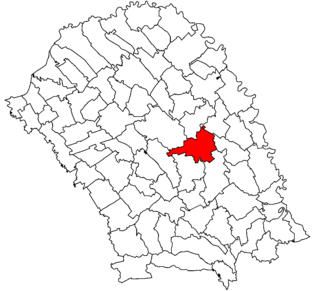
Dângeni is a commune in Botoșani County, Romania. It is composed of four villages: Dângeni, Hulub, Iacobeni and Strahotin.

Decatur Township is located in Macon County, Illinois. As of the 2010 census, its population was 52,915 and it contained 24,918 housing units.

Subotište is a village in Serbia. It is situated in the Pećinci municipality, in the Srem District, Vojvodina province. The village has a Serb ethnic majority and its population numbering 942 people.
Valdenebro de los Valles is a municipality located in the province of Valladolid, in Castile and León, Spain. According to the 2017 census (INE), the municipality has a population of 208 inhabitants.

Siby is a department or commune of Balé Province in southern Burkina Faso. Its capital lies at the town of Siby. According to the 1996 census the department has a total population of 12,089.

Mărașu is a commune located in Brăila County, Romania. It is composed of five villages: Băndoiu, Măgureni, Mărașu, Plopi and Țăcău. It formerly included Nedelcu village, now depopulated.
Siby is a town in the Siby Department of Balé Province in south-western Burkina Faso. The town has a population of 3723.

Zakrzów is a village in the administrative district of Gmina Wojnicz, within Tarnów County, Lesser Poland Voivodeship, in southern Poland. It lies approximately 2 kilometres (1 mi) east of Wojnicz, 14 km (9 mi) south-west of Tarnów, and 67 km (42 mi) east of the regional capital Kraków.

Grzywiczówka is a village in the administrative district of Gmina Tarczyn, within Piaseczno County, Masovian Voivodeship, in east-central Poland. It lies approximately 2 kilometres (1 mi) south-east of Tarczyn, 16 km (10 mi) south-west of Piaseczno, and 30 km (19 mi) south of Warsaw.

Józefowice is a village in the administrative district of Gmina Tarczyn, within Piaseczno County, Masovian Voivodeship, in east-central Poland. It lies approximately 2 kilometres (1 mi) south-east of Tarczyn, 16 km (10 mi) south-west of Piaseczno, and 30 km (19 mi) south of Warsaw.

Pierzchno is a village in the administrative district of Gmina Wręczyca Wielka, within Kłobuck County, Silesian Voivodeship, in southern Poland. It lies approximately 3 kilometres (2 mi) east of Wręczyca Wielka, 8 km (5 mi) south of Kłobuck, and 67 km (42 mi) north of the regional capital Katowice.

Dzikowo is a village in the administrative district of Gmina Gubin, within Krosno Odrzańskie County, Lubusz Voivodeship, in western Poland, close to the German border. It lies approximately 10 kilometres (6 mi) east of Gubin, 19 km (12 mi) south-west of Krosno Odrzańskie, and 46 km (29 mi) west of Zielona Góra.
Vaali is a village in Järva Parish, Järva County in northern-central Estonia.
Liivi is a village in Lääne-Nigula Parish, Lääne County, in western Estonia.

Košutica is a village in the municipality of Sokolac, Bosnia and Herzegovina.

German submarine U-774 was a Type VIIC U-boat of Nazi Germany's Kriegsmarine during World War II.


