
Aragua State is located in the north-central region of Venezuela. It has plains and jungles and Caribbean beaches. The most popular are Cata and Choroni. It has Venezuela's first national park which is called Henri Pittier.

Amazonas State is one of the 23 states (estados) into which Venezuela is divided. It covers nearly a fifth of the area of Venezuela, but has less than 1% of Venezuela's population.

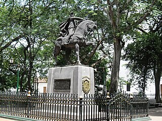
Apure State is one of the 23 states (estados) into which Venezuela is divided. Its territory formed part of the provinces of Mérida, Maracaibo, and Barinas, in accordance with successive territorial ordinations pronounced by the colonial authorities. In 1824 the Department of Apure was created, under jurisdiction of Barinas, which laid the foundations for the current entity. In 1856 it separated from Barinas and for the first time Apure appeared as an independent province, which in 1864 acquired the status of state. In 1881, however, a new territorial division combined Apure and Guayana to form a single state named Bolívar. In 1899 it reestablished its autonomy and finally, by means of the Constitution of 1909, gained its current borders.
Villa de Todos los Santos de Calabozo is an inland town of Venezuela, once capital of the Province of Caracas in the colonial period, formerly in the State of Miranda and former capital of the state of Guárico.

The Meta River is a major left tributary of the Orinoco River in eastern Colombia and southern Venezuela, South America. The Meta originates in the Eastern Ranges of the Andes and flows through the Meta Department, Colombia as the confluence of the Humea, Guatiquía and Guayuriba rivers. It flows east-northeastward across the Llanos Orientales of Colombia following the direction of the Meta Fault. The Meta forms the northern boundary of Vichada Department, first with Casanare Department, then with Arauca Department, and finally with Venezuela, down to Puerto Carreño where it flows into the Orinoco.

Guárico River is a river in Venezuela.

El Marqués is a municipality in the Mexican state of Querétaro. It receives its name from Juan Antonio de Urrutia y Arana, the Marquis of the Villa del Villar del Águila, who built the aqueduct that supplied water to Querétaro for centuries. Its seat is the city of La Cañada. It forms part of the metropolitan area of Querétaro and has many state-of-the-art industrial parks and Querétaro International Airport.

San Fernando de Atabapo was the capital city of Venezuela's Amazonas state until the early 1900s. The population in 1997 was approximately 5,000.

Tam Giang Đông is a commune (xã) and village in Năm Căn District, Cà Mau Province, in Vietnam.

Capanaparo River is a river of Colombia and Venezuela. It is part of the Orinoco River basin. In Venezuela together with the Cinaruco River, other smaller rivers and the area around them they form the Santos Luzardo National Park since 1988.

Cinaruco River is a river of Colombia and Venezuela. It is part of the Orinoco River basin. It has partially clear tanic waters. In Venezuela this river is part of the Santos Luzardo National Park since the year 1988. The Cinaruco River together with the Capanaparo River, other smaller rivers and the area around them form this national park. It houses a big biodiversity and many fisherman go each year looking for peacock bass. Three different species of peacock bass are found in this river: Cichla intermedia, Cichla orinocensis and Cichla temensis from smallest to biggest.

The Inírida is a river in the north-west of South America, in the territory of Colombia, the largest tributary of the Guaviare.

Portuguesa River is a river of Venezuela. It is part of the Orinoco River basin, and is a tributary of the Apure River.
The Caño Central is a river of Venezuela. It drains into Lake Valencia.
Suapure River is a river of Venezuela. It is part of the Orinoco River basin.
Parguaza River is a river of Venezuela. It is part of the Orinoco River basin.
Cuao River is a river of Venezuela. It is part of the Orinoco River basin.
The Autana River is a blackwater river of Venezuela, a tributary of the Sipapo River in the middle Orinoco River basin.

The Third Republic of Venezuela is the name commonly used to refer to the reestablished Republic of Venezuela declared by Simón Bolívar in the year 1817, during the Venezuelan War of Independence. The beginning of the Third Republic of Venezuela is attributed to the period after the Guyana Campaign, during which the republicans restored democratic institutions in Angostura. The Republic ended after the Congress of Angostura of 1819 decreed the union of Venezuela with New Granada, to form the republic of Gran Colombia.
Jackson Township is a township in Carter County, in the U.S. state of Missouri.

