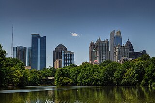
Midtown Atlanta, or Midtown, is a high-density commercial and residential neighborhood of Atlanta, Georgia. The exact geographical extent of the area is ill-defined due to differing definitions used by the city, residents, and local business groups. However, the commercial core of the area is anchored by a series of high-rise office buildings, condominiums, hotels, and high-end retail along Peachtree Street between North Avenue and 17th Street. Midtown, situated between Downtown to the south and Buckhead to the north, is the second-largest business district in Metro Atlanta. In 2011, Midtown had a resident population of 41,681 and a business population of 81,418.
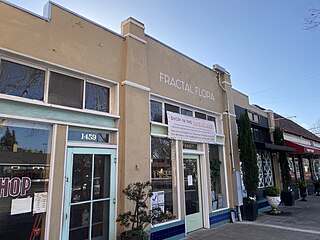
Rose Garden, also rendered as Rosegarden, is a historic district of Central San Jose, California, near Downtown San Jose and The Alameda. Rose Garden is a district made up of numerous historic neighborhoods, such as Hanchett Park, primarily characterized by its architecture and numerous cultural institutions, including the San Jose Municipal Rose Garden, Rosicrucian Park, which includes the Rosicrucian Egyptian Museum, and the historic Hoover Theater.

Central Gardens is a historic Memphis neighborhood in Midtown.
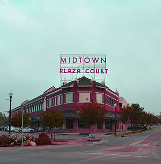
Midtown is located northwest of downtown Oklahoma City, surrounded by Automobile Alley to the east and Asia District to the north. It is home to St. Anthony's Hospital and smaller communities like Church Row. It is a 387-acre (1.57 km2) area with an estimated 3,501 residents.
The Flatiron District in Oklahoma City is so named because several buildings in the district were built in a flatiron (triangular) architectural style due to Harrison Avenue diagonally intersecting the east-west and north-south streets of the district. The district is bounded by N.E. 4th St on the south, Interstate-235 on the east, the Santa Fe Railroad on the west and N.E. 9th St on the north. Like much of downtown Oklahoma City, the district was blighted for decades until the downtown renaissance began in the 1990s. Since then the district has seen numerous developments and is closely tied to the revitalization of both Deep Deuce and Automobile Alley.
Mahncke Park is an urban neighborhood and park located on the eastern fringe of Midtown San Antonio, Texas, USA.
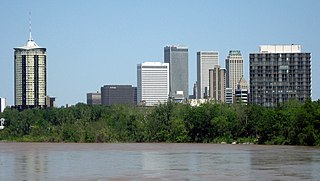
Tulsa is the second-largest city in the state of Oklahoma. It has many diverse neighborhoods due to its size.

The East Side is a district of Milwaukee, Wisconsin consisting of several neighborhoods encompassing an area just north of Downtown Milwaukee to the village of Shorewood, bordered by the Milwaukee River to the west and Lake Michigan to the east. The area encompasses residences, museums, bars, shops, theaters, live music clubs and the University of Wisconsin–Milwaukee campus.
The City of Oklahoma City uses Special Zoning Districts as a tool to maintain the character of many neighborhood communities.

The architecture of metropolitan Detroit continues to attract the attention of architects and preservationists alike. With one of the world's recognizable skylines, Detroit's waterfront panorama shows a variety of architectural styles. The post-modern neogothic spires of One Detroit Center refer to designs of the city's historic Art Deco skyscrapers. Together with the Renaissance Center, they form the city's distinctive skyline.
Uptown is an area of Oklahoma City. It is often bounded by the northernmost edge of downtown Oklahoma to south, and Northwest 23rd Street to the north. The area is known for its upper-scale classical houses, its bar and nightlife district, and being a major cultural hub of Oklahoma City.

Downtown Oklahoma City is located at the geographic center of the Oklahoma City metropolitan area and contains the principal, central business district of the region. Downtown has over 80,000 workers and over 13,310,000 sq ft (1,237,000 m2) of leasable office space to-date. Downtown Oklahoma City is the legal, financial, economic, nightlife, and entertainment center of the region.
Downtown Tulsa is an area of approximately 1.4 square miles (3.6 km2) surrounded by an inner-dispersal loop created by Interstate 244, US 64 and US 75. The area serves as Tulsa's financial and business district; it is the focus of a large initiative to draw tourism, which includes plans to capitalize on the area's historic architecture. Much of Tulsa's convention space is located in downtown, such as the Tulsa Performing Arts Center and the Tulsa Convention Center, as well as the BOK Center. Prominent downtown sub-districts include the Blue Dome District, the Tulsa Arts District, and the Greenwood Historical District, which includes the site of ONEOK Field, a baseball stadium for the Tulsa Drillers opened in 2010.
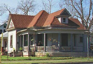
The Willow–Spence Streets Historic District is a neighborhood that lies east of downtown Austin, Texas. Its houses, churches, and commercial buildings were built in the early twentieth century. It is bounded roughly by Interstate 35 to the west, East César Chávez Street to the north, and Spence Street to the south. It extends a few houses east of San Marcos Street along Willow and Canterbury Streets. It thus includes portions of Willow, Spence, Canterbury, San Marcos, and Waller Streets. It was added to the National Register of Historic Places in 1985.

Midtown has an area of six square miles in Columbus, Georgia. It possesses residential neighbourhoods, eleven public schools, the Columbus Museum, the Columbus Public Library, the Muscogee County Public Education Center, the Columbus Aquatic Center and the international headquarters for Aflac. The population of Midtown is 22,000 residents living in 8500 households and is 10 kilometres north of Fort Benning on I-185.

The Arts & Entertainment District, or previously known as Omni, is a neighborhood of Downtown Miami, Florida. It is bound roughly by North 19th Street to the north, North 10th Street to the south, North West 2nd Avenue to the west, and Biscayne Boulevard to the east.
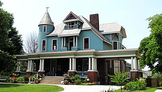
Old North Knoxville is a neighborhood in Knoxville, Tennessee, United States, located just north of the city's downtown area. Initially established as the town of North Knoxville in 1889, the area was a prominent suburb for Knoxville's upper middle and professional classes until the 1950s. After a period of decline, preservationists began restoring many of the neighborhood's houses in the 1980s. In 1992, over 400 houses and secondary structures in the neighborhood were added to the National Register of Historic Places as the Old North Knoxville Historic District.

The Sherman Hill Historic District is located in Des Moines, Iowa, United States. It is one of the oldest residential neighborhoods in Des Moines. Single-family houses were constructed beginning around 1880 and multi-family dwellings were built between 1900 and 1920. The district encompasses 80 acres (0.32 km2) and 210 buildings and is bounded by 15th Street to the East, High Street to the South, Martin Luther King Parkway on the West, and School Street to the North. The historic district has been listed on the National Register of Historic Places since 1979.
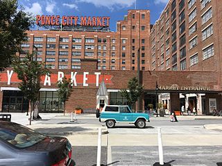
Eastside refers to the city district comprising the easternmost portion of Atlanta, Georgia, United States. The Eastside generally encompasses the area bounded on the west by Midtown Atlanta and Downtown Atlanta and on the east by the city limits. The central corridor of the district is the BeltLine Eastside Trail, which connects northern Eastside neighborhoods with those to the south. The Eastside is known for its nightlife establishments, craftsman architecture, local eateries, and quirky public art.


